Ec?
-
Hello, please take a minute to check out our awesome content, contributed by the wonderful members of our community. We hope you'll add your own thoughts and opinions by making a free account!
You are using an out of date browser. It may not display this or other websites correctly.
You should upgrade or use an alternative browser.
You should upgrade or use an alternative browser.
Tropical TS Imelda
- Thread starter SD
- Start date
Brent
Member
Humberto is next for sure
But does the other one develop too
But does the other one develop too
GeorgiaGirl
Member
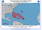
At my latest peek, my untrained eyes say this is starting to try to rotate, but the NHC cone might need to be adjusted south.
I'm presuming this is the westernmost invest.
I'm presuming this is the westernmost invest.
lexxnchloe
Member
lexxnchloe
Member
lexxnchloe
Member
Since 93 and 94 will likely remain close and interact why not have 1 thread for both?
I think both threads for 93L/94L should be separate.
Think that would get really confusing. Separate threads is the best option.Since 93 and 94 will likely remain close and interact why not have 1 thread for both?
I’m curious if 12z runs continue the momentum of actually having a system from 94L. Way too early to talk about track but definitely looks like it could be threatening if something forms
94L
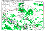
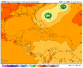
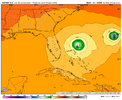
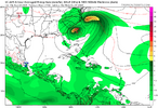
6Z Euro at 144 has a strengthening 998 TS moving NNW N of the Bahamas threatening the SE US.
6Z Icon at 120 is well E of Euro
6Z GFS has nothing from this, alone, although it appears to combine its vorticity with 93L and develop that well offshore
—————-
No UK run has had this as a TC AFAIK
6Z Euro at 144 has a strengthening 998 TS moving NNW N of the Bahamas threatening the SE US.
6Z Icon at 120 is well E of Euro
6Z GFS has nothing from this, alone, although it appears to combine its vorticity with 93L and develop that well offshore
—————-
No UK run has had this as a TC AFAIK
Didn't see 93L my bad thread started
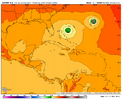
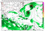
ICON likes the dual system idea. Both go out to sea this run
lexxnchloe
Member
94L
6Z Euro at 144 has a strengthening 998 TS moving NNW N of the Bahamas threatening the SE US.
6Z Icon at 120 is well E of Euro
6Z GFS has nothing from this, alone, although it appears to combine its vorticity with 93L and develop that well offshore
—————-
No UK run has had this as a TC AFAIK
ICON likes the dual system idea. Both go out to sea this run
Good thread
12Z UK: TD NW Bahamas that drifts NE
NEW TROPICAL CYCLONE FORECAST TO DEVELOP AFTER 138 HOURS
FORECAST POSITION AT T+138 : 25.0N 77.1W
LEAD CENTRAL MAXIMUM WIND
VERIFYING TIME TIME POSITION PRESSURE (MB) SPEED (KNOTS)
-------------- ---- -------- ------------- -------------
1200UTC 29.09.2025 144 25.6N 76.9W 1010 30
0000UTC 30.09.2025 156 26.0N 76.2W 1009 24
1200UTC 30.09.2025 168 26.9N 74.2W 1008 27
ULL just doesn't have enough staying power to really influence the track at all that run, and the ridge to the north gets shredded by that big -NAO before storm has a chance to get west any.
But more importantly the idea for a system is way more popular than it was 24-48 hours ago. should see ensemble uptick
But more importantly the idea for a system is way more popular than it was 24-48 hours ago. should see ensemble uptick
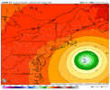
12Z Euro: After recurving, the center misses Bermuda to the NW, as it did for 93L two days earlier in this run. Then it turns back NW before ultimately turning back NE missing the NE US and barely missing Newfoundland.
GeorgiaGirl
Member
Good catch - yeah gets close to the NE in fantasy land
View attachment 175026
Yeah, that'd be pretty interesting lol, as is even if there's no effects, I find it interesting that most models suggest both invests develop now and there's going to be a possible fujiwhara effect.
Shaggy
Member
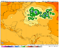
I'd think 94L would have been a serious issue had 93L had more separation or wasn't there.Man what a mess on the ensemble mins
View attachment 175028
The NWS in Raleigh mentions 94L in its latest forecast discussion noting that some of the models were bringing it towards the Southeast coast later in the discussion period. It also mentioned that those models were widely divergent in intensity and track. At least it's good to know that 94L is being watched in case it develops and moves towards the Eastern United States.
Shaggy
Member
That's alot of members bringing whatever it is to the coast
Good luck figuring this one out. Two tropical waves in close proximity, a ULL somewhere near/over the SE, ridging building in over the Lakes/NE, and a ridge out in the Atlantic, with a trough to the north. Lol
My guess is both waves/TCs miss and remain OTS. The ULL will end up being east and transitory. If that is wrong, however, and it cuts off over AL, oh boy.
My guess is both waves/TCs miss and remain OTS. The ULL will end up being east and transitory. If that is wrong, however, and it cuts off over AL, oh boy.
Fujiwhara double landfall into the ull! Seriously though you said it right good luck figuring this one outGood luck figuring this one out. Two tropical waves in close proximity, a ULL somewhere near/over the SE, ridging building in over the Lakes/NE, and a ridge out in the Atlantic, with a trough to the north. Lol
My guess is both waves/TCs miss and remain OTS. The ULL will end up being east and transitory. If that is wrong, however, and it cuts off over AL, oh boy.
ULL just hasnt been super impressive as we’ve gotten closer. Obviously time for it to change but I don’t know that I have any reason to believe it’ll beef up in the time we have left beyond just “models can and will change at X range”Good luck figuring this one out. Two tropical waves in close proximity, a ULL somewhere near/over the SE, ridging building in over the Lakes/NE, and a ridge out in the Atlantic, with a trough to the north. Lol
My guess is both waves/TCs miss and remain OTS. The ULL will end up being east and transitory. If that is wrong, however, and it cuts off over AL, oh boy.
lexxnchloe
Member
Setup is different than earlier in the year atmospheric wise but wondering how many west/east adjustments will be made? Sad that we can’t get weather dialed in within a week!
Lots of adjustments incoming. Really complex setup with this one.Setup is different than earlier in the year atmospheric wise but wondering how many west/east adjustments will be made? Sad that we can’t get weather dialed in within a week!
BrickTamland
Member
Setup is different than earlier in the year atmospheric wise but wondering how many west/east adjustments will be made? Sad that we can’t get weather dialed in within a week!
Lots of adjustments incoming. Really complex setup with this one.
Seems that is always the case when there is a real threat of a landfall.
Here’s multi model ensemble from Tomer

