• Hello, please take a minute to check out our awesome content, contributed by the wonderful members of our community. We hope you'll add your own thoughts and opinions by making a free account!

Pattern July Fry and Dry

Greensbiro averages 27-29 , 90 degree plus days a year.
In 1914 they had over 80 for the all time hottest year. ( all those Ford Model T's wrecking the climate back then I supose)
This year we are around 23ish after today.
I cant remember a summer with so many consecutive days of a at least a trace of rain. The streak might get broken for a day, 2 if your real lucky. But this has been the theme for 5 weeks now. Also of note is the consistent 70ish degree DP days.
Yeah those 70s dews used to be a coastal thing only.
 
Greensbiro averages 27-29 , 90 degree plus days a year.
In 1914 they had over 80 for the all time hottest year. ( all those Ford Model T's wrecking the climate back then I supose)
This year we are around 23ish after today.
I cant remember a summer with so many consecutive days of a at least a trace of rain. The streak might get broken for a day, 2 if your real lucky. But this has been the theme for 5 weeks now. Also of note is the consistent 70ish degree DP days.

Yeah something I find interesting here too is that the 1930s are unmatched on record heat with several years being the worst on record

The only even year that has come close since is 1980

Meanwhile since 1980 we've had several historic cold snaps 🤔 December 1983 only barely beat February 2021 here for the all time longest below freezing streak we've had and a couple years ago in January was the 6th coldest high ever recorded at the airport plus last winter was the third winter in a row we got down near zero which I would equate to us being over 105 degrees. That's how rare it is

The only heat record I can find since 2000 really is some record high lows in 2012

🤔 🤔
 
Last edited:
Yeah something I find interesting here too is that the 1930s are unmatched on record heat with several years being the worst on record

The only even year that has come close since is 1980

Meanwhile since 1980 we've had several historic cold snaps 🤔 December 1983 only barely beat February 2021 here for the all time longest below freezing streak we've had and a couple years ago in January was the 6th coldest high ever recorded at the airport plus last winter was the third winter in a row we got down near zero which I would equate to us being over 105 degrees. That's how rare it is

The only heat record I can find since 2000 really is some record high lows in 2012

🤔 🤔
It's going to take something crazy for those 1930's records in the plains to fall. The 1950's were rough too, but nothing like the 30's.
 
It's going to take something crazy for those 1930's records in the plains to fall. The 1950's were rough too, but nothing like the 30's.

Drought will do it. Like a continental sized drought as was back then.

Something else to think about regarding weather in the old days at least in the Carolinas is tree cover. The coastal plains and Piedmont would have been clear cut almost entirely several times over from European settlement until post WW2. The Piedmont in particular is a jarring example. There wasn't red clay everywhere back in the 18th-19th century period. Soils were described as loamy with some clay in the upland areas. Clearcutting and poor farming practices caused nearly all of that soil to wash into the rivers, leaving the clay behind. There are still some known areas of OG Piedmont soil in both Carolinas but very few. I've seen so many pictures of the period from the period of the 1870s onward and the most striking thing is the absolute barren, treeless view of the land a century ago. Places that weren't swamp would have been bare ground or loosely cultivated everywhere you looked. The greening of North America, particularly the south post WW2 is crazy. The lack of trees before and the growth of them after had to have regional effects on the climate.
 
I’m just coming by to remind everyone of just how much I hate this time of year. So much so that I’m begging for a hurricane to come shake up the pattern and end this mess. Fall can’t get here soon enough. The good news is we are on the back half of summer now and while the first of September can be hot, averages would be falling like a rock.
 
I’m just coming by to remind everyone of just how much I hate this time of year. So much so that I’m begging for a hurricane to come shake up the pattern and end this mess. Fall can’t get here soon enough. The good news is we are on the back half of summer now and while the first of September can be hot, averages would be falling like a rock.
Most areas are at their peak summer averages right now. So at least we’ve made it to the hottest time of year.
 
Most areas are at their peak summer averages right now. So at least we’ve made it to the hottest time of year.
Some models say the hottest temps have yet to come for many of us. I look for 90's well into October this year. I'm still not sold on our brief shot at relief Tuesday and Wednesday In NC and SC.
 
I’m just coming by to remind everyone of just how much I hate this time of year. So much so that I’m begging for a hurricane to come shake up the pattern and end this mess. Fall can’t get here soon enough. The good news is we are on the back half of summer now and while the first of September can be hot, averages would be falling like a rock.
Nothing from the tropics will help us this year. This summer and fall are going to be like 2016.
 
I don't know if it'll be right, but the Euro says we cool off after tomorrow and then get back to around 90-95 for a couple of days. Then it's much cooler after that with some of us not seeing 80 for highs some days.
 
Nothing from the tropics will help us this year.

After last year’s horrendous season for many US residents, especially FL/GA/SC/NC, saying that (based on my intentional reinterpretation of your statement) “Nothing from the tropics will help us this year” is an understatement to say the least. Technically, “nothing more” as Chantal already hit and hit pretty hard in NC with its bad flooding and several tornadoes.
 
A nice dry outflow boundary ahead of a small area of convection has just come ESE through here with winds picking up. We’ll see if I get much rain.

Edit: There was no rain here as it slid by just to my south.
 
Last edited:
After last year’s horrendous season for many US residents, especially FL/GA/SC/NC, saying that (based on my intentional reinterpretation of your statement) “Nothing from the tropics will help us this year” is an understatement to say the least. Technically, “nothing more” as Chantal already hit and hit pretty hard in NC with its bad flooding and several tornadoes.
It will probably take a tropical system to break what I think becomes a severe drought over much of the southeast by September. Chantal did what it did because it almost stalled in NC. A system more like what we had with storms like Beryl in 1994 and Hanna in 2002 can be great drought busters. If I remember right neither of them were hurricanes and the 2002 system did break a very severe drought in NC, SC, and GA.
 
The storm has begun to rain out, but the way the summertime thunderstorms have typically patterned themselves this year around this area is starting to get dangerous for the part of the county within I-520:

BULLETIN - EAS ACTIVATION REQUESTED
Flash Flood Warning
National Weather Service Columbia SC
631 PM EDT Sun Jul 20 2025

The National Weather Service in Columbia has issued a

* Flash Flood Warning for...
East Central Columbia County in east central Georgia...
Northeastern Richmond County in east central Georgia...
Western Aiken County in central South Carolina...
Southern Edgefield County in central South Carolina...

* Until 800 PM EDT.

* At 631 PM EDT, Doppler radar and automated rain gauges indicated
thunderstorms producing heavy rain across the warned area. Between
2 and 2.5 inches of rain have fallen. Additional rainfall amounts
of 0.5 to 1.5 inches are possible in the warned area. Flash
flooding is ongoing or expected to begin shortly.

HAZARD...Flash flooding caused by thunderstorms.

SOURCE...Radar and automated gauges.

IMPACT...Flash flooding of small creeks and streams, urban
areas, highways, streets and underpasses as well as
other poor drainage and low-lying areas.

* Some locations that will experience flash flooding include...
North Augusta, Evans, Augusta, Martinez, Belvedere, Augusta
National Golf Club, Summerville, Midtown, Daniel Field, Glendale,
Village Plaza Shopping Center, Eisenhower Park, Village at
Riverwatch Shopping Center, Westover Memorial Park, Savannah
Bluffs Heritage Preserve, West End Augusta, Kroc Center,
Harrisburg, Westwick and Waverly.

This includes the following highways...
Interstate 520 in South Carolina between mile markers 17 and 18.
Interstate 20 in South Carolina between mile markers 0 and 2.
Interstate 20 in Georgia between mile markers 196 and 201.
 
It will probably take a tropical system to break what I think becomes a severe drought over much of the southeast by September. Chantal did what it did because it almost stalled in NC. A system more like what we had with storms like Beryl in 1994 and Hanna in 2002 can be great drought busters. If I remember right neither of them were hurricanes and the 2002 system did break a very severe drought in NC, SC, and GA.

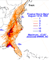
1. I can’t find drought maps from 1994. But I do know that TS Beryl caused a lot of SE US flooding, including in some areas already hit very hard by the devastating rains of TS Alberto. So, that storm may have done more harm than good:

Beryl of 1994’s rainfall
IMG_4097.gif

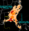
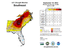
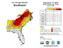
2. TS Hanna of 2002 had mixed results. Though it had its share of flooding, it also helped alleviate the severe drought to an extent in some areas as you said:

Hanna of 2002’s rainfall:
IMG_4098.gif

Drought Monitor just before Hanna:
IMG_4099.png

Drought Monitor just after Hanna:
IMG_4100.png
 
Last edited:
1. I can’t find drought maps from 1994. But I do know that TS Beryl caused a lot of SE US flooding, including in some areas already hit very hard by the devastating rains of TS Alberto. So, that storm may have done more harm than good:

Beryl of 1994’s rainfall
View attachment 173582

2. TS Hanna of 1994 had mixed results. Though it had its share of flooding, it also helped alleviate the severe drought to an extent in some areas as you said:

Hanna of 2002’s rainfall:
View attachment 173583

Drought Monitor just before Hanna:
View attachment 173584

Drought Monitor just after Hanna:
View attachment 173585
Yeah, Berly did do more harm than good with that summer being very wet and going over many areas Alberto had hit. My point was that it does not take a hurricane to help with drought. Well organized tropical storms can do it too and as long as they keep moving along will not cause major flooding. Hanna did slow down once it got up into western NC and SC, dropping a ton of rain and causing some flooding. Jerry in 1995 is another great example of a very slow moving system that dropped too much rain. Upstate SC had been dry that summer, but 19 inches of rain in 24 hours is still way too much.
 
Most people can’t seem get use to this kind of weather. Summer in the southeast. We should be used to this

If you put on your "really" rose colored glasses, it's only awful in my opinion from around the second week of July to the second week of August here in the coastal plains. I'm in the field 4 days a week doing estimates and there's subtle shift around the 4th of July every year plus or minus a week or two. It gets REALLY muggy all at once. Then around that second week of August, again plus or minus a week or two, the worst of the high dew points retreat south and the sun angle is getting lower/days shorter giving a noticeably different feel to the air.

It's kind of like winter to me. We'll get ~6 weeks or so of on again off again cold weather (I loosely define cold weather as lows in the 20s) making it hard to get used to it. Same with summer.
 
Back
Top