• Hello, please take a minute to check out our awesome content, contributed by the wonderful members of our community. We hope you'll add your own thoughts and opinions by making a free account!

Wintry Feb. 19-20

im actually curious about when RAP and HRRR became most viable -- i know not before 24 hours before start time, but we are definitely at that mark now for NC. do we need to wait a little longer before leaning more on them?

and fwiw, GFS *did* forecast very well 24ish hours out for the Jan event.
the globals are better until less than 12 hours out, imo. And even then the globals are still better... you can just get off-hour corrections(dont have to wait 6 hours to see) based on current obs/radar trends using the hourly RAP/Hrrr which helps forecasting.
 
I’d trade a mix or even a lot of sleet if we can jackpot precip.
100%. We’ve already had two events this winter where we were fighting to get .1-.2” of QPF. Amp this up and let’s see what happens with 0.5-0.75” of qpf. If that means more sleet then so be it, but that makes it a real storm
 
Not sure if the GEFS/GFS is the best guidance to use right now. I always thought this is the range for the RAP/HRRR. Guess I was wrong lol
If model (any model) is trending colder and snowier = good

If model (any model) is trending warmer and less snowy = bad

I just keep it simple like that. I’ve never understood the aversion from just simply watching all model trends up to go time
 
If model (any model) is trending colder and snowier = good

If model (any model) is trending warmer and less snowy = bad

I just keep it simple like that. I’ve never understood the aversion from just simply watching all model trends up to go time
Always going to be some biases but from what I see, areas west are looking colder but the Carolinas will be battling the WAA either way. As mentioned by a few also the moisture feed looks fine based on jet interaction and the overall increase I'm QPF likely is a response to that.
 
UK met just absolutely refuses to fill in that huge dry slot through pretty much all of NC save the NE quadrant
Probably has something to do with that long line of 6+ inch rainfall totals in the gulf from that squall line it's showing.
 
100%. We’ve already had two events this winter where we were fighting to get .1-.2” of QPF. Amp this up and let’s see what happens with 0.5-0.75” of qpf. If that means more sleet then so be it, but that makes it a real storm
The 3km NAM is usually very good inside 36 hours and will usually spot the warm nose. I can’t recall a time where it showed snow and we got sleet. Tonight’s runs will be big for us.
 
If a warm nose is being modeled remotely close to the RDU area, you can count on mixing. There have been so many storms in that past where the warm nose was being modeled just north of the sandhills and we mixed in RDU. So I'm 100% counting on a lot of mixing in the RDU area.
 
Prolly means nothing …. Or I can’t see bc the cold meds … but looks like Brent is already Struggling out in Sooner land.


Sent from my iPhone using Tapatalk
 
Prolly means nothing …. Or I can’t see bc the cold meds … but looks like Brent is already Struggling out in Sooner land.


Sent from my iPhone using Tapatalk

Everyone still thinks the main show will be this afternoon tbh. I also remember the struggle in January and then once it started getting dark it piled up

We may still bust but we got a long way to go
 
Halfway considering a drive up to like Chattanooga or heck even Nashville just to see a good snow fall. But not sure I can justify it for only 1-2 inches. Wish there was some consistency on higher amounts in those areas or even like Cashiers/Highlande
 
Halfway considering a drive up to like Chattanooga or heck even Nashville just to see a good snow fall. But not sure I can justify it for only 1-2 inches. Wish there was some consistency on higher amounts in those areas or even like Cashiers/Highlande
The roads should be fine so I'd wait until we see who is going to jackpot.
 
Over performing on highs today it seems , classic sunny day. I feel like ahead of a lot of these storms we do overperform on highs day before. I don’t think that matters a whole lot however for the outcome of the storm perhaps. Maybe mid 50s today?
 
a386485ec5082651614e33ac6da009d3.jpg


Sent from my iPhone using Tapatalk
 
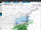
12z Euro is going to be wetter, I think. WB seems to be down, so only have coarse maps.
Screenshot 2025-02-18 123003.png


It may not translate to jack..... BUT its encouraging to see the radar look NAM(ish) Baby steps

EDIT : Takes 4ever to bomb imo and even Wake kinda lightish on the radar precip anyway looks good for Ol Mayock NC !!
 
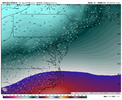
So I assume the 850 line is generally south of the 540 line correct? Looks like euro taking that 540 north of Wake county but surface p-types staying relatively stationary. Don't let this fool me??
 
So I assume the 850 line is generally south of the 540 line correct? Looks like euro taking that 540 north of Wake county but surface p-types staying relatively stationary. Don't let this fool me??
Euro’s lower resolution. I would say watch the NAMs trends for warm nose information
 
Snowfall Forecast Contest Thread 3.0 is up and running. Thanks @SD for the thread load!

$50 in the pot. Winner take all. DM me if you would like to add to the pot

The forecast cities:
Greensboro, NC (PTI)
Raleigh, NC (RDU)
Elizabeth City, NC (Coast Guard Air Station)
Norfolk, VA (ORF)
Richmond, VA (RIC)

Link to the contest thread: https://southernwx.com/community/threads/griteater-contest-3-0.1380/
 
1739900807236.png

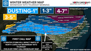
first call map from NC Weather Authority. Ethan is great -- been following him for a few years now.

im riding the line between glory and disappointment per this call map -- just north of the tip top of the red dash line with risk for mixing, just south of the lower edge of the purple for highest boom potential.
 
The gradient on the west and south sides of the snow will be very sharp. Really tough forecast for Wake. Sweet spot looks to be the Wake/Franklin county line ENE to VA Beach
 
The models are underdoing precip.....that's the hill I am willing to die on for this storm lol. And here's why.
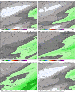
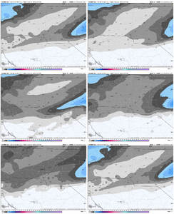
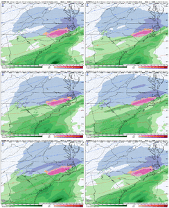
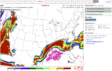
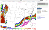
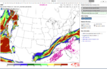
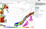
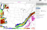
PW probability maps from the SPC. The latest HREF has greater than 90% chance of PW's exceeding 0.5" all the way up to the Kentucky and Virginia borders, and that's even with Gulf coast convection. Moisture is fine, plenty to go around. That doesn't solve for questions on temps or precip types, (that's somebody else's hill lol) but getting confident the board sees more precip than what is modeled.
Also like how this tongue of 0.5-0.8 PW pivots around and then tightens up over NC, thing of beauty. Somebody in NC is getting crushed.

1739897547361.png


1739897610913.png

1739897643014.png

1739897694722.png
1739897749707.png
 
The models are underdoing precip.....that's the hill I am willing to die on for this storm lol. And here's why.
PW probability maps from the SPC. The latest HREF has greater than 90% chance of PW's exceeding 0.5" all the way up to the Kentucky and Virginia borders, and that's even with Gulf coast convection. Moisture is fine, plenty to go around. That doesn't solve for questions on temps or precip types, (that's somebody else's hill lol) but getting confident the board sees more precip than what is modeled.
Also like how this tongue of 0.5-0.8 PW pivots around and then tightens up over NC, thing of beauty. Somebody in NC is getting crushed.

View attachment 170404


View attachment 170405

View attachment 170406

View attachment 170407
View attachment 170408
so the areas shown in the red block of 90+% for the last three images here are the most likely to receive said crush, right? triangle / a bit NE of it?
 
kinda at the point where most of the analyzing left to do for e/cnc is warm nose progression. not worried about getting qpf for those areas. with this weird hybrid cad setup its kinda like the early jan one where there's nothing substantial to really stop the WAA from getting to the Us-1 corridor. its sorta nice to have one where qpf doesn't appear to be a huge worry tho
 
View attachment 170427

IK is the SREF , but pretty much all of NC minus far SW, and SC are .3" or higher. .5" Line now into Eastern Rowan and Cabarrus county

EDIT : 1.3" QPF in Mayok NC !
This matches up perfectly with the GFS graphcast has been showing for a couple days now.
 
Last edited:
Back
Top