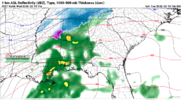
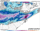
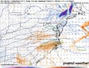
Somebody down our way and points east/NE is gonna get lucky catching the western end of that WAA/fgen band that’s for sureView attachment 170365
Heres the crazy twin sister though... still fun but in a different way... she makes you chase
Somebody down our way and points east/NE is gonna get lucky catching the western end of that WAA/fgen band that’s for sureView attachment 170365
Heres the crazy twin sister though... still fun but in a different way... she makes you chase
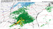
Yes and both the HRRR and 3k NAM have been consistent on showing that since last nightword to the wise if the gulf convection sets up like that then this is one of those rare times it needs to be watched for moisture transport issues (gulf stealing our moisture, in the parlance)
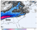
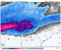
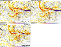
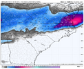
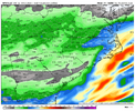
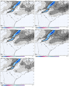
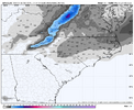
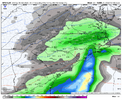
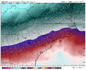
Now, the question is ... how can you possibly know which one is going to pan out? Also, what minor tweaks need to happen upstream to prevent the transport issue from occurring? At what point do these two models diverge?Rap: Best case with gulf coast convection
Hrrr: Worst case with gulf coast convection
View attachment 170370View attachment 170371
To directly answer your question, just a matter of luck. Same way you don’t know if the summer thunderstorm is going to soak Raleigh or Zebulon.Now, the question is ... how can you possibly know which one is going to pan out? Also, what minor tweaks need to happen upstream to prevent the transport issue from occurring? At what point do these two models diverge?
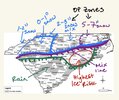
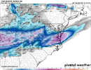
Paying homage to the Bunnlevel Line -- through southern Harnett, southern Moore and into central Richmond.Second Call!View attachment 170378
It’s been fairly consistent in the last 24 hours in giving my back yard over 2 inches. I doubt it, but it is nice to see.
Seems like gulf coast convection is gonna play a big part in how much qpf there is to go around and who gets what. Idealy we get almost no gulf convection and everybody gets better qpf.
Worst case we get a horizontal line of convetion racing out over the gulf and hardly anyone gets qpf except Far NE NC, and they can actually get even more in this scenario b/c it seems to initiate a transfer to the coastal quicker.
Models are all over the place with how the convection works out. The RAP is the best case scenario, imo. It basically has no convection in the gulf.
Higher precip rates will keep the column colder in WAA situations.The southern cutoff shifted south a bit, that’s interesting
Sent from my iPhone using Tapatalk
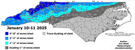
@1300m neck of the woods prolly the best spot in wakeI'd shove the southern edge of the big snow gradient a bit north of the GFS and drop it right over central Wake County instead of central Johnston-Harnett.
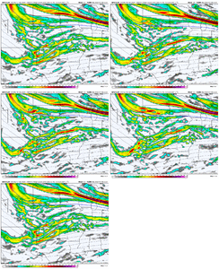
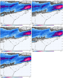
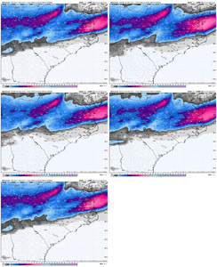
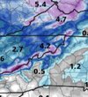
Locked inGFS last 4 runs View attachment 170385
Any thoughts on western regions? Triad, CLT, etc... Looks like there might be a sliver of precip max in the I-85 corridor.I'd shove the southern edge of the big snow gradient a bit north of the GFS and drop it right over central Wake County instead of central Johnston-Harnett.
I agree with you Webb, but other than the NAM it looks as if other models are trending to having the boundary layer and sleet skewed further east. Probably won’t know until game time, however.I'd shove the southern edge of the big snow gradient a bit north of the GFS and drop it right over central Wake County instead of central Johnston-Harnett.
I agree with you Webb, but other than the NAM it looks as if other models are trending to having the boundary layer and sleet skewed further east. Probably won’t know until game time, however.
Stop shoving things north! We like em south in RaleighI'd shove the southern edge of the big snow gradient a bit north of the GFS and drop it right over central Wake County instead of central Johnston-Harnett.
Its ok we're used to it in Garner. Happy to get anything based on how the last few years have gone!The kind of snow gradient we might see in/around Wake County here could definitely rival storms like Dec 2018 & Feb 2015.
There will probably be a massive sensible difference between places like Wake Forest vs say Garner & Fuquay-Varina.