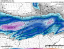
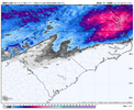
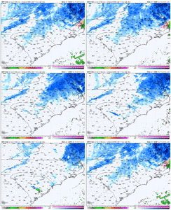
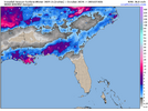
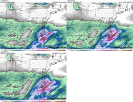
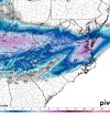
I mean even if there’s a good bit of sleet that’s .75+ QPF for US-1/east. Impactful wintry event
-
Hello, please take a minute to check out our awesome content, contributed by the wonderful members of our community. We hope you'll add your own thoughts and opinions by making a free account!
You are using an out of date browser. It may not display this or other websites correctly.
You should upgrade or use an alternative browser.
You should upgrade or use an alternative browser.
beanskip
Member
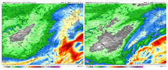
NAM goes one way, FV3 goes the other ....
This gets me darn close to that 10% higher end slide the NWS shared. Somebody just to the north of the transition line is going to get smokedThe 3km would be about perfect for Raleigh...max out precip and toe the line with mix of sleet/snow. About as perfect event.
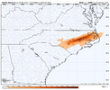
View attachment 170350View attachment 170351
packfan98
Moderator
Pretty substantial differences between the 12k and 3k Nam suite for 12z. I would think that one should lean toward the 3k, but the precip totals looks a little funky to areas in the west. I think it should fill in a little more on the next run.
Call me crazy, but I often find the 3km’s precip depictions to be a little overdone on being spotty / variable oftentimes. Either way, it’s a marked improvement on 06z, too (basically tripled QPF in the RDU area, for example).Pretty substantial differences between the 12k and 3k Nam suite for 12z. I would think that one should lean toward the 3k, but the precip totals looks a little funky to areas in the west. I think it should fill in a little more on the next run.
Stormlover
Member
ChattaVOL
Member
Found my model… I’m riding the RAP
Bigedd09
Member
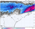
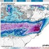
You think it's underdoing QPF out west?3km NAM certainly painting a winter wonderland type scenario with 5-7" of snow in Wake with snow showers around through at least 1-2 pm Thursday.
View attachment 170355View attachment 170356
NBAcentel
Member
Saddest part is that’s charlottes biggest snow in 3 years3km NAM certainly painting a winter wonderland type scenario with 5-7" of snow in Wake with snow showers around through at least 1-2 pm Thursday.
View attachment 170355View attachment 170356
Question on the NAM model kits. If one shows a warm nose but the others do not why do we take that one as more gospel? Suppose it was the 3km that showed the warm nose more but the plain ole NAM not, would we be believing that one more?
Tsappfrog20
Member
Allan Huffman
Sent from my iPhone using Tapatalk
Sent from my iPhone using Tapatalk
SimeonNC
Member
That snow matches what the NWS said about a possible "jackpot" zone from South CLT-GSOThe 3km would be about perfect for Raleigh...max out precip and toe the line with mix of sleet/snow. About as perfect event.
View attachment 170350View attachment 170351
The influence of the upper jet dynamics are going to be better from Raleigh north and east into VA. I think from CLT to GSO east stands the best chance at a uniform 1-3" event, with areas further west probably struggling more. That is definitely the area that is the absolute most difficult to forecast with this one, but some heartache is probably inevitable in western NC/SC etc.You think it's underdoing QPF out west?
beanskip
Member
WRF-NSSL (whatever the hell that is) just became the CLT crowd's new model of choice -- almost 5 inches for the Queen City.
Interested to see the 12z HREF now that it seems the American CAMs have woken back up as far as QPF. Looked like it was headed for .5-.75+ for C/ENC at 00z
12z NAM 12k has snow falling "I'm sure most is light" for over 20 hours here that would be awesome if it were to happen. Which I'm sure it won't... lol
astroworld123
Member
If i recall correctly, didn't the NAM overdo the warm nose for the Jan 9 storm in ATL? Had them getting all sleet i believe but they ended up with 3-5"
Webberweather53
Meteorologist
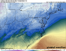
Gotta be real careful with those precip type maps and snow output from the 3km NAM
The max t aloft over Raleigh during the height of the storm even on the 3km NAM is slightly above freezing while there’s active warm advection aloft occurring.
Those 2 things together in the model world in a setup like this usually means you’re sleeting or at the very least a snow/sleet mix which greatly slashes your snow totals.

belowfreezing
Member
Is a Trace to 1 inch still the consensus Gastonia, Shelby & Forest City back west? Thoughts?
My take is that the 3km NAM is one of the best to watch for warm nosing. The regular NAM is generally just not a very good model (in winter at least). But I’d lump it in there with the SREF in that you can use it a bit just to see QPF trends as much as anythingQuestion on the NAM model kits. If one shows a warm nose but the others do not why do we take that one as more gospel? Suppose it was the 3km that showed the warm nose more but the plain ole NAM not, would we be believing that one more?
WolfpackHomer91
Member
Northern Burbs had a 8-10" one in 2018 too depending where you stood. Dec 18' I had like 8-9" at my old house in RowanIt's too bad we don't live in Elizabeth City...they looking at approaching double digit winter. Raleigh hasn't had a 10"+ winter in 20 years. Charlotte had one in 2014.
View attachment 170358
Fountainguy97
Member
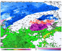
Hey everyone. Quite the event unfolding tomorrow. This is a super weird start time for a winter event across the region. It's slowly made its way to being a morning onset. The image below is lunch time tmrw.
Could be a recipe for some major travel issues if we don't get many cancellations in the Raleigh region.
I remember one storm when I was in high school in Greenville NC. It started snowing at 11am and hit the roads fast and they hadn't cancelled because it was supposed to start later.
Could be a recipe for some major travel issues if we don't get many cancellations in the Raleigh region.
I remember one storm when I was in high school in Greenville NC. It started snowing at 11am and hit the roads fast and they hadn't cancelled because it was supposed to start later.

any reason this type of chart isn't used/produced more often? seems more useful than just 850 mapsGotta be real careful with those precip type maps and snow output from the 3km NAM
The max t aloft over Raleigh during the height of the storm even on the 3km NAM is slightly above freezing while there’s active warm advection aloft occurring.
Those 2 things together in the model world in a setup like this usually means you’re sleeting or at the very least a snow/sleet mix which greatly slashes your snow totals.
View attachment 170357
astroworld123
Member
Hey everyone. Quite the event unfolding tomorrow. This is a super weird start time for a winter event across the region. It's slowly made its way to being a morning onset. The image below is lunch time tmrw.
Could be a recipe for some major travel issues if we don't get many cancellations in the Raleigh region.
I remember one storm when I was in high school in Greenville NC. It started snowing at 11am and hit the roads fast and they hadn't cancelled because it was supposed to start later.
View attachment 170360
Was that in 2014? I remember that storm, started 11 am and we had early release around 11:30 but it was already white everywhere.
Sent from my iPhone using Tapatalk
Tsappfrog20
Member
Hey everyone. Quite the event unfolding tomorrow. This is a super weird start time for a winter event across the region. It's slowly made its way to being a morning onset. The image below is lunch time tmrw.
Could be a recipe for some major travel issues if we don't get many cancellations in the Raleigh region.
I remember one storm when I was in high school in Greenville NC. It started snowing at 11am and hit the roads fast and they hadn't cancelled because it was supposed to start later.
View attachment 170360
I agree with you but I will be very surprised if Wake County does not cancel schools with the onset being around 11am
Sent from my iPhone using Tapatalk
Webberweather53
Meteorologist
I haven’t produced a map for this event yet, but I personally think central wake gets about 2-3” of snow sleet/mix. I can see more northern wake and points north
Iceagewhereartthou
Member
Piedmont dry slot is PAINFUL!Hey everyone. Quite the event unfolding tomorrow. This is a super weird start time for a winter event across the region. It's slowly made its way to being a morning onset. The image below is lunch time tmrw.
Could be a recipe for some major travel issues if we don't get many cancellations in the Raleigh region.
I remember one storm when I was in high school in Greenville NC. It started snowing at 11am and hit the roads fast and they hadn't cancelled because it was supposed to start later.
View attachment 170360
WolfpackHomer91
Member
Thats @Jimmy Hypocracy Dwarf sisters I thinkWRF-NSSL (whatever the hell that is) just became the CLT crowd's new model of choice -- almost 5 inches for the Queen City.
Only cases I’ve seen where it was OK to go against the 3km NAM warm nosing was in heavy and deep cold air dammingMy take is that the 3km NAM is one of the best to watch for warm nosing. The regular NAM is generally just not a very good model (in winter at least). But I’d lump it in there with the SREF in that you can use it a bit just to see QPF trends as much as anything
Fountainguy97
Member
Yeah that's probably right!Was that in 2014? I remember that storm, started 11 am and we had early release around 11:30 but it was already white everywhere.
Sent from my iPhone using Tapatalk
Same reason why kids don’t eat green beans - doesn’t usually give the desired resultany reason this type of chart isn't used/produced more often? seems more useful than just 850 maps
packfan98
Moderator
12z Icon


WolfpackHomer91
Member
Tsappfrog20
Member
I haven’t produced a map for this event yet, but I personally think central wake gets about 2-3” of snow sleet/mix. I can see more northern wake and points north
I agree with you Eric but I would definitely be ok with 2-3”. The Roads are going to be horrible tomorrow night imo
Sent from my iPhone using Tapatalk
WolfpackHomer91
Member
In the discussion it was said that areas still under a Winter Storm Watch were not updated to a warning because of issues with snow versus ice in the modeling. The discussion did say that they were monitoring future model runs for a possible update to Winter Storm Warnings for these areas.

