Henry2326
Member
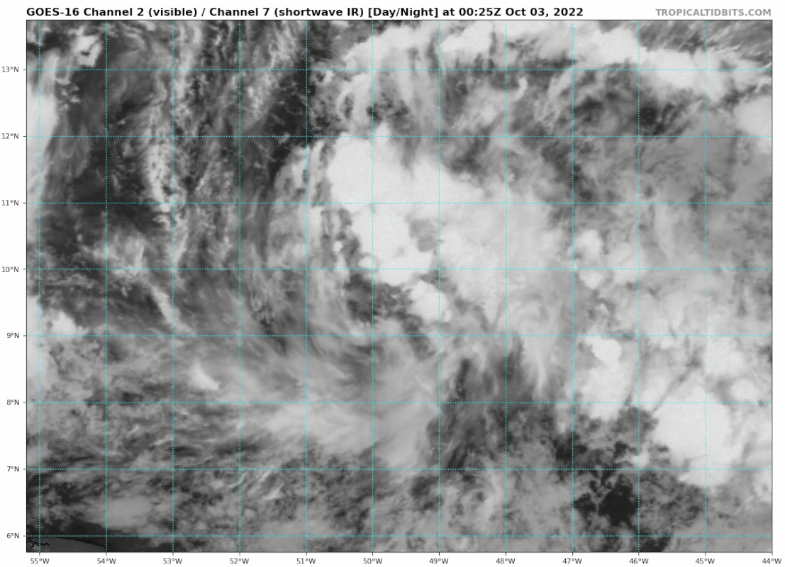
You think this could end up in the gulf? Even if it’s weak?
Definitely the season with the deep troughs that continue to dig.You think this could end up in the gulf? Even if it’s weak?
IMO....depends on position of the H. If it gets some room, maybe.You think this could end up in the gulf? Even if it’s weak?


.png")
.png")
.png")

Going west into Central America or south Mexico. Can’t go north.Idk, looks like trough after trough. Texas or Mexico would probably be the area it will go.
Why is this? I would think trough after trough could have to potential to bring it north if one of them dips down to the Gulf, no?Going west into Central America or south Mexico. Can’t go north.


That’s definitely a look the Southeast can work with

Per TWC this morning from Jim Cantore this storm won’t hit the gulf. Just repeating what I heard.Why is this? I would think trough after trough could have to potential to bring it north if one of them dips down to the Gulf, no?
It's not as clear as it was with Ian. This time we have a flatter more west extended subtropical ridge under the rounds of EC troughs. In a general sense that's going to bias the track W toward C America before it gets much of a notth component. That said there will likely be small weaknesses in the ridge for a stronger system to find and leak northward where it might feel the troughs.Why is this? I would think trough after trough could have to potential to bring it north if one of them dips down to the Gulf, no?
Well it’s gonna hit the gulf. Then If JB says it’s only gonna be a TS you can mark down a Cat 5.Per TWC this morning from Jim Cantore this storm won’t hit the gulf. Just repeating what I heard.
Gefs doesn't clear it up much eitherIt's not as clear as it was with Ian. This time we have a flatter more west extended subtropical ridge under the rounds of EC troughs. In a general sense that's going to bias the track W toward C America before it gets much of a notth component. That said there will likely be small weaknesses in the ridge for a stronger system to find and leak northward where it might feel the troughs.
.png")
.png")
.png")
I’m sure the Central American thread is on ?.
.png")

This setup is also a rain killer for the SE no gulf/carribbean tap means mostly dry front after dry frontThis could be a great ACE accumulating storm maybe if it can grab some strength before reaching land. But this pattern won’t lend you a threat to the US. View attachment 122802

Only opportunity I see is cold and dry , frost potential down to the SE with that look! Monster high after monster high over the US12z GFS.....looks like fun...all kinds of opportunity.
4 days dancing around......
View attachment 122803
If we can get an evolution like the CMC shows, that could bring a potential period of some good moisture transport from the gulf .. but a lot of things have to go right there so it’s still meh for rainThis setup is also a rain killer for the SE no gulf/carribbean tap means mostly dry front after dry front
.png")
 2nd
2nd


.png")
.png")
.png")
.png")