Cadi40
Member
Is this shaping up to be more of an NC threat or less of one?
Is this shaping up to be more of an NC threat or less of one?
Are you expecting a Florida landfall? A landfall in Florida would likely mean a weaker storm for NC.Now that both the deep-layer ridge to the north of Isaias and Isaias itself are looking more impressive, I'd wager the threat has unfortunately increased a lot.
Hot towers going up. With those SSTs it’s like throwing gas on a wet pile of wood to get it burning.
Sent from my iPhone using Tapatalk
Are you expecting a Florida landfall? A landfall in Florida would likely mean a weaker storm for NC.
054
URNT15 KNHC 312316
AF305 0909A ISAIAS HDOB 24 20200731
230700 2309N 07615W 8432 01528 0044 +188 +098 053052 053 051 004 00
230730 2308N 07614W 8434 01522 0042 +186 +097 049048 052 050 006 02
230800 2307N 07613W 8434 01522 0046 +177 +096 048047 051 054 007 00
230830 2306N 07611W 8428 01523 0046 +168 +096 051053 055 053 012 00
230900 2306N 07610W 8447 01502 0039 +177 +094 052058 062 059 014 00
230930 2305N 07609W 8431 01519 0046 +166 +090 051056 062 060 013 00
231000 2304N 07608W 8425 01527 0047 +168 +087 049056 059 056 007 00
231030 2303N 07606W 8435 01516 0046 +167 +084 051058 060 052 001 00
231100 2302N 07605W 8425 01519 0043 +164 +082 051053 056 052 001 00
231130 2301N 07604W 8434 01505 0040 +157 +083 052056 059 054 018 00
231200 2300N 07603W 8426 01502 0031 +152 +084 055060 062 053 021 00
231230 2259N 07601W 8439 01484 0022 +155 +085 050054 060 055 058 00
231300 2258N 07600W 8416 01500 0018 +154 +088 044058 062 064 031 03
231330 2257N 07559W 8445 01460 9999 +162 +094 058063 070 064 027 00
231400 2257N 07558W 8436 01461 9982 +170 +100 056051 058 067 014 00
231430 2256N 07556W 8432 01450 9967 +173 +106 049044 051 073 022 03
231500 2255N 07555W 8436 01437 9950 +173 +112 046038 044 073 023 03
231530 2254N 07553W 8425 01432 9923 +195 +116 045032 036 049 002 00
231600 2253N 07552W 8432 01416 9911 +200 +119 050025 029 061 008 03
231630 2252N 07551W 8434 01405 9903 +197 +123 054016 021 027 000 00
A stronger Isaias w/ a deeper warm core is going to be steered further north by the upper level trough to its NW.
Yikes.Closed off eye latest VDM
F. Eye Character: Closed
G. Eye Shape & Diameter: Circular with a diameter of 13 nautical miles (15 statute miles)
Yikes.
How about for eastern SC?Now that both the deep-layer ridge to the north of Isaias and Isaias itself are looking more impressive, I'd wager the threat has unfortunately increased a lot.
The ridge is strong and most likely prevents even a stronger hurricane from turning OTS... however that trough to the west is gonna prevent it from going to far to the west. Perhaps what we might see is a longer due north movement with a landfall more around Charleston and moving north inland through eastern SC and central and eastern NC before going NNEEven with the hurricane being stronger I just don’t see that ridge allowing it to get pushed East. I think we may end up having a strong hurricane that is getting pushed into the coast.
if it fills in the SW quad and has a good Dmax period then game on.....my question for you is given the current setup/environment do you think its more likely that the storm tries to stay steady state and expand the CDO/winds or will it stay small and just try to bomb out some....


Given the strength of the WAR and the trough to the west, a track similar to that would make senseLooks like the Euro has it riding up the east coast of FL, then back out to sea and into Charleston and up the Triangle of NC.


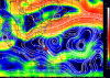
It's quite awesome that this storm has been firing an almost continuous CDO with -80c cloud tops for the last 12 hours.
Levi makes the point that despite the center wrapping around, there is still a good amount of shear and dry air to the southwest that should remain from now until it turns north. While it has proven to be able to fight this better, if there is a weakness in the eyewall, some dry air could briefly make it into the center, and weaken it slightly. Even though Isaias shouldn't weaken too much, this feature should keep it from undergoing a strong period of rapid intensification.I mean what’s there to stop it from getting to cat 2? I think it gets to cat 2 by morning
Sent from my iPhone using Tapatalk