• Hello, please take a minute to check out our awesome content, contributed by the wonderful members of our community. We hope you'll add your own thoughts and opinions by making a free account!

Tropical TS Fay

Snowfan

When NW trend?
Member
Joined
Jan 5, 2017
Messages
10,457
Reaction score
9,602
Location
Not telling
A new invest has been designated.
Recent satellite and radar observations indicate that a small low
pressure system has formed within a broader area of low pressure
near the northern Gulf Coast. The low is producing a few showers
near its center, and some slight development is possible before it
moves inland early Monday. The broader low pressure system is
forecast to move northeastward and could emerge offshore of the
Carolinas later this week, where environmental conditions are
expected to be more conducive for development.
* Formation chance through 48 hours...low...20 percent.
* Formation chance through 5 days...medium...40 percent.
 
1. A small low pressure system is located over the northern Gulf of
Mexico about 100 miles south-southwest of Panama City, Florida.
While the low currently has limited thunderstorm activity, some
development is still possible before it moves inland early Monday.
This system is expected to evolve into a larger low pressure system
and move northeastward, possibly emerging offshore of the Carolinas
later this week where environmental conditions are expected to be
more conducive for development.
* Formation chance through 48 hours...low...20 percent.
* Formation chance through 5 days...medium...40 percent.
 
A low pressure system is centered inland over southern Georgia.
The low is forecast to move northeastward, near the coast of the
Carolinas and the mid-Atlantic during the next few days. No
development is expected while the low remains over land, however
some development will be possible if the system moves over water
later this week. Regardless of development, the low is forecast to
produce locally heavy rainfall that could cause flash flooding
across portions of the southeast U.S. during the next couple of
days.
* Formation chance through 48 hours...low...10 percent.
* Formation chance through 5 days...medium...40 percent.
 
A low pressure area centered inland over southern Georgia is
forecast to move northeastward near the coast of the Carolinas and
the mid-Atlantic during the next few days. Some development of this
system is possible if the system moves over water in two or three
days. Regardless of development, the low is forecast to produce
locally heavy rainfall that could cause flash flooding across
portions of the southeastern U.S. during the next couple of days.
* Formation chance through 48 hours...low...10 percent.
* Formation chance through 5 days...medium...40 percent.
 
An area of low pressure located inland over northeastern Georgia is
producing a large area of showers and heavy rain over portions of
the southeastern U.S. The low is expected to move generally
northeastward toward the coast of the Carolinas and the mid-Atlantic
states and some development of this system is possible later this
week if it moves over water. Regardless of development, the low is
forecast to produce locally heavy rainfall that could cause flash
flooding across portions of the southeastern U.S. during the next
couple of days.
* Formation chance through 48 hours...low...20 percent.
* Formation chance through 5 days...medium...40 percent.
 
An area of low pressure located inland over northeastern Georgia
continues to produce a large area of showers and heavy rain over
portions of the southeastern U.S. The low is expected to move
generally northeastward toward the coast of the Carolinas and the
mid-Atlantic states and some development of this system is possible
later this week if it moves over water. Regardless of development,
the low is forecast to produce locally heavy rainfall that could
cause flash flooding across portions of the southeastern U.S. during
the next couple of days.
* Formation chance through 48 hours...low...30 percent.
* Formation chance through 5 days...medium...40 percent.
 
An elongated area of low pressure is located along the coast of
northeastern South Carolina. This system is producing a large area
of disorganized showers and thunderstorms over the adjacent Atlantic
waters. The low is expected to move northeastward near or just
offshore of the North Carolina Outer Banks on Thursday, and then
turn north-northeastward and move along the mid-Atlantic coast
Friday. Environmental conditions are expected to be conducive for
development, and a tropical or subtropical cyclone is likely to form
within the next couple of days. Regardless of development, the low
is expected to produce locally heavy rainfall that could cause
some flash flooding across portions of eastern North Carolina, the
coastal mid-Atlantic, and southern New England during the next few
days. Gusty winds are also possible in the North Carolina Outer
Banks through Thursday.
* Formation chance through 48 hours...medium...60 percent.
* Formation chance through 5 days...high...70 percent.
 
Fay?

Tropical Weather Outlook
NWS National Hurricane Center Miami FL
200 PM EDT Wed Jul 8 2020

For the North Atlantic...Caribbean Sea and the Gulf of Mexico:

A broad area of low pressure located near the coast of northeastern
South Carolina continues to produce a large area of disorganized
showers and thunderstorms over the adjacent Atlantic waters and
portions of eastern North Carolina. The low is expected to move
northeastward near or just offshore of the North Carolina Outer
Banks on Thursday, and then turn north-northeastward and move along
the mid-Atlantic coast Friday. Environmental conditions are
expected to be conducive for development, and a tropical or
subtropical cyclone is likely to form within the next day or so.

Regardless of development, the system is expected to produce locally
heavy rainfall that could cause some flash flooding across portions
of eastern North Carolina, the coastal mid-Atlantic, and southern
New England during the next few days. Gusty winds are also possible
along the North Carolina Outer Banks through Thursday and along the
mid-Atlantic and southern New England coasts Friday and Saturday.
Interests in these areas should monitor the progress of this system
and refer to products from your local National Weather Service
office.
* Formation chance through 48 hours...high...70 percent.
* Formation chance through 5 days...high...70 percent.
 
Hurricane hunters are on their way. Let’s see what they find out

The buoys out there are not very impressive, that storm complex looks ok on sat but meh on radar.....needs at least another 12 hrs..

 
The buoys out there are not very impressive, that storm complex looks ok on sat but meh on radar.....needs at least another 12 hrs..

Looks like we might have 2 competing centers or a disjointed llc mlc combo with one swirl east of Hatteras and another south of Morehead
 
Looks like we might have 2 competing centers or a disjointed llc mlc combo with one swirl east of Hatteras and another south of Morehead

Yeah thats what I see, the llc is fairly weak though and might fade.....so its mlc or bust IMO
 
Shower and thunderstorm activity associated with a low pressure area
located near the Outer Banks of North Carolina has continued to
increase and is showing signs of organization. Recent satellite
and radar imagery, along with surface observations and data from an
Air Force Reserve reconnaissance aircraft that is just beginning to
investigate the system, suggest that a new center of circulation
could be forming east of Cape Hatteras. If these development trends
continue, this system is likely to become a tropical depression or
storm later today or tonight.
The low is expected to move north-
northeastward along the mid-Atlantic coast tonight through
Friday night.

Regardless of development, the system is expected to produce
locally heavy rainfall that could cause some flash flooding across
portions of eastern North Carolina, the coastal mid-Atlantic, and
southern New England during the next few days. Gusty winds are also
possible along the North Carolina Outer Banks today, and along
the mid-Atlantic and southern New England coasts Friday and
Saturday. Interests in these areas should monitor the progress of
this system and refer to products from your local National Weather
Service office.
* Formation chance through 48 hours...high...90 percent.
* Formation chance through 5 days...high...90 percent.
 
Now we have our 6th named storm.


Special Message from NHC​
Issued 9 Jul 2020 20:17 UTC​

NHC will initiate advisories on Tropical Storm Fay, located just east of North Carolina, at 5 pm EDT.


738
URNT12 KNHC 092004
VORTEX DATA MESSAGE AL982020
A. 09/19:37:30Z
B. 35.43 deg N 074.87 deg W
C. NA
D. EXTRAP 1006 mb
E. NA
F. NA
G. NA
H. 39 kt
I. 050 deg 33 nm 19:26:30Z
J. 125 deg 39 kt
K. 048 deg 15 nm 19:32:00Z
L. NA
M. NA
N. 263 deg 14 kt
O. 225 deg 15 nm 19:43:00Z
P. 22 C / 318 m
Q. 23 C / 315 m
R. NA / NA
S. 134 / 01
T. 0.02 / 10 nm
U. AF301 01BBA INVEST OB 12
MAX FL WIND 44 KT 087 / 69 NM 18:18:00Z
SLP EXTRAP FROM BELOW 1500 FT
MAX FL TEMP 24 C 059 / 6 NM FROM FL CNTR
;
 
Last edited:
I'm confused why the NHC didn't do a PTC earlier given the population center I know it's gonna be weak but still isn't this the whole point of a PTC
 
BULLETIN
Tropical Storm Fay Intermediate Advisory Number 1A
NWS National Hurricane Center Miami FL AL062020
800 PM EDT Thu Jul 09 2020

...FAY MOVING NORTHWARD EAST OF THE NORTH CAROLINA COAST ...
...EXPECTED TO BRING HEAVY RAINFALL AND GUSTY WINDS TO PORTIONS OF
THE MID-ATLANTIC COAST AND SOUTHERN NEW ENGLAND...


SUMMARY OF 800 PM EDT...0000 UTC...INFORMATION
----------------------------------------------
LOCATION...36.0N 74.8W
ABOUT 70 MI...115 KM NE OF CAPE HATTERAS NORTH CAROLINA
ABOUT 140 MI...225 KM SSE OF OCEAN CITY MARYLAND
MAXIMUM SUSTAINED WINDS...45 MPH...75 KM/H
PRESENT MOVEMENT...N OR 360 DEGREES AT 8 MPH...13 KM/H
MINIMUM CENTRAL PRESSURE...1005 MB...29.68 INCHES
 
090
WTNT31 KNHC 100238
TCPAT1

BULLETIN
Tropical Storm Fay Advisory Number 2
NWS National Hurricane Center Miami FL AL062020
1100 PM EDT Thu Jul 09 2020

...FAY CONTINUING TO MOVE NORTHWARD TO THE EAST OF NORTHEASTERN
NORTH CAROLINA ...
...EXPECTED TO BRING HEAVY RAINFALL AND GUSTY WINDS TO PORTIONS OF
THE MID-ATLANTIC COAST AND SOUTHERN NEW ENGLAND...


SUMMARY OF 1100 PM EDT...0300 UTC...INFORMATION
-----------------------------------------------
LOCATION...36.3N 74.8W
ABOUT 85 MI...140 KM NNE OF CAPE HATTERAS NORTH CAROLINA
ABOUT 140 MI...225 KM S OF OCEAN CITY MARYLAND
MAXIMUM SUSTAINED WINDS...45 MPH...75 KM/H
PRESENT MOVEMENT...N OR 10 DEGREES AT 8 MPH...13 KM/H
MINIMUM CENTRAL PRESSURE...1005 MB...29.68 INCHES
 
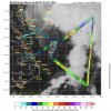
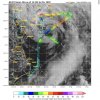
Recon went out this morning. Here’s what they found. Another one on the way now
4717F93E-E690-4B50-A66F-83209AD95893.jpeg
 
  • Like
Reactions: SD
BULLETIN
Tropical Storm Fay Advisory Number 5
NWS National Hurricane Center Miami FL AL062020
1100 AM EDT Fri Jul 10 2020

...TROPICAL STORM CONDITIONS AND HEAVY RAINFALL SPREADING NORTHWARD
ALONG THE MID-ATLANTIC COAST...


SUMMARY OF 1100 AM EDT...1500 UTC...INFORMATION
-----------------------------------------------
LOCATION...38.4N 74.5W
ABOUT 40 MI...65 KM SSE OF CAPE MAY NEW JERSEY
ABOUT 170 MI...270 KM S OF NEW YORK CITY
MAXIMUM SUSTAINED WINDS...60 MPH...95 KM/H
PRESENT MOVEMENT...N OR 5 DEGREES AT 12 MPH...19 KM/H
MINIMUM CENTRAL PRESSURE...999 MB...29.50 INCHES
 
...HEAVY RAINFALL AND GUSTY WINDS MOVING INTO NORTHERN NEW
JERSEY...SOUTHEASTERN NEW YORK...AND LONG ISLAND...
...FAY MAKES LANDFALL JUST NORTH-NORTHEAST OF ATLANTIC CITY NEW
JERSEY...


SUMMARY OF 500 PM EDT...2100 UTC...INFORMATION
----------------------------------------------
LOCATION...39.5N 74.3W
ABOUT 10 MI...15 KM NNE OF ATLANTIC CITY NEW JERSEY
ABOUT 90 MI...145 KM S OF NEW YORK CITY
MAXIMUM SUSTAINED WINDS...50 MPH...85 KM/H
PRESENT MOVEMENT...N OR 10 DEGREES AT 14 MPH...22 KM/H
MINIMUM CENTRAL PRESSURE...998 MB...29.47 INCHES
 
Back
Top