• Hello, please take a minute to check out our awesome content, contributed by the wonderful members of our community. We hope you'll add your own thoughts and opinions by making a free account!

Learning NAO and Snowfall Correlation

Here’s a question that would be interesting to look into as well, hinted at in the original post. What is it that drives the NAO cycles? I haven’t seen any convincing data on that although I haven’t done much digging either.
 
Oh man the AAM and GWO are great tools but I haven't been able to fully wrap my head around them. I would suggest reading into those as changes in the AAM and propagation of +/-AAM through the latitudes can often signal pattern changes

Sent from my SM-G955U using Tapatalk

I’ll added it to the ever piled list ?

I’m really wanting to branch out into indexes and MJO and all of that. I’ve got a good grasp on general weather but not the big gears that really drive our patterns. I know of them and what we need but not the nitty gritty.
 
I’ll added it to the ever piled list ?

I bet Mack would find it worthwhile enough to give you his cruise in exchange for all of the work you're doing and have planned. I think Mack would prefer to sacrifice a cruise just to see the results to have a better handle on when to expect a big snow in the GSP area so as to not be heartbroken time and time, again.
 
I bet Mack would find it worthwhile enough to give you his cruise in exchange for all of the work you're doing and have planned. I think Mack would prefer to sacrifice a cruise just to see the results to have a better handle on when to expect a big snow in the GSP area so as to not be heartbroken time and time, again.
I can get the cold, and the moisture, I just can’t shutoff that darn warm nose aloft! Turns my 12+ inch snows, into 1” slop fests!???
 
I plan on breaking down the AO in a similar fashion as well. Maybe I will make a big post with all the indexes. Problem is the PNA and AO and the others are much more random. Will have to do a lot of cherry picking to find them.

NAO correlation is probably best described as "increases cold and therefore increases snowfall"
You could probably do the same exact steps and find that a +PNA leads to cold + snow. Same with the -AO. Increased cold coming our way just undoubtedly increases the odds.

I'm a firm believer in the -NAO though, I think it's paramount for snow chances here in Raleigh. We hardly ever get blocking, but when we do I get pumped. But for our region the truth is it all depends on timing, everything has to link up perfectly to get a Mid-Atlantic or NE event in the southeast..

It's also important to note that just because the winter averages as a neutral or +NAO, doesn't mean there wasn't a possibly substantial albeit short-lived -NAO period during the winter. For instance we could have been +NAO Dec-Jan and ended -NAO in Feb and had a big storm late Feb, but the averaged seasonal DJF NAO is neutral, skewing results. It's will take time but you could dig through daily indexes and link them up with individual storm dates.

There's also the problem when analyzing any one index -- trouble controlling for multiple factors or chaos...like you said, a fluke storm could have happened, but why did it happen? A pattern can be driven primarily by one factor without us knowing or ever finding out, but it's fun to try. Adding other teleconnections and stuff like ENSO phase into the composite and you start getting what reality might look like, but THAT could still bust. Nature finds a way to do what it wants, despite history.

Sorry I'm rambling, didn't expect winter to be brought up in June!


Summer is just the season to learn about winter ??

Yeah I’m going to go storm by storm but I’m afraid it’ll just end up a jumbled mess. I don’t expect to find any magic correlation at all. Like you said storms come in all shapes and sizes and all different types of background states.

Who knows!


Anyone have any good database of southeast winter storms? I have some but just curious to see what might be out there
 
Here’s a question that would be interesting to look into as well, hinted at in the original post. What is it that drives the NAO cycles? I haven’t seen any convincing data on that although I haven’t done much digging either.
I've been too lazy to put the numbers together but I wonder how the amo and nao stack up year over year

Sent from my SM-G955U using Tapatalk
 
Summer is just the season to learn about winter

Yeah I’m going to go storm by storm but I’m afraid it’ll just end up a jumbled mess. I don’t expect to find any magic correlation at all. Like you said storms come in all shapes and sizes and all different types of background states.

Who knows!


Anyone have any good database of southeast winter storms? I have some but just curious to see what might be out there

I would just pick one airport or area of focus and use this, some events are spread over 2 days so make sure to include at least 2 day duration. https://xmacis.rcc-acis.org

Webber has graphics but only recent history storms at webberweather.com

NWS Raleigh’s “events” page is good but lacking.


Sent from my iPhone using Tapatalk
 
I've been too lazy to put the numbers together but I wonder how the amo and nao stack up year over year

Sent from my SM-G955U using Tapatalk

here are graphs of NAO averaged winters and AMO.

I did the general + and - phase of AMO. Also did rising and falling. Dont see too much in common BUT 1920-1940 saw rising AMO and alot of +NAO and 1955-1970 saw lowering AMO and alot of -nao....

STill not sure id call it a connectionnao-amo.pngUntitled.png
 
I would just pick one airport or area of focus and use this, some events are spread over 2 days so make sure to include at least 2 day duration. https://xmacis.rcc-acis.org

Webber has graphics but only recent history storms at webberweather.com

NWS Raleigh’s “events” page is good but lacking.


Sent from my iPhone using Tapatalk

Much appreciated! I think I am going to break it down into Miller A, Miller B, and maybe clippers if i have the time. We will see how my spreadsheet looks after the notable Miller A's.

Should I use specific location or just take Miller A's that produced for the Southeast in general.

If i should use stations which ones?
 
here are graphs of NAO averaged winters and AMO.

I did the general + and - phase of AMO. Also did rising and falling. Dont see too much in common BUT 1920-1940 saw rising AMO and alot of +NAO and 1955-1970 saw lowering AMO and alot of -nao....

STill not sure id call it a connectionView attachment 20491View attachment 20492
Looks like the first 30 years or so was split pretty evenly between a + and -NAO. From 1900 on positive looks to be the dominant state with the exception of the 20 year span from the 50s through the 70s. Definitely not very encouraging going forward if you like -NAO winters.
 
Much appreciated! I think I am going to break it down into Miller A, Miller B, and maybe clippers if i have the time. We will see how my spreadsheet looks after the notable Miller A's.

Should I use specific location or just take Miller A's that produced for the Southeast in general.

If i should use stations which ones?

1. Based on my many years experience of doing this kind of thing, I recommend that you concentrate on analyzing only one index at a time. Once you start trying to do combos, you end up with too small groups of data to conclude with confidence. There’s not enough major snow events in the SE in the first place to be able to do that without worrying about too small a sample size.

For example, let's say you find 20 storms for a particular location. That's a halfway decent sized sample to assess -NAO vs neutral NAO vs +NAO. But if you were to analyze, say, NAO, EPO, and PNA together, you'd then have 27 combos. So, you'd have many combos with merely 1-2 or even no storms. Your highest number could be, say, only 4. If so, how much can you really conclude from one combo that has a pretty small size of 4, which is still only 20% of the 20 storms?

Or what if you analyze the 8 MJO phases? You may instead want to consider doing left side vs right side and inside vs outside circle.

2. Before worrying about classifying, I’d just pick a number such as 4” and just look at all events that totaled, say, 4”+ at a particular location (including a storm spread over 2 cal days with, say, 2” on consecutive days). This makes it cut and dry. Then analyze by individual index. After that, you can break those 4”+ storms into Miller A, B, etc., if you want.

3. I’d use only stations far apart, not too far south (so you have a decent sample size), and with a long official easily obtainable record such as perhaps Birmingham, Chattanooga, Atlanta, Columbia, and Raleigh

4. For MJO, I know you asked for the link to charts. But don’t forget to use this, too, for the textual data:

http://www.bom.gov.au/climate/mjo/graphics/rmm.74toRealtime.txt

This is good because once you have the storm dates, you can just scroll down to the dates and get the phase and amplitude. Sometimes the charts are hard to decipher for single dates. Keep in mind that amplitudes of under 1.00 are inside the circle but are still in a phase, which is easier to decipher by just looking at the textual data here.
 
Last edited:
Summer is just the season to learn about winter ??

Yeah I’m going to go storm by storm but I’m afraid it’ll just end up a jumbled mess. I don’t expect to find any magic correlation at all. Like you said storms come in all shapes and sizes and all different types of background states.

Who knows!


Anyone have any good database of southeast winter storms? I have some but just curious to see what might be out there

Yeah as Jon said my page is extremely extensive however is still incomplete (as I'm currently working on analyzing the winter of 1950-51) and is only available for NC. (I plan to expand into South Carolina in the coming years)
https://www.webberweather.com/

However, I also have pre-1950 ENSO data (ENS ONI) that goes back to 1865 and a version of the MEI I run in real-time using NCEP-NCAR Reanalysis. I also have separate pages on my site for seasonal & decadally averaged snow maps for NC & am running some preliminary data behind the scenes on the actual data that's being displayed on the maps for my site.

This for example is roughly what the statewide seasonal snowfall total time series for NC from the winter of 1895-96 thru 1950-51 would generally look like w/ a linear trend line overlaid. I could do a similar analysis with specific stations, climate divisions, NWS Weather Forecast Office (WFO) domains, etc.
Screen Shot 2019-06-20 at 6.20.39 AM.png


Seasonal: Seasonal NC Statewide Snow Maps
Decadal: Decadally-Averaged NC Statewide Snow Maps

I've also cleverly placed the seasonally averaged map hyperlinks within the individual storm cases and the decadally averaged maps you can also find in the seasonally-averaged page (any hyperlink on any of the pages that's bold & underlined will direct you to a winter storm map).

There are other good places to look for winter storm archived data, I'll just throw out a few that I like.

NCEI's Regional Snowfall Index (RSI) viewer tool:
https://gis.ncdc.noaa.gov/maps/ncei/rsi

Southeastern Regional Climate Center (SERCC) NWS NOWData (similar to xamcis Jon discussed above although I think the SERCC NOWData page is a little more user friendly, however I could be biased because I use it very frequently)
https://sercc.com/nowdata.html

The Midwestern Regional Climate Center's cli-mate tool, I see you're already using but also keep in mind that this data hasn't been quality controlled (doesn't matter quite as much for long-term climatologies or for particular stations like Raleigh & Charlotte with very reliable data, but for individual cases it definitely does). While you may already know this, this piece of information might help others on this site, but on the MRCC cli-mate page you can also click on the "Download data" button on the side of the page and it will export the data in that particular map into an excel spreadsheet but again take a lot of that with a grain of salt because there are quality control issues outside of areas like Raleigh, Charlotte, Asheville, Columbia, & Wilmington, etc.

https://mrcc.illinois.edu/CLIMATE/welcome.jsp

Screen Shot 2019-06-20 at 6.30.07 AM.png

If you want to look at the actual (mostly written) publications that the snow data is derived from I highly recommend going here:
NCEI's Image and Publication System (IPS) is a fantastic resource for looking at and quality controlling archived data. Snowfall measurements for most stations began in 1895.
https://www.ncdc.noaa.gov/IPS/

If you ever forget any of these links, I have all of them listed (& a few others) at the bottom of my "About" page for my NC winter storm archive.
https://www.webberweather.com/about.html


Cheers
 
1. Based on my many years experience of doing this kind of thing, I recommend that you concentrate on analyzing only one index at a time. Once you start trying to do combos, you end up with too small groups of data to conclude with confidence. There’s not enough major snow events in the SE in the first place to be able to do that without worrying about too small a sample size.

For example, let's say you find 20 storms for a particular location. That's a halfway decent sized sample to assess -NAO vs neutral NAO vs +NAO. But if you were to analyze, say, NAO, EPO, and PNA together, you'd then have 27 combos. So, you'd have many combos with merely 1-2 or even no storms. Your highest number could be, say, only 4. If so, how much can you really conclude from one combo that has a pretty small size of 4, which is still only 20% of the 20 storms?

Or what if you analyze the 8 MJO phases? You may instead want to consider doing left side vs right side and inside vs outside circle.

2. Before worrying about classifying, I’d just pick a number such as 4” and just look at all events that totaled, say, 4”+ at a particular location (including a storm spread over 2 cal days with, say, 2” on consecutive days). This makes it cut and dry. Then analyze by individual index. After that, you can break those 4”+ storms into Miller A, B, etc., if you want.

3. I’d use only stations far apart, not too far south (so you have a decent sample size), and with a long official easily obtainable record such as perhaps Birmingham, Chattanooga, Atlanta, Columbia, and Raleigh

4. For MJO, I know you asked for the link to charts. But don’t forget to use this, too, for the textual data:

http://www.bom.gov.au/climate/mjo/graphics/rmm.74toRealtime.txt

This is good because once you have the storm dates, you can just scroll down to the dates and get the phase and amplitude. Sometimes the charts are hard to decipher for single dates. Keep in mind that amplitudes of under 1.00 are inside the circle but are still in a phase, which is easier to decipher by just looking at the textual data here.

Just as an addendum, NOAA ESRL has another great page on MJO data with a multitude of other available & published indices including the OLR MJO index and Velocity Potential MJO Index developed by Ventrice et al (2013). They don't have phases listed for the individual text files although that's likely an easy addition in a coding language like matlab where you can just throw in a bunch of nested "if" statements because the amplitude of both the first and second Principal Components (PCs) of U850, U200, &/or OLR are in those text files. Also, who's to say you have to convert that amplitude PC data into 8 MJO phases? You could really go with 2,4,6,8, or 10 if you so choose.

https://www.esrl.noaa.gov/psd/mjo/mjoindex/
 
here are graphs of NAO averaged winters and AMO.

I did the general + and - phase of AMO. Also did rising and falling. Dont see too much in common BUT 1920-1940 saw rising AMO and alot of +NAO and 1955-1970 saw lowering AMO and alot of -nao....

STill not sure id call it a connectionView attachment 20491View attachment 20492

What you're seeing here is the ocean's pivotal role in communicating cumulative, lower-frequency (long-term) variability in the atmosphere to the ocean & vis versa. One of the prevailing arguments that explains this connection you're touching on here w/ the AMO & NAO is the Atlantic Meridional Overturning Circulation (AMOC) which during the positive phase of the NAO becomes more intense, leading to more poleward heat transport, ultimately then favoring large-scale warming of the Atlantic. This warming of the Atlantic is reflected onto the positive phase of the AMO, which then implicates the heat fluxes that affect the sign & amplitude of the NAO, etc & vis versa. Obviously, persistence of sea surface temperature anomalies across successive winters as result of changes in mixed-layer depth during the season also matter too (referring to the "reemergence" mechanism here). This is effectively why there's a lagged relationship between the AMO & NAO.
 
You could probably do the same exact steps and find that a +PNA leads to cold + snow. Same with the -AO. Increased cold coming our way just undoubtedly increases the odds.

I'm a firm believer in the -NAO though, I think it's paramount for snow chances here in Raleigh. We hardly ever get blocking, but when we do I get pumped. But for our region the truth is it all depends on timing, everything has to link up perfectly to get a Mid-Atlantic or NE event in the southeast..

It's also important to note that just because the winter averages as a neutral or +NAO, doesn't mean there wasn't a possibly substantial albeit short-lived -NAO period during the winter. For instance we could have been +NAO Dec-Jan and ended -NAO in Feb and had a big storm late Feb, but the averaged seasonal DJF NAO is neutral, skewing results. It's will take time but you could dig through daily indexes and link them up with individual storm dates.

There's also the problem when analyzing any one index -- trouble controlling for multiple factors or chaos...like you said, a fluke storm could have happened, but why did it happen? A pattern can be driven primarily by one factor without us knowing or ever finding out, but it's fun to try. Adding other teleconnections and stuff like ENSO phase into the composite and you start getting what reality might look like, but THAT could still bust. Nature finds a way to do what it wants, despite history.

Sorry I'm rambling, didn't expect winter to be brought up in June!


I've tended to find, as I've discussed on other occasions here, that the NAO really tends to implicate the frequency and intensity of Miller A cyclones/coastal low type winter storms in NC, which usually favor snow over the coastal plain, eastern, northwestern piedmont &/or mountains of NC, whereas for cold air damming events and these so-called "hybrid"/anafrontal storm types, the NAO is really not a huge player, if at all. Taking away the -NAO really tends to reduce the number of these coastal low setups around here but obviously doesn't
eradicate the potential for other winter storms.

Here again is the composite 500mb & MSLP patterns in NCEP Reanalysis for 184 Miller type A "days" and 205 type B winter storm "days" in NC, showing fairly clearly what large-scale pattern favors and tends to be associated with each storm type.
NCEPR1 MSLPa & z500 NC Miller A & B Winter Storms (1948-2019).png

When you really start to dig into the numbers and now look at the snowfall from these storm types & the hybrid class of winter storms you can see which parts of NC benefit the most from Miller A cyclones often found during -NAOs.

Raleigh & the I-95 corridor's bread & butter are indeed these Miller type A storms. Once you take those away however, the playing field changes significantly.

In fact if you were able to remove Miller type A storms from NC's snowfall climatology, Raleigh's long-term snowfall climo would actually be the same as Charlotte's!

Things are much different when you look at Charlotte however, which actually tends to perform better in comparison during Miller B & especially these Hybrid/Anafrontal type storms (which are usually coupled w/ big +PNAs) that really don't occur in conjunction w/ -NAOs at least anywhere near as frequently. Furthermore, the reason (as @GaWx has noted ad nauseam) really don't see these significant -NAO correlations w/ snowfall in other areas of the southeastern US likely is because in those areas like GA, SC, AL, MS, etc you really just don't see intense Miller A cyclones all that frequently (w/ Jan 3-4 2018 & Mar 1993 being huge exceptions). This really makes sense because these areas of the deep south are further removed from the climatological position of the mid-latitude jet core and most favorable baroclinicity near the SE US coast in association w/ the Gulf Stream being adjacent to the relatively cooler SE US both of which aren't as conducive to intense coastal cyclones which again are significantly implicated by the -NAO. In a majority of cases where a Miller A winter storm occurs over NC these other areas of the SE US either see nothing or a preceding hybrid/anafrontal type winter storm during the earlier stages of the storm's overall life cycle.

Oth, if you progress further north into the mid-Atlantic and NE US, an overwhelming majority of their biggest winter storms come exclusively from coastal cyclones/Miller type A events. NC sits awkwardly in the middle of these 2 areas with one relying very, very heavily on the -NAO for large winter storms (NE US), whereas the other, the deep south, not so much.

Winter Storm Type & East-Central NC Station-Based Snowfall (1948-2019).png


Based on the above information & research, I really think if you take coastal cyclone winter storm cases out of the equation, the NAO really doesn't matter that much to NC's winter storm climatology.
 
I've tended to find, as I've discussed on other occasions here, that the NAO really tends to implicate the frequency and intensity of Miller A cyclones/coastal low type winter storms in NC, which usually favor snow over the coastal plain, eastern, northwestern piedmont &/or mountains of NC, whereas for cold air damming events and these so-called "hybrid"/anafrontal storm types, the NAO is really not a huge player, if at all. Taking away the -NAO really tends to reduce the number of these coastal low setups around here but obviously doesn't
eradicate the potential for other winter storms.

Here again is the composite 500mb & MSLP patterns in NCEP Reanalysis for 184 Miller type A "days" and 205 type B winter storm "days" in NC, showing fairly clearly what large-scale pattern favors and tends to be associated with each storm type.
View attachment 20502

When you really start to dig into the numbers and now look at the snowfall from these storm types & the hybrid class of winter storms you can see which parts of NC benefit the most from Miller A cyclones often found during -NAOs.

Raleigh & the I-95 corridor's bread & butter are indeed these Miller type A storms. Once you take those away however, the playing field changes significantly.

In fact if you were able to remove Miller type A storms from NC's snowfall climatology, Raleigh's long-term snowfall climo would actually be the same as Charlotte's!

Things are much different when you look at Charlotte however, which actually tends to perform better in comparison during Miller B & especially these Hybrid/Anafrontal type storms (which are usually coupled w/ big +PNAs) that really don't occur in conjunction w/ -NAOs at least anywhere near as frequently. Furthermore, the reason (as @GaWx has noted ad nauseam) really don't see these significant -NAO correlations w/ snowfall in other areas of the southeastern US likely is because in those areas like GA, SC, AL, MS, etc you really just don't see intense Miller A cyclones all that frequently (w/ Jan 3-4 2018 & Mar 1993 being huge exceptions). This really makes sense because these areas of the deep south are further removed from the climatological position of the mid-latitude jet core and most favorable baroclinicity near the SE US coast in association w/ the Gulf Stream being adjacent to the relatively cooler SE US both of which aren't as conducive to intense coastal cyclones which again are significantly implicated by the -NAO. In a majority of cases where a Miller A winter storm occurs over NC these other areas of the SE US either see nothing or a preceding hybrid/anafrontal type winter storm during the earlier stages of the storm's overall life cycle.

Oth, if you progress further north into the mid-Atlantic and NE US, an overwhelming majority of their biggest winter storms come exclusively from coastal cyclones/Miller type A events. NC sits awkwardly in the middle of these 2 areas with one relying very, very heavily on the -NAO for large winter storms (NE US), whereas the other, the deep south, not so much.

View attachment 20503


Based on the above information & research, I really think if you take coastal cyclone winter storm cases out of the equation, the NAO really doesn't matter that much to NC's winter storm climatology.

A back of the envelope calculation based on the nearly 400 winter storm cases I analyzed for this project I conducted last semester for my climate dynamics course over the period 1948 to present suggests that Miller type A cyclones constitute roughly 25% of NC's winter storm climatology, with a similar proportion being Miller B/CAD events. The other half includes hybrid Miller A-B storms, anafrontal-type events, and upper level lows.
 
I've tended to find, as I've discussed on other occasions here, that the NAO really tends to implicate the frequency and intensity of Miller A cyclones/coastal low type winter storms in NC, which usually favor snow over the coastal plain, eastern, northwestern piedmont &/or mountains of NC, whereas for cold air damming events and these so-called "hybrid"/anafrontal storm types, the NAO is really not a huge player, if at all. Taking away the -NAO really tends to reduce the number of these coastal low setups around here but obviously doesn't
eradicate the potential for other winter storms.

Here again is the composite 500mb & MSLP patterns in NCEP Reanalysis for 184 Miller type A "days" and 205 type B winter storm "days" in NC, showing fairly clearly what large-scale pattern favors and tends to be associated with each storm type.
View attachment 20502

When you really start to dig into the numbers and now look at the snowfall from these storm types & the hybrid class of winter storms you can see which parts of NC benefit the most from Miller A cyclones often found during -NAOs.

Raleigh & the I-95 corridor's bread & butter are indeed these Miller type A storms. Once you take those away however, the playing field changes significantly.

In fact if you were able to remove Miller type A storms from NC's snowfall climatology, Raleigh's long-term snowfall climo would actually be the same as Charlotte's!

Things are much different when you look at Charlotte however, which actually tends to perform better in comparison during Miller B & especially these Hybrid/Anafrontal type storms (which are usually coupled w/ big +PNAs) that really don't occur in conjunction w/ -NAOs at least anywhere near as frequently. Furthermore, the reason (as @GaWx has noted ad nauseam) really don't see these significant -NAO correlations w/ snowfall in other areas of the southeastern US likely is because in those areas like GA, SC, AL, MS, etc you really just don't see intense Miller A cyclones all that frequently (w/ Jan 3-4 2018 & Mar 1993 being huge exceptions). This really makes sense because these areas of the deep south are further removed from the climatological position of the mid-latitude jet core and most favorable baroclinicity near the SE US coast in association w/ the Gulf Stream being adjacent to the relatively cooler SE US both of which aren't as conducive to intense coastal cyclones which again are significantly implicated by the -NAO. In a majority of cases where a Miller A winter storm occurs over NC these other areas of the SE US either see nothing or a preceding hybrid/anafrontal type winter storm during the earlier stages of the storm's overall life cycle.

Oth, if you progress further north into the mid-Atlantic and NE US, an overwhelming majority of their biggest winter storms come exclusively from coastal cyclones/Miller type A events. NC sits awkwardly in the middle of these 2 areas with one relying very, very heavily on the -NAO for large winter storms (NE US), whereas the other, the deep south, not so much.

View attachment 20503


Based on the above information & research, I really think if you take coastal cyclone winter storm cases out of the equation, the NAO really doesn't matter that much to NC's winter storm climatology.


Thank you for all the info! It is much appreciated.

In my few hrs of looking at the NAO I can clearly see how dependent on it some areas are. Central-Eastern NC see a “significant” increase in snowfall during -NAO winters. The mountains also do too.

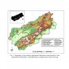
When I was researching the Southern Appalachian spatial snowfall patterns I stumbled onto this interesting paper with this graph. (I just moved to Erwin TN in the “northern Tennessee territory” barely outside of high country)

894AF575-7B93-4F60-B723-06DF48FC0FD9.jpeg
Pretty easy to see the -nao helping winters in most areas of Western NC. Basically every area in the Southern Apps sees sizeable snow increase during -NAO.

Here are the mapping of areas for clarity.6F4EEDC8-A4DC-448C-855F-04E56C55F0F9.jpeg

Here is the link to the paper:
http://climate.appstate.edu/~perrylb/Pubs/Theses/Eck_2017_Thesis.pdf

I’ve been reading tons of papers like this haha most go over my head but I’m getting there.


As you get down into SC and Upstate SC especially you notice on my low res snow maps that the NAO doesn’t really seem to change too much.


You hit on this but I figured the mrcc page was low res stuff. They do have maps with interpolated station data that seems to be much better quality but no long term average option for it. I did find for example that the MRCC data has average snowfall to high for Erwin, TN by 5 inches or so. But not surprised since the valley is 1700-1900 feet and surrounding mountains are 3400+. Hard to find snowfall maps that detailed to clearly see the valley’s accurate snowfall.


I also now realize how spoiled we are in NC with data archives. NWS Morristown here in TN doesn’t have any great archives of storms or anything. (They are still awesome though ?
 
Back
Top