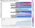
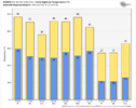
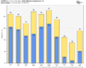
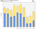
Wow guys what a run. I think us Mountain Peeps are sitting pretty. Buckle up fellas it's going to be a wild ride.
-
Hello, please take a minute to check out our awesome content, contributed by the wonderful members of our community. We hope you'll add your own thoughts and opinions by making a free account!
You are using an out of date browser. It may not display this or other websites correctly.
You should upgrade or use an alternative browser.
You should upgrade or use an alternative browser.
Mountain/Foothills Discussion and Observation Thread
- Thread starter SNOWMANN
- Start date
Cad Wedge NC
Member
Holy, Moly, I need to temper my excitement. We just need to get it inside 72 hours. That's a tough task.Wow guys what a run. I think us Mountain Peeps are sitting pretty. Buckle up fellas it's going to be a wild ride.
At least where within an hour drive of snow if push comes to show the higher elevation will see something in the next ten days I'm sure.Holy, Moly, I need to temper my excitement. We just need to get it inside 72 hours. That's a tough task.
Cad Wedge NC
Member
Yeah, the higher elevations will have NWFS even if the rest of us are bone dry.At least where within an hour drive of snow if push comes to show the higher elevation will see something in the next ten days I'm sure.
CraggyRider
Member
Will be prepping tomorrow by cutting some firewood which probably will put the voodoo jinx on the snow storm. Still good fire and eggnog weather.
Nice to see you post away my friend.Will be prepping tomorrow by cutting some firewood which probably will put the voodoo jinx on the snow storm. Still good fire and eggnog weather.
GSP sounds optimistic.
LONG TERM /TUESDAY NIGHT THROUGH FRIDAY/...
As of 245 PM Friday: Very high uncertainty and very low confidence
in the forecast for the long term. That said, there is increasing
confidence in a very cold air mass settling over the area from
Friday onward. Model guidance shows a strong short wave diving into
the central US and digging an deep upper low over the eastern CONUS.
At the surface, Since the models handle the upper low differently,
they handle the resulting surface features differently as well. The
GFS has more of a Miller A type low, mainly Thursday night and
Friday with significant wintry precip potential. The ECMWF and
Canadian develop a warm front Wednesday night into Thursday with an
all liquid CAD event, a scouring cold front Thursday night, again
mainly liquid for all but the mountains, then some NW flow snow for
Friday. The GEFS mean has a Carolina coastal low developing Thursday
with liquid precip, then more of a clipper type system on Friday
with any wintry precip mainly for the mountains. Given the
uncertainty, have gone with the model blend which has PoP increasing
Wednesday night, maximizing Thursday, tapering off Thursday night,
and dry for Friday. This has the best chance of wintry precip over
the mountains and the I-40 corridor with a mix of rain and snow
along the I-85 corridor and rain to the south. Precip would end as
snow. Obviously, this forecast should not be taken as gospel as it
will likely change given the uncertainty. Temps, however, may be
more certain with readings about 5 degrees below normal Wednesday,
10 below normal Thursday, and 20 below normal Friday.
SWVAwxfan
Member
I'm in the NRV of SW VA. Guess that counts as a mountain area.
SWVAwxfan
Member
Subtract about 8 degrees from those numbers for my area. It is indeed a beautiful area. Great place for the outdoors enthusiasts.
Up in Boone this weekend working on the house. Man it’s just not the cold but the wind that really bytes.
CraggyRider
Member
Oh yes, went to grad school at VT and love that area.I'm in the NRV of SW VA. Guess that counts as a mountain area.
I was hoping to see some flurries this morning.(near Boone). But nothing so far.
Cad Wedge NC
Member
Looks like there was some snow last night up on Beech per web cam. Still foggy up there.I was hoping to see some flurries this morning.(near Boone). But nothing so far.
Avalanche
Member
We will get that day in March where it will snow, and snow at a decent rate, but melt upon impact due to marginal soil and air temps.
SWVAwxfan
Member
Maybe in Chapel Hill.We will get that day in March where it will snow, and snow at a decent rate, but melt upon impact due to marginal soil and air temps.

