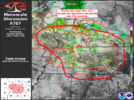
Could that last line become a derecho?
I think the Derecho threat is gonna come Thursday night. Nasty MCS showing on other CAMs with surface CAPE of 2000-3000 even during the over night.
Could that last line become a derecho?
Could that last line become a derecho?
For I-20 North into Tennessee I think the main threat will be overnight into the early part of tomorrow afternoon.I think the Derecho threat is gonna come Thursday night. Nasty MCS showing on other CAMs with surface CAPE of 2000-3000 even during the over night.
A match was lit up there. I was not expecting that kind of response as I thought this area was already worked over pretty good.Lots of supercells in TN/KYView attachment 147628

For I-20 North into Tennessee I think the main threat will be overnight into the early part of tomorrow afternoon.
Thursday night MCS seems really conditional even for areas to the south. I don't see much support on the 3K NAM, HRRR, or RGEM for an organized convective line but maybe I'm missing something
Thanks for the heads up. I now see this as well in the SPC discoI wouldn’t trust the 3km NAM at all with convection. Ever since they nerfed it several years ago it went from being crazy with convection to showing mostly too little. Both WRFs and the FV3(which has done pretty good) show a strong MCS and associated meso low hitting central AL after dark. An Enhanced risk is also in effect now for that time frame. Now track of the MCS is completely up in the air.
Thanks for the heads up. I now see this as well in the SPC disco
With time, the damaging wind risk will increase as clustering
occurs. Most guidance generates an eastward propagating MCS from
the east TX cluster, moving across northern LA into MS/AL during the
evening/nighttime hours. This activity is expected to move along the
gradient of strong to extreme instability across this region ahead
of the southeastward progressing cold front. Some potential will
exist for significant gusts (to near 75 mph).

Was just going to post this. Sounds very bad
Maury County Fire Live Audio Feed
Maury County Fire Live Audio Feed on Broadcastify.comm.broadcastify.com
Columbia Tn feed. Multiple structures collapsed. Ambulances being called for.
