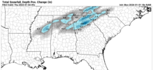
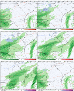
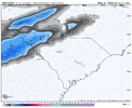
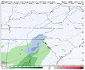
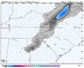
Nam good
-
Hello, please take a minute to check out our awesome content, contributed by the wonderful members of our community. We hope you'll add your own thoughts and opinions by making a free account!
You are using an out of date browser. It may not display this or other websites correctly.
You should upgrade or use an alternative browser.
You should upgrade or use an alternative browser.
Wintry Jan 3-4 2024 System
- Thread starter SD
- Start date
NoSnowATL
Member
And so it begins. Let’s go boys!
000
FXUS62 KFFC 011938
AFDFFC
Area Forecast Discussion
National Weather Service Peachtree City GA
238 PM EST Mon Jan 1 2024
...Afternoon Area Forecast Discussion...
.LONG TERM...
(Wednesday morning through next Sunday)
Issued at 238 PM EST Mon Jan 1 2024
The long term forecast looks interesting as several systems are
expected to bring several rounds of rainfall to the forecast area.
The first begins Wednesday morning as the shortwave kicks out of the
Southern Plains and phases with the trough over the east coast. A
surface low will develop in the northern Gulf of Mexico and will
advect moisture far northward across much of the southeast. Rain
will expand from the southwest to the northeast throughout the day
Wednesday where the highest QPF totals can be found primarily
focused in our southwestern counties (~0.25"). Whether or not
precipitation becomes more of a rain/snow mix or fully transitions
to periods of snow showers (and how far south this mixture could
get) Wednesday afternoon and into the early morning hours Thursday
continues to remain uncertain with this forecast update. Not only is
there still spread between the global deterministic model solutions
(with the NAM 12km being the most aggressive with our chances for
winter precipitation), ensemble members still exhibit a good bit of
uncertainty. Global ensembles have several members indicating our
best chance p-type will be rain while other members have portions of
north Georgia as far south as the metro getting snow. GEFS mean has
the 540dm line (typically a good first guess for the changeover from
rain to snow) sweeping through north Georgia while the Euro ensemble
mean has this line displaced just further north, but still over
extreme portions of north Georgia. However, 850mb temperatures are
right at the freezing mark for portions of north Georgia overnight
Wednesday with surface temperatures at or below freezing in only the
areas of highest terrain (over 2000ft) before becoming more
widespread in lower elevations beyond midnight. The fine details of
these components will bear a close watch in future forecast cycles
as the system gets into the Hi-Res guidance time frame as a few
degrees in either direction or displacement further north/south can
spell trouble for the forecast. For now, have opted for a rain/snow
mix to begin in areas of terrain at 2000ft or higher Wednesday
afternoon that will transition to snow showers after sunset through
the early morning hours of Thursday. The chance for a snowflake
flying across the metro is non-zero, but confidence is not high
enough to include in the forecast at this time.
Spann is starting to talk about it.
W
WSW
Guest
I hope you guys get something. That would be cool.
Its certainly doubtful, but the model watching is entertaining.I hope you guys get something. That would be cool.
W
WSW
Guest
It really is. Bout time you guys had something. May be the start of something for the next 6 weeks.Its certainly doubtful, but the model watching is entertaining.
18z RGEM is a whiff
iGRXY
Member
jeremyt
Member
I hope y’all get blanketed with half an inch! Story of my life!
Snowlover87
Member
I think most would be happy with a dusting. It doesn't take much to make southerners happy.I hope y’all get blanketed with half an inch! Story of my life!
jeremyt
Member
Absolutely! I would be happy with seeing some wintry precip!
Parker
Member
GFS looks slightly better
View attachment 139694
It’s definitely catching on. It’s all about the precip filed and heavier rates. Would definitely think that the snow line would be more impressive if the precip field was more impressive. Gotta hope the NAM is right with that. I’m all in, it’s at least something to talk about and it’s not some cold chasing moisture setup.
Forevertothee
Member
GSP Discussion
SHORT TERM /TUESDAY NIGHT THROUGH THURSDAY/...
As of 100 PM New Year`s Day: Flat upper ridging will traverse the
CFWA Tuesday night, ahead of a potent shortwave trough moving in
from the west across the Southern Plains. Model guidance are in
good agreement with the shortwave traveling along the Gulf Coast,
inducing weak surface cyclogenesis as a coastal low develops
underneath. Expect increasing mid to high clouds late Tuesday night
into Wednesday before completely blanketing the CFWA by Wednesday
afternoon. Temperatures are expected to drop 5 or so degrees below
normal for lows Tuesday night. Temperatures will remain a few ticks
below normal for highs Wednesday afternoon due to being disrupted
by the increasing cloud cover.
Conditions start to change relatively quick later Wednesday as the
coastal low pushes south of the CFWA, across the Florida Panhandle
late Wednesday into Thursday morning. Good upper divergence will
settle over the region as a piece of the southern stream jet to
the south settles over the southeastern CONUS. Factor in weak
isentropic lift and a decent moisture transport from deep layer
southwesterly flow will support at least mentionable PoPs in the
forecast across most of the area. Profiles will be saturated enough
from the top-down to support ice nucleation in the cloud tops. With
dry air in place ahead of the system, the process of evaporational
cooling will occur before any precip makes contact with the surface,
which will lead to wet-bulbing as the low-levels cool to a point
that will support snow across the mountains Wednesday night into
Thursday morning. 850mb temperatures are in question outside of the
mountains, but will linger close to the freezing point. Wet-bulb
temperatures will be above freezing when the primary QPF response
is expected late Wednesday night across the Piedmont. Can`t fully
rule out rain with mixing with snow/sleet across the Piedmont zones,
but with guidance pushing the precip out sooner than previous runs,
temperatures won`t have enough time to cool enough for a complete
changeover, despite what the 06Z run of the NAM suggests, and now
the 12Z NAM has barely any wintry precip-types at all outside of the
mountains. This lowers confidence even more for wintry precipitation
outside of the mountains. Only light accumulations in the mountains
are expected as the better QPF amounts and lift reside south of the
CFWA. Temperatures will be near-normal for lows Wednesday night. Dry
high pressure will move in from the northwest as the shortwave
trough axis shifts offshore by mid-morning Thursday. CAA filters
in behind the departing system, which will keep the mountains cold
during the day Thursday with highs in the 30s and low to mid 40s
in the major mountain valleys. Temperatures should rebound close
to normal for the Piedmont zones.
Ron Burgundy
Member
WoahGFS looks slightly better
View attachment 139694
Interesting that the mention the 12z NAM backing off from 6z. Now the 18z has come back to a solution closer to the 6zGSP Discussion
SHORT TERM /TUESDAY NIGHT THROUGH THURSDAY/...
As of 100 PM New Year`s Day: Flat upper ridging will traverse the
CFWA Tuesday night, ahead of a potent shortwave trough moving in
from the west across the Southern Plains. Model guidance are in
good agreement with the shortwave traveling along the Gulf Coast,
inducing weak surface cyclogenesis as a coastal low develops
underneath. Expect increasing mid to high clouds late Tuesday night
into Wednesday before completely blanketing the CFWA by Wednesday
afternoon. Temperatures are expected to drop 5 or so degrees below
normal for lows Tuesday night. Temperatures will remain a few ticks
below normal for highs Wednesday afternoon due to being disrupted
by the increasing cloud cover.
Conditions start to change relatively quick later Wednesday as the
coastal low pushes south of the CFWA, across the Florida Panhandle
late Wednesday into Thursday morning. Good upper divergence will
settle over the region as a piece of the southern stream jet to
the south settles over the southeastern CONUS. Factor in weak
isentropic lift and a decent moisture transport from deep layer
southwesterly flow will support at least mentionable PoPs in the
forecast across most of the area. Profiles will be saturated enough
from the top-down to support ice nucleation in the cloud tops. With
dry air in place ahead of the system, the process of evaporational
cooling will occur before any precip makes contact with the surface,
which will lead to wet-bulbing as the low-levels cool to a point
that will support snow across the mountains Wednesday night into
Thursday morning. 850mb temperatures are in question outside of the
mountains, but will linger close to the freezing point. Wet-bulb
temperatures will be above freezing when the primary QPF response
is expected late Wednesday night across the Piedmont. Can`t fully
rule out rain with mixing with snow/sleet across the Piedmont zones,
but with guidance pushing the precip out sooner than previous runs,
temperatures won`t have enough time to cool enough for a complete
changeover, despite what the 06Z run of the NAM suggests, and now
the 12Z NAM has barely any wintry precip-types at all outside of the
mountains. This lowers confidence even more for wintry precipitation
outside of the mountains. Only light accumulations in the mountains
are expected as the better QPF amounts and lift reside south of the
CFWA. Temperatures will be near-normal for lows Wednesday night. Dry
high pressure will move in from the northwest as the shortwave
trough axis shifts offshore by mid-morning Thursday. CAA filters
in behind the departing system, which will keep the mountains cold
during the day Thursday with highs in the 30s and low to mid 40s
in the major mountain valleys. Temperatures should rebound close
to normal for the Piedmont zones.

