• Hello, please take a minute to check out our awesome content, contributed by the wonderful members of our community. We hope you'll add your own thoughts and opinions by making a free account!

Tropical Hurricane Dorian

If I were on the water in Charleston I'd leave, anywhere else in the area and I'd watch radar trends closely through tomorrow and if Dorian somehow ends up south of Freeport or gets past before throwing up the brakes I'd also leave (and if that happens, parts of Florida are in trouble to boot).

Some of the issue in these low lying cities isn't even hurricane conditions. It's storm surge. They've also called for evacuations around St Augustine too.
 
Is the storm just wobbling to the south or is it now moving just south of west? I'm guessing wobble but not a good direction to wobble.

Trochoidal wobbling is normal though and it is way more noticeable at slower speeds and you will go crazy tracking every little wobble...

its gained latitude all day though it has wobbled Sw decently in the last 2-3 hrs that is just temporary though...its gonna go back WNW then eventually more NW tomorrow...

Ruun this loop is shows it nicely

https://weather.cod.edu/satrad/?parms=meso-meso1-13-200-0-100-12&checked=map&colorbar=data
 
I just don't feel comfortable with thinking Dorian is just going to stop right before it gets to Florida and go straight north. What exactly is going to make it stop and go north?
 
Charleston and surrounding areas should leave by Tuesday. It’s not the winds it’s the water and that whole Charleston area floods very easily, imagine how it will look once Dorian rolls by
 
I just don't feel comfortable with thinking Dorian is just going to stop right before it gets to Florida and go straight north. What exactly is going to make it stop and go north?

Steering currents are never static. The high is weakening and has already lead to it slowing.
 
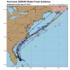
Yep...trends for todays runs.

View attachment 22813
That height line thumbing in over top and trying to bridge with the ridge across the conus along with the expanding and slightly west ridge near Bermuda makes me uneasy. That's a good recipe for taking a good portion of the easterly component out of the movement and getting the center inland

Sent from my SM-G975U using Tapatalk

Yeap ridges have been over-performing for the last few years it seems and so have canes.


Sent from my iPhone using Tapatalk
 
That height line thumbing in over top and trying to bridge with the ridge across the conus along with the expanding and slightly west ridge near Bermuda makes me uneasy. That's a good recipe for taking a good portion of the easterly component out of the movement and getting the center inland

Sent from my SM-G975U using Tapatalk
So inland N.C. should keep an eye on this?
 
I just don't feel comfortable with thinking Dorian is just going to stop right before it gets to Florida and go straight north. What exactly is going to make it stop and go north?
Are you wanting the majority of global models to fail in the year 2019? It’s not gonna happen there is very decent agreement but still dangerously close to the coast or east.
 
That height line thumbing in over top and trying to bridge with the ridge across the conus along with the expanding and slightly west ridge near Bermuda makes me uneasy. That's a good recipe for taking a good portion of the easterly component out of the movement and getting the center inland

Sent from my SM-G975U using Tapatalk

Everything today is making me uneasy. A lot more factors and the west trend with the models today point to Dorian making landfall. I hope the NHC is right about the recurve, but I am not sold on that happening.
 
I was off by 5. I was just guessing by how beastly canes have gotten these last few years.


Sent from my iPhone using Tapatalk
 
Are you wanting the majority of global models to fail in the year 2019? It’s not gonna happen there is very decent agreement but still dangerously close to the coast or east.
I said the same thing in December when they had a foot of snow here

Sent from my SM-G975U using Tapatalk
 
So inland N.C. should keep an eye on this?
Certainly should along and east of US1. Back toward the 85 corridor it's worth keeping an eye on but it would take a pretty significant shift to get anything of concern in that area

Sent from my SM-G975U using Tapatalk
 
Whoops.


Sent from my iPhone using Tapatalk
Whoops indeed. It missed 190 by a hair though. This was 4 days ago though.

Dont feel bad when it first formed someone said it would top Irma and i laughed and said no way lol

Or when we laughed at the NAM showing 906 mb near the Bahamas 3 days ago

It hasnt been a good storm to try and forecast
 
Back
Top