NCSNOW
Member
I'm watching the severe parameters on these fronts over the next few weeks. But I wouldn't be surprised if there is secondary low development closer to the Gulf that consolidates the energy to the south. GEFS ensemble members have been hinting at this for days now.12Z ICON is on board.


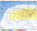
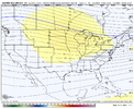
If I was a betting man, other then a quick hitting trough/cold, including the one around day 7, (that may pose a severe wx threat as well), mid dec-leading up to Christmas, looks AN to me. Pac jet looks to overextend around that time, looks like December is gonna do what it normally does during a stronger El Niño. View attachment 138309View attachment 138310
It always happens later than we expect.If I had to guess, I’d say we see a flip towards the last week of December. It’s just getting to that point we have to drive through garbage for the next 3 weeks
Shouldn’t be a big suprise that December was going be above normal temp wise … that was the consensus that most Mets and forecast hadIf I had to guess, I’d say we see a flip towards the last week of December. It’s just getting to that point we have to drive through garbage for the next 3 weeks
I thought we didn’t want vodka cold. Suppression is no good.Noticed the Euro hasn't backed off on the front/ big storm late this upcoming weekend. But something new is it keeps it cold/seasonably chilly all the way out through 240 afterwards. GFS sends us back to AN 2 days afterwards. You can see the CFS advertising the pattern change starting Christmas eve with an ice storm then has Vodka Cold/hammer drop as we head back to work post NY day. Interesting to see the ensembles latter this week, if they start sniffing it out
We ALWAYS want vodka cold. Because by the time it gets here, it usually turns out to be Shirley Temple cold.I thought we didn’t want vodka cold. Suppression is no good.
Our 42 turned into 36. Seems to be a widespread colder than forecast.Forecasted low was 39 for me last night but it got down to 32. Even the short range models have had me warmer than it has really been the past month or so.
The Euro ensembles aren’t really on board with keeping things seasonable. After the quick chilly shot after the weekend storm, it really wants to keep things mild, but you can start to see the pattern change begin to unfold at the end of the run as a ridge starts to go up out west and a split flow begins to set up.Noticed the Euro hasn't backed off on the front/ big storm late this upcoming weekend. But something new is it keeps it cold/seasonably chilly all the way out through 240 afterwards. GFS sends us back to AN 2 days afterwards. You can see the CFS advertising the pattern change starting Christmas eve with an ice storm then has Vodka Cold/hammer drop as we head back to work post NY day. Interesting to see the ensembles latter this week, if they start sniffing it out
We ALWAYS want vodka cold. Because by the time it gets here, it usually turns out to be Shirley Temple cold.
It would be so dry … all you feel would be static electricityNo cap. Lol. I want it vodka, bottled in bond cold as long as possible. Barney purples all in the Carolinas. The colder it is, the longer window you seem to have of cold that can do work IMO.
Yep. Anything below about 20 degrees is too cold. 27-30 degrees is perfect for snow.It would be so dry … all you feel would be static electricity
Here in Georgia, I'll take my chances with vodka cold and a juiced up STJ.I thought we didn’t want vodka cold. Suppression is no good.
Usually don’t work together lolHere in Georgia, I'll take my chances with vodka cold and a juiced up STJ.
I wasn’t expecting to have ice on my truck.Our 42 turned into 36. Seems to be a widespread colder than forecast.
Neither does the usual 33 and rain lol.Usually don’t work together lol

Yeah but seriously I take my chances with that scenario lolNeither does the usual 33 and rain lol.

For the 10th?Euro is a BIG severe weather threat for the Carolina’s
Yes that timeframe. Wedge boundary, huge mid level wind field, large amounts of the low level shear and a negatively tilted trough. Pretty high end look right there. Instability is always in question but as usual in the winter it only takes a 100+ joules of capeFor the 10th?
You do not even need lightning either to get tornadoes around here. Heavy showers will get the job done if we have enough shear. Feb 1997 and Jan 2007 are good examples of that. The Spartanburg tornado in Feb 2020 had little to no lightning if I remember correctly.Yes that timeframe. Wedge boundary, huge mid level wind field, large amounts of the low level shear and a negatively tilted trough. Pretty high end look right there. Instability is always in question but as usual in the winter it only takes a 100+ joules of cape
