• Hello, please take a minute to check out our awesome content, contributed by the wonderful members of our community. We hope you'll add your own thoughts and opinions by making a free account!

Severe 4/12 - (?) Severe Weather

Iceresistance

Be ready for anything
Member
Joined
Mar 25, 2022
Messages
97
Reaction score
113
Location
Tecumseh, OK
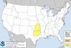
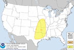
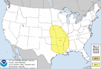
The SPC has put out a Slight risk of Severe Storms starting April 11th in the Southern Plains, but April 13th (Even though the SPC does not have a Severe Weather risk on that day) appears to have a ridiculously high ceiling for severe storms.

Joe Bastardi is worried about it, he's saying it's going to be a 'Mega-outbreak'


Mike Ventrice's Automated Severe Weather forecasting (Please take it as a grain of salt) is showing a HIGH risk for the Central & Southern Plains for April 13th.
:yikes:


Looks like a multi day dry line storm/supercell development is possible on Monday and Tuesday with plenty of instability in place. Although mesoscale details will really get a better read on these days which we won’t know for several more days still.

Wednesday is when the main system finally starts to move east, but there is too much model variability on how fast the system moves right now, but certainly will have some degree of severe weather potential somewhere.
 
Just with a quick look at the wind profiles and lifting mechanisms, not familiar at all with plains severe weather events but I'd say your biggest severe weather events will probably be on that 2nd or 3rd risk day into east Oklahoma, Missouri and north Arkansas. Disclaimer though I'm not familiar with plains setups usually you have a dryline that sits over west Oklahoma and that area that they form off of but idk. Just thought I'd put a cent or two in the bucket
 
Just with a quick look at the wind profiles and lifting mechanisms, not familiar at all with plains severe weather events but I'd say your biggest severe weather events will probably be on that 2nd or 3rd risk day into east Oklahoma, Missouri and north Arkansas. Disclaimer though I'm not familiar with plains setups usually you have a dryline that sits over west Oklahoma and that area that they form off of but idk. Just thought I'd put a cent or two in the bucket
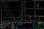
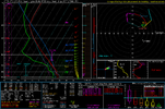
The sounding is on the 2nd day of the SPC Risk Days, on Tuesday.

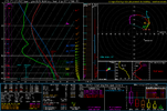
Sunday has a CINH of 300 to 400, likely capped off.
Monday has limited moisture return.
 
Very strong cap and elevated storm mode on this sounding. But looks like a potential 3 day severe weather event nonetheless
Looks like pretty weak capping and likely surface based convection. The issue I see is the pretty weak(30knt) winds at 500mb, but like you I really don’t know plains events that well.
 
Looks like pretty weak capping and likely surface based convection. The issue I see is the pretty weak(30knt) winds at 500mb, but like you I really don’t know plains events that well.
I thought 90 CIN was pretty strong? Maybe I'm looking at it wrong haha. Most of your lift is coming from mesoscale and wind divergence and peak heating takes a lot to bust a pretty strong cap.

I've seen where strong cap days bust pretty good. I think that plains super tornado oubtreak that was forecasted a couple years back was a high cap day and busted very bad for what was actually forecasted.
Now this is a strong cap.C23B6A0E-94D1-4C05-94CA-35A742BCBF6A.jpeg
 
Last edited by a moderator:
Back
Top