Might have to watch this one if the models are missing on the big eastern trough
-
Hello, please take a minute to check out our awesome content, contributed by the wonderful members of our community. We hope you'll add your own thoughts and opinions by making a free account!
You are using an out of date browser. It may not display this or other websites correctly.
You should upgrade or use an alternative browser.
You should upgrade or use an alternative browser.
Tropical Hurricane Sam
- Thread starter SD
- Start date
Shaggy
Member
Might have to watch this one if the models are missing on the big eastern trough
12z was closer to a threat on the gfs. It's okay though we have 2 weeks to watch it.
Last edited:
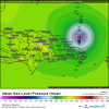
Out of 51 12Z EPS members, 2 hit S FL from the SE/S, 1 is in the GOM moving NE, and just about all of the rest miss the CONUS although there might also be a weak member (TD-TS) that hits Wilmington, NC from the south...hard to tell if that's from 98L. Even though there are only three assumed hits excluding that weak NC hit, ~25% make it at least as far W as 70W, which is uncomfortably too close to feel confident about a safe recurve from the CONUS based on this run.
You can see the two S FL hits on this 360 hour map as well as the one in the GOM, which is moving NE:

You can see the two S FL hits on this 360 hour map as well as the one in the GOM, which is moving NE:

Downeastnc
Member
With these troughs diving in like being shown on some of the models, this system is one to watch. Still pretty good ridging in the North Atlantic and if one of these troughs digs enough with the right timing, it could cause a storm to hook back to the west instead of going OTSOut of 51 12Z EPS members, 2 hit S FL from the SE/S, 1 is in the GOM moving NE, and just about all of the rest miss the CONUS although there might also be a weak member (TD-TS) that hits Wilmington, NC from the south...hard to tell if that's from 98L. Even though there are only three assumed hits excluding that weak NC hit, ~25% make it at least as far W as 70W, which is uncomfortably too close to feel confident about a safe recurve from the CONUS based on this run.
You can see the two S FL hits on this 360 hour map as well as the one in the GOM, which is moving NE:
View attachment 91095
Downeastnc
Member
With these troughs diving in like being shown on some of the models, this system is one to watch. Still pretty good ridging in the North Atlantic and if one of these troughs digs enough with the right timing, it could cause a storm to hook back to the west instead of going OTS
At the least it looks likely there will be a legit threat to the northern Leewards and Puerto Rico......
Downeastnc
Member
GFS doing silly stuff at 00Z....looks to turn out early, then a hard west turn, then stalls drifts back due east, then sharp hook back west headed right for Bermuda as a very large hurricane.....then turns back north and OTS
Last edited:
Downeastnc
Member
Henry2326
Member
This is what I was mentioning last night. With the blocking that’s showing further north in this timeframe, it’s going to be very hard to get that ridge kicked out of the way so you can get an OTS recurve. The question becomes how far south does the trough dig… if it’s further south you get a landfall in GA or the Carolinas, and if not is much you get a landfall into the Mid-Atlantic like Sandy. Either way in that scenario you would have a storm coming into the coast perpendicular which would be worse for surge.We would be in a less than ideal situation here. Ridge over the top and the system bending back west. Avoiding a US impact from here going forward would be getting more and more difficult
View attachment 91126
Up to 90% now, haven't really been following it so it may have already been 90% lol anyway, looks like we probably got us a long track system. Might be the last one before "homegrown" season kicks in
I don’t agree with “it will be very hard to pull an OTS track”. A strong storm will feel any influence greatly to bend north and climo suggests a recurve at some point. This is just another non-zero chance storm that could impact more land areas imo. The only surprise I’m seeing is that people are using the euro again after bashing it for quiet some time. The GFS is a different solution but I could see a compromise further west maybe even dangerously further west but who knows. Will be nice tracking a long track hurricane again.
Nice rotation.
I don’t disagree with you that climo suggests a recurve at some point… which at this time is still the most likely solution. However we also know from climo the set up that is required to bend a storm back west into the coast and that is certainly what the Euro showed earlier… it’s just one example and of course timing would also be key as well. Yesterday’s 12z GFS showed something similar but with different timing and it allowed the storm to find a weakness to go OTSI don’t agree with “it will be very hard to pull an OTS track”. A strong storm will feel any influence greatly to bend north and climo suggests a recurve at some point. This is just another non-zero chance storm that could impact more land areas imo. The only surprise I’m seeing is that people are using the euro again after bashing it for quiet some time. The GFS is a different solution but I could see a compromise further west maybe even dangerously further west but who knows. Will be nice tracking a long track hurricane again.
The Euro is problematic
Downeastnc
Member
The Euro is problematic
Woof....and it moving WNW at a pretty good clip.....for sure a Bahama threat on this run....threaded the needle and went between Puerto Rico and the Virgin Islands as a solid Cat 3 at least, then turned more westerly...gonna take a big stall and turn out for this to miss.....

What I see problematic is that it’s current state of health (lack of convection) is allowing it to miss influences to the north to cause recurvature. I swear sometimes these things almost know when to hold back…just to survive long enough to make it this far west before rapidly intensifying.
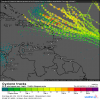
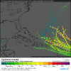
Take a look at 2021 tracks so far. The winds are funneling all these storms into the exact same area (perhaps the euro is too far north and we will see some mountain interaction come into play in a few runs). Largely a food for thought post but no Hugo like tracks have been seen so far this year thankfully! 

Last edited:


