VegasEagle
Member
Deltadog03 said:2nd call map folks...

I am with you! My map would look the same.
Deltadog03 said:2nd call map folks...
Deltadog03 said:2nd call map folks...

GaWx said:Chris,
Looks reasonable.
Webberweather53 said:I like it!! "Roadtrip" Lol!
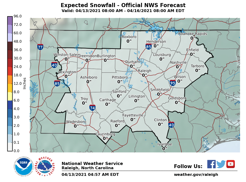
Im probably going to wait until after the 0z runs tonight to update the first call map (if you wanna call it that) I put out a few days ago. Definitely still a little early for thinking about exact amounts but I think a reasonable, somewhat conservative (& rightfully so) scenario west of I-95 in NC is for ~ 2-5"... Georgia and your neck of the woods is probably a little tougher because the entire dynamic of the storm changes thereafter from overrunning to a strengthening Miller A off/along the coast of the Carolinas
So you're saying that the Carolinas will have more moisture to work with than North GA? BTW, I'll be very interested to see your map. I've been reading this forum/talkweather for years and have come to learn to listen to you almost more than anyone else for a very informative/detailed, extremely knowledgeable prediction. You're definitely one of the best this forum has to offer!
Deltadog03 said:2nd call map folks...
SD said: