Watch any cells out in front that can get going later this afternoon

Sent from my iPhone using Tapatalk

Sent from my iPhone using Tapatalk
41 up here but the HRRR is just about spot on right now with DP's and shows a strong surge or moisture in a few hours..... guess time will tellWe really need to get some moisture in here if we are going to see anything besides a few sprinkles. A dew of 44 ain't gonna cut it
I think that the models should get a upgrade. There has been a LOT of busts lately.
41 up here but the HRRR is just about spot on right now with DP's and shows a strong surge or moisture in a few hours..... guess time will tell
")
Well my gut tells me it is too fast with moisture return but we will keep ya posted....HRRR did a horrible job in my area as far as moisture surge goes . Maybe it will do better for your area . Let us know
Sent from my iPhone using Tapatalk
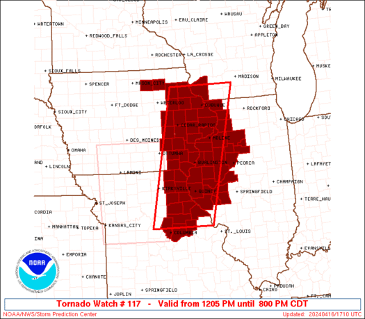
I wonder if anything touched down with the warnings to our west? Surprised this is happening since they lowered the risk today.