• Hello, please take a minute to check out our awesome content, contributed by the wonderful members of our community. We hope you'll add your own thoughts and opinions by making a free account!

Severe Severe Weather Threat 1/1/17-1/2/17

Laucked

Member
Joined
Dec 8, 2016
Messages
2
Reaction score
0
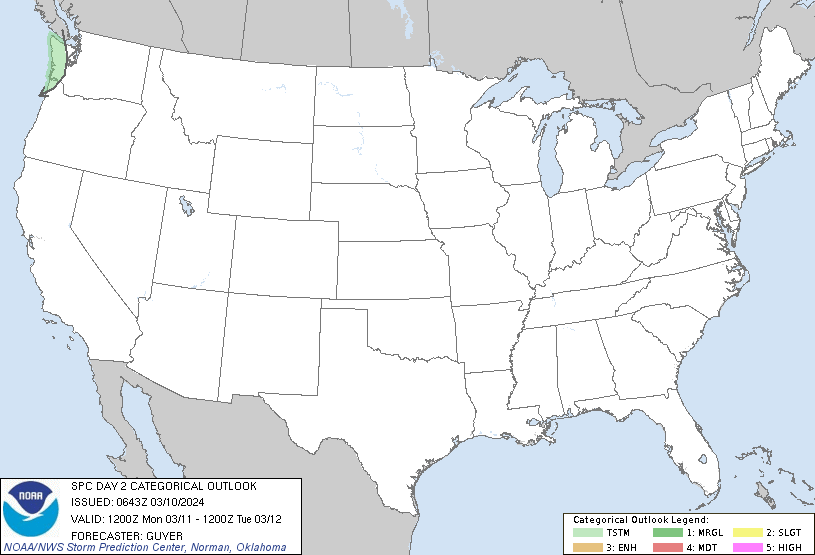
As some you may already know, a slight risk of severe wx is outlined for the next couple of days across the southern gulf coast states. The main mitigating factor for severe potential may very well end up being a muddy warm sector with coastal convection pinching off the warm sector, pretty common with severe threats during the winter months. Nonetheless, some solutions show the warm front making its way north with an appreciative warm sector across much of Mississippi, and Alabama.

Here's the discussion from BMX: "There is fairly good support for a quality warm sector moving
inland on Monday ahead of a potent shortwave headed eastward
from Texas. Temperatures will be quite cold aloft, leading to
moderate amounts of instability if mid to upper 60s dewpoints move
into the area. A fairly substantial severe weather threat looks
likely if (and this is a big if) Gulf convection does not disrupt
the wind fields across the warm sector. The close proximity of the
500mb shortwave to the Gulf Coast and the left exit region of a
300mb jet over the Central Gulf are both factors in favor of
coastal convection. However, the warm front is expected to be
inland by 12Z Monday which argues against the idea of widespread
coastal convection. If the warm sector remains largely
uncontaminated, moderate amounts of shear and CAPE would probably
yield an environment favorable for supercells and tornadoes ahead
of a QLCS. It seems unlikely that our low forecast confidence will
get much higher until Sunday night or Monday morning, but there
appears to be two distinct and opposite possible outcomes. A low
confidence threat will be maintained in the HWO."
 
Large enhanced risk area now on the Day 2 outlook

day2otlk_0700.gif
 
Was just about to post this. Weird they would differ that much. SPC has slight risk covering almost all of Alabama, with an enhanced risk almost all the way to Birmingham; BMX has what you posted.

That's a pretty substantial difference.
 
Crazy difference of opinion for sure. In BMX's defense cape values were still very marginal last night in modeling. Unless something changed I can see why BMX is hesitant to make that jump. Going to be interesting to see who breaks away towards the other first. On to the setup last night models showed a pretty classic surface low track for a Dixie alley event. The low was also under 1000mb if coastal convection is limited and we can get cape values approaching 1000 j/k it's game on. Otherwise threat may be limited to the southern tier of the coastal states.
 
' In BMX's defense cape values....'

On the other hand, they admit forecadt confidence is low.  With a reasonably high ceiling on this event and tomorrow a holiday for most, I do not understand the conservative approach.  I would expect them to ramp up quickly if there is not a big precip blob off the coast this evening or if it is apparent a secondary low does indeed form.

That said, these set-ups seem to rarely thread the needle and if coastal convection doesn't mitigate
the threat, crapvection does- although with the cooler temps aloft that may not be such an issue.  I do believe the enhanced risk upgrade is primarily due to the potential for damaging wind associated with an MCS.
 
So I asked BMX about it and this is what they said:

We believe that the rain will be ongoing Monday morning across Southern AL, which will disrupt the severe weather threat for later in the day across our northern areas. With that said, we can't rule out having to move the risk further northward and/or increasing it as more data comes in.
 
The 18z 4km nam really turned around this run and de escalates the threat in Alabama. The coastal crapvection really appears to take a toll on the destabilization further north. Although, this comes as no surprise to me as it was the primary mitigating force all along. That all being said the threat further south and west is still very much there. Always, with situation like this, it will come down to mesoscale features that guidance cannot fully iron out just yet. I suspect we won't fully understand how this threat will evolve until early tomorrow morning. For us folks in Central Alabama as of now I don't see this becoming much more than a slight threat with no EML present in the warm sector, and ongoing convection to the south "muddying" up the warm sector.
 
Why is Glenn burns honking big time for tornadoes and severe weather for ga?  Not one other station in the market has said said such a thing only that the threat is to our west. 


Sent from my iPhone using Tapatalk
 
MBell link said:
Why is Glenn burns honking big time for tornadoes and severe weather for ga?  Not one other station in the market has said said such a thing only that the threat is to our west. 


Sent from my iPhone using Tapatalk
Seriously?? It's pretty iffy still in Alabama (minus southern portions), and the more this crapvection gets modeled the less potent it is looking. He must like stepping out on limbs just to see how far he can go before it breaks. Anyways going to do lots of radar watching pior to heading in to work tomorrow especially to see what convection on the coast is doing
 
Thundersnow89 link said:
[quote author=MBell link=topic=84.msg6677#msg6677 date=1483331895]
Why is Glenn burns honking big time for tornadoes and severe weather for ga?  Not one other station in the market has said said such a thing only that the threat is to our west. 


Sent from my iPhone using Tapatalk
Seriously?? It's pretty iffy still in Alabama (minus southern portions), and the more this crapvection gets modeled the less potent it is looking. He must like stepping out on limbs just to see how far he can go before it breaks. Anyways going to do lots of radar watching pior to heading in to work tomorrow especially to see what convection on the coast is doing
[/quote]
Yup!  Big bold post on Facebook in all caps!  Just a ratings ploy!  So sad! 
c7b2ba93432f37c44687166d832d67af.jpg


Sent from my iPhone using Tapatalk
 
Going to be interesting to see which way SPC goes with this. Do they put their eggs in the crapvection basket and start trimming back the slight risk area? Or stick to their guns because of how high the ceiling could be for this event if coastal convection doesn't play a role. Decisions decisions.
 
MBell link said:
[quote author=Thundersnow89 link=topic=84.msg6692#msg6692 date=1483332638]
[quote author=MBell link=topic=84.msg6677#msg6677 date=1483331895]
Why is Glenn burns honking big time for tornadoes and severe weather for ga?  Not one other station in the market has said said such a thing only that the threat is to our west. 


Sent from my iPhone using Tapatalk
Seriously?? It's pretty iffy still in Alabama (minus southern portions), and the more this crapvection gets modeled the less potent it is looking. He must like stepping out on limbs just to see how far he can go before it breaks. Anyways going to do lots of radar watching pior to heading in to work tomorrow especially to see what convection on the coast is doing
[/quote]
Yup!  Big bold post on Facebook in all caps!  Just a ratings ploy!  So sad! 
c7b2ba93432f37c44687166d832d67af.jpg


Sent from my iPhone using Tapatalk
[/quote]
LOL!!! While BARELY over half the state is in a MARGINAL risk.
 
MBell link said:
Unless he is looking at the supposed "super model" they have.  Guess we'll see how it pans out.


Sent from my iPhone using Tapatalk
From ACME? LOL!
 
Here's an interesting AFD from BMX.

An active severe weather day is shaping up across the Gulf States,
and confidence in the local severe weather threat has increased
somewhat this morning. However, the threat across our forecast
area remains very conditional on mesoscale features and quite
complicated. Overnight convection extending from the southeast tip
of Louisiana into Southeast AL and southern Georgia has created an
effective cold front which is now beginning to stall. This
boundary should begin to return northward later this morning and
become the effective warm front. To the north of this boundary,
the airmass is rather stable and characterized by temperatures and
dewpoints in the lower 60s. Some modification of the airmass is
possible north of the effective warm front as SSW 850 mb flow
continues to feed moisture into the region, but the strongest CAPE
should remain south of the boundary. For this reason and in the
scenarios discussed below, we will continue to show the northern
one-third of the forecast area as having no discernible severe
weather risk.

Part 1 (Noon to 8 PM): Elevated thunderstorm activity has formed
this morning in Southwest Mississippi and may reach our southwest
counties late this morning into the early afternoon. At the same
time, airmass modification may lead to surface-based instability
as these storms arrive into the CWA. There is some suggestion by
recent model information that another effective warm front will
develop in the vicinity of the Highway 80 corridor, enhancing the
threat for tornadoes and damaging winds. To account for this, our
severe weather timeframe will be shown starting at noon with an
elevated risk area extending from Demopolis to Phenix City
southward and a lower threat to the north.

Part 2 (8 PM to 3 AM): We are now also concerned about the
potential for a more substantial nocturnal severe weather
episode mainly along and south of the Interstate 85 corridor.
Short range ensemble guidance and other individual models are
coming to a consensus regarding the development of a 45-55 kt LLJ
tonight across southern Alabama along with large clockwise-curved
hodographs. This LLJ could promote the advancement of much
stronger CAPE into our S/SE counties after 8 PM. Mid-level lapse
rates have also been trending stronger with time, and forecast
soundings show an increasingly dangerous environment. What
initially may form into a QLCS could break up into supercells as
the 500 mb trough deamplifies and and 0-6 km shear vectors become
westerly or even west-northwesterly. The threat appears to
continue much longer than previously thought, and an elevated risk
for tornadoes and damaging winds will be maintained through 3 AM.
A strong tornado or two may also be possible, and that possibility
will need to be evaluated in later updates.
 
Back
Top