-
Hello, please take a minute to check out our awesome content, contributed by the wonderful members of our community. We hope you'll add your own thoughts and opinions by making a free account!
You are using an out of date browser. It may not display this or other websites correctly.
You should upgrade or use an alternative browser.
You should upgrade or use an alternative browser.
Severe Threat 10/24 - 10/26
- Thread starter SASQUATCH
- Start date
Looking at other parameters it seems the main threat will be straight line winds and maybe some large hail, in my opinion. Never can rule out a spinner or two.
Z
Zander98al
Guest
This one really flew under the radar lol. I just now realized some bad weather was coming tommorow
Z
Zander98al
Guest
Still a few different model outcomes it looks like.
What's interesting is the WRF model suites. With the clear cut storm cells And not a linear mess. Usually for convective mode WRF models are preferred. Your highest threat area will be that mesh point in west central Alabama.
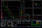
It looks fairly reasonable for a decent 1000j of sbcape tommorow depending on cloud cover. Alot of the northern extent of severe storms will really depend on how well it destabilizes, or you'll be running off those 100-200j spinning tops with damaging wind gusta as soon as you get north of i-20.
Those cells really get pushed off and rolling at that pinch in south Mississippi.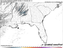

Belle Lechat
Member
- Joined
- Aug 29, 2021
- Messages
- 1,529
- Reaction score
- 1,215
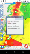
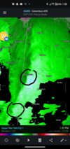
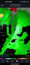
TORNADO WARNING
NATIONAL WEATHER SERVICE AUSTIN/SAN ANTONIO TX
846 PM CDT MON OCT 24 2022
THE NATIONAL WEATHER SERVICE IN AUSTIN SAN ANTONIO HAS ISSUED A
* TORNADO WARNING FOR...
NORTHEASTERN WILLIAMSON COUNTY IN SOUTH CENTRAL TEXAS...
* UNTIL 930 PM CDT.
* AT 846 PM CDT, A SEVERE THUNDERSTORM CAPABLE OF PRODUCING A TORNADO
WAS LOCATED OVER JARRELL, OR 7 MILES NORTHEAST OF SERENADA, MOVING
EAST AT 60 MPH.
HAZARD...TORNADO.
SOURCE...RADAR INDICATED ROTATION.
IMPACT...FLYING DEBRIS WILL BE DANGEROUS TO THOSE CAUGHT WITHOUT
SHELTER. MOBILE HOMES WILL BE DAMAGED OR DESTROYED.
DAMAGE TO ROOFS, WINDOWS, AND VEHICLES WILL OCCUR. TREE
DAMAGE IS LIKELY.
* LOCATIONS IMPACTED INCLUDE...
GEORGETOWN, GRANGER, SERENADA, BARTLETT, JARRELL, WEIR, GEORGETOWN
DAM, SUN CITY, GRANGER DAM, THEON, LANEPORT, HOXIE, HARE, WALBURG,
SCHWERTNER AND SANDOVAL.
Belle Lechat
Member
- Joined
- Aug 29, 2021
- Messages
- 1,529
- Reaction score
- 1,215
Belle Lechat
Member
- Joined
- Aug 29, 2021
- Messages
- 1,529
- Reaction score
- 1,215
Belle Lechat
Member
- Joined
- Aug 29, 2021
- Messages
- 1,529
- Reaction score
- 1,215
Belle Lechat
Member
- Joined
- Aug 29, 2021
- Messages
- 1,529
- Reaction score
- 1,215
Belle Lechat
Member
- Joined
- Aug 29, 2021
- Messages
- 1,529
- Reaction score
- 1,215
Hpdb301
Member
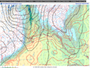
Always learning here, so don't shoot me if I blow this but looking at 12km Nam does it not appear to be giving a more neutral to a slight negative tilt as the Low advects off to the North? The isobars are still oriented in a positive tilt, however, all that energy seems to circulate around in a neutral to negative fashion.. It may not mean a thing, just an observation and sharing for input. If my thinking is correct this setup always tends to bring surprises this time of year! To the southeast. anyway back to your regularly scheduled programming, pounce on my observation at will.


Z
Zander98al
Guest
I think talking nonsense is the normal for this forum at least in my case lol. That trough looks pretty negative tilt at the point in time that you show though. I think it starts turning from neutral to negative about when the severe storm chance startsAlways learning here, so don't shoot me if I blow this but looking at 12km Nam does it not appear to be giving a more neutral to a slight negative tilt as the Low advects off to the North? The isobars are still oriented in a positive tilt, however, all that energy seems to circulate around in a neutral to negative fashion.. It may not mean a thing, just an observation and sharing for input. If my thinking is correct this setup always tends to bring surprises this time of year! To the southeast. anyway back to your regularly scheduled programming, pounce on my observation at will.

Z
Zander98al
Guest
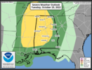
Something to note the 5 percent tornado risk was expanded quite a bit into Alabama.
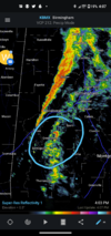
Spc wording makes it seem as if a close eye is being kept on the possibility or raising or broading of the risk area. As mentioned with possibly a organized severe weather event materializing. Probably a damaging wind event from squall line. But mesovorticies are very annoying.
Spc wording makes it seem as if a close eye is being kept on the possibility or raising or broading of the risk area. As mentioned with possibly a organized severe weather event materializing. Probably a damaging wind event from squall line. But mesovorticies are very annoying.
Z
Zander98al
Guest
Some schools are starting to dismiss early. In northwest Alabama
Z
Zander98al
Guest
Any of you folks in west Alabama pay attention. Spann posted this
Z
Zander98al
Guest
Don't shoot the messenger but here's abc3340. School closings list should update has the day goes on. I think it's incredibly stupid for such a lower end threat day to have closings but oh well ? https://abc3340.com/weather/closings
Z
Zander98al
Guest
Wouldn't be surprised for a upgrade to enhanced 10% tornado risk on the MS/AL border. Model forecast on thermodynamics is below the actual thermodynamics being observed. Warm front is currently stretching down through about the western 3rd of Alabama
Z
Zander98al
Guest
Lots of clear skies in west Alabama. Will further aid in thermodynamics. Likely see 1000+ sbcape by afternoon
Z
Zander98al
Guest
Z
Zander98al
Guest
Tornado watch incoming for west Alabama and portions of central Alabama.
Z
Zander98al
Guest
Z
Zander98al
Guest
It seems like things are supposed to flair up here soon. Cape is pushing 1500 in portions of west Alabama
Z
Zander98al
Guest
Z
Zander98al
Guest
Z
Zander98al
Guest
Muggy as crap here in downtown
If this severe threat were Halloween candy, it would be god awful candy corn.
Z
Zander98al
Guest
That's a good thing haha.If this severe threat were Halloween candy, it would be god awful candy corn.
Z
Zander98al
Guest
Well, glad this is a nothing burger so far for central AL. Maybe if I start all severe threads it would be like this. Things that make you go, hmmmmmmmm!?
Z
Zander98al
Guest
Watch cancelled in bama
NBAcentel
Member
Bust lol, this event could have been formidable if it wasn’t from poor skinny thermodynamics. That and the trough in the Atlantic

