-
Hello, please take a minute to check out our awesome content, contributed by the wonderful members of our community. We hope you'll add your own thoughts and opinions by making a free account!
You are using an out of date browser. It may not display this or other websites correctly.
You should upgrade or use an alternative browser.
You should upgrade or use an alternative browser.
Tropical TS Bonnie
- Thread starter SD
- Start date
Brent
Member
accu35
Member
And here we go.
accu35
Member
ALEET! ALEET! You know this is going straight to TX and around the SE!! Just always does when you need the rain! That’s why I moved! TN gets 5-7”, up into the Ohio valley
Brent
Member
ALEET! ALEET! You know this is going straight to TX and around the SE!! Just always does when you need the rain! That’s why I moved! TN gets 5-7”, up into the Ohio valley
Texas is in a bad drought too to be fair
Tornadocane
Member
I'll give this one a few days before I get interested.
BHS1975
Member
Gonna be a crazy season if we got action in MDR already.
accu35
Member
Tornadocane
Member
Got a skeleton forming on this on. The Caribbean graveyard looks quite fertile for this time of year. I've upgraded my interest level to 20%!
Brent
Member
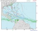
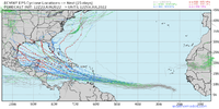
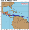
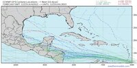
Pretty good consensus on Central America right now. Threat has definitely lessened a bit to the Northern Gulf I think but things can easily change if it can stay on the northern side of the guidance and we are still talking about beyond day 7. Either way for this being late June this storm yeah may be very impressive

Last edited:
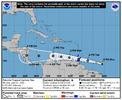
PTC coming out later today.A tropical wave located about 900 miles east-southeast of the
southern Windward Islands is producing a large area of showers and
thunderstorms. Environmental conditions appear conducive for
further development, and a tropical depression is likely to form
during the next couple of days before the system reaches the
Windward Islands Tuesday night or possibly while moving westward
across the southern Caribbean Sea Wednesday through Friday. A NOAA
Hurricane Hunter aircraft is scheduled to investigate the system
this afternoon. Interests in the Windward Islands and along the
northeastern coast of Venezuela should monitor the progress of this
system, and tropical storm watches or warnings could be required for
portions of these areas later today. Regardless of development,
locally heavy rainfall is possible over the Windward Islands and the
northeastern coast of Venezuela Tuesday night and Wednesday.
* Formation chance through 48 hours...high...70 percent.
* Formation chance through 5 days...high...90 percent.
Brent
Member
Tornadocane
Member
This might become a tropical storm overnight as it looks like the wave has oriented itself more n to s, and now convection is much better organized than 24 hours ago.
Brent
Member
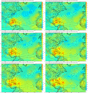
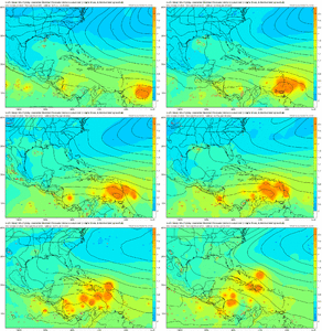
I’ve seen some signals that it may survive into the EPAC.Forecasting a hurricane View attachment 119541
Brent
Member
BHS1975
Member
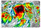
Haven't seen one develop this far south in ages.Very impressive satellite appearance this morning but so far no sign of a center. If they can find a center it'll go straight to Bonnie most likely View attachment 119551
Tornadocane
Member
You don't need visible Satellite to know that PTC 2 is a mess. The vorticity at all levels, in addition to convection, has an elongated WSW to ENE orientation, which is a small improvement from the E to W. This system needs to wrap around the NE lobe to its N, and take on a N to S orientation. However, the alleged COC has been running away to the WSW of vigorous 700-500Mb vortexes that appear to want to reform the storm further NNE. Given that the NHC designated COC is pretty much run aground, I would expect a relocation around 13.5N,38W some point today.
PTC 2 needs to slow down. The about to be old COC is traveling at 30MPH. This system has the potential to quickly develop into a hurricane if it can just slow down enough for a new LLC to form further north. I've seen some impressive gusts already.
PTC 2 needs to slow down. The about to be old COC is traveling at 30MPH. This system has the potential to quickly develop into a hurricane if it can just slow down enough for a new LLC to form further north. I've seen some impressive gusts already.
Tornadocane
Member
Has this been designated as Remnants of PTC2 lol? It might relocate its center overnight, but this is just getting uglier with the lowest pressures and most vigorous voriticies hiking over those Moutains of Venezuela.
Last edited:
Brent
Member
I remember when this storm was gonna be a hurricane in the Gulf ?
Looks like it might happen in the Pacific at this rate...
Looks like it might happen in the Pacific at this rate...
Tornadocane
Member
I remember when this storm was gonna be a hurricane in the Gulf ?
Looks like it might happen in the Pacific at this rate...
Based on Satellite presentation, I can see how the models would have over-developed this system. If it had some breathing room to slow and move North in favorable wind shear, this one would be wrapping up into a Major Hurricane. It's a huge, juiced and vigorous vortex that is trying to bundle energy from 925-500Mbs. IDK... This one seems like it would only need a day to ramp up north of Venezuela, so I would only bet that it doesn't hit the Gulf Coast.
Brent
Member
Based on Satellite presentation, I can see how the models would have over-developed this system. If it had some breathing room to slow and move North in favorable wind shear, this one would be wrapping up into a Major Hurricane. It's a huge, juiced and vigorous vortex that is trying to bundle energy from 925-500Mbs. IDK... This one seems like it would only need a day to ramp up north of Venezuela, so I would only bet that it doesn't hit the Gulf Coast.
Yeah it's also moving faster than the models said and that's always a bad thing in this area... Can't get it together. The Eastern Caribbean is known as a graveyard for this reason
Brent
Member
About 3 days late
..DISTURBANCE BECOMES A TROPICAL STORM...
Data from an Air Force Reserve Hurricane Hunter aircraft indicate
that the disturbance has now become Tropical Storm Bonnie over the
southwestern Caribbean Sea with maximum winds of 40 mph (65 km/h).
..DISTURBANCE BECOMES A TROPICAL STORM...
Data from an Air Force Reserve Hurricane Hunter aircraft indicate
that the disturbance has now become Tropical Storm Bonnie over the
southwestern Caribbean Sea with maximum winds of 40 mph (65 km/h).

