BULLETIN
Potential Tropical Cyclone One Advisory Number 1...Corrected
NWS National Hurricane Center Miami FL AL012024
400 PM CDT Mon Jun 17 2024
...LOW PRESSURE AREA OVER THE BAY OF CAMPECHE EXPECTED TO BRING
HEAVY RAINFALL THREAT TO PARTS OF THE WESTERN GULF COAST...
...TROPICAL STORM WATCH ISSUED FOR PARTS OF THE COAST OF TEXAS AND
NORTHEASTERN MEXICO...
SUMMARY OF 400 PM CDT...2100 UTC...INFORMATION
----------------------------------------------
LOCATION...20.3N 93.2W
ABOUT 380 MI...615 KM SE OF LA PESCA MEXICO
ABOUT 470 MI...755 KM SE OF BROWNSVILLE TEXAS
MAXIMUM SUSTAINED WINDS...40 MPH...65 KM/H
PRESENT MOVEMENT...NNW OR 345 DEGREES AT 7 MPH...11 KM/H
MINIMUM CENTRAL PRESSURE...1001 MB...29.56 INCHES
WATCHES AND WARNINGS
--------------------
CHANGES WITH THIS ADVISORY:
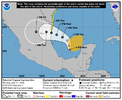
A Tropical Storm Watch has been issued for the Texas coast from
Port O'Connor southward to the mouth of the Rio Grande.
The government of Mexico has issued a Tropical Storm Watch for the
northeastern coast of Mexico south of the mouth of the Rio Grande
to Boca de Catan.
—————-
Potential Tropical Cyclone One Discussion Number 1
NWS National Hurricane Center Miami FL AL012024
400 PM CDT Mon Jun 17 2024
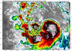
Satellite, surface, and aircraft data show that the center of
the large low pressure area is over the Bay of Campeche with a
central pressure near 1001 mb. The system currently does not have
the structure of a tropical cyclone, as the associated convection
is poorly organized and the maximum winds are located about
200-250 n mi northeast of the center. The various global models
forecast this band of stronger winds to start moving onto the
western Gulf coast on Wednesday, and a Tropical Storm Watch is
required at this time. Thus, advisories are being initiated on
Potential Tropical Cyclone One.
The initial motion is 345/6. This general motion should continue
for the next 24 h or so, although there could be some erratic
motion due to center reformation. After that, the cyclone is
expected to turn west-northwestward and westward on the south side
of a mid- to upper-level ridge over the northern Gulf coast. This
should steer the system into northeastern Mexico between 48-72 h.
While there are differences in details due to the disorganized
nature of the system, the track guidance is in good agreement on
this general scenario.
The global models suggest that some deepening of the central
pressure could occur, although none of them currently forecast the
system to tighten up into a classic tropical cyclone. Based on
that, the intensity forecast calls for only modest strengthening.
There is a chance than a small-scale vorticity center inside the
large cyclonic envelope may develop enough convection to form a
tighter wind core as suggested by the GFS, and based on this
possibility the forecast has the system becoming a tropical storm in
about 36 h. However, there is a chance the system will never
become a tropical cyclone.
issued.
FORECAST POSITIONS AND MAX WINDS
INIT 17/2100Z 20.3N 93.2W 35 KT 40 MPH...POTENTIAL TROP CYCLONE
12H 18/0600Z 21.1N 93.4W 35 KT 40 MPH...POTENTIAL TROP CYCLONE
24H 18/1800Z 22.2N 93.8W 35 KT 40 MPH...POTENTIAL TROP CYCLONE
36H 19/0600Z 22.9N 95.0W 35 KT 40 MPH...TROPICAL CYCLONE
48H 19/1800Z 23.4N 96.4W 40 KT 45 MPH...TROPICAL CYCLONE
60H 20/0600Z 23.8N 97.7W 40 KT 45 MPH...TROPICAL CYCLONE
72H 20/1800Z 24.0N 98.9W 30 KT 35 MPH...INLAND
96H 21/1800Z 24.0N 101.4W 20 KT 25 MPH...INLAND
120H 22/1800Z...DISSIPATED
$$
Forecaster Beven


