Decided to start the thread to avoid confusion with Wednesday's threat.
-
Hello, please take a minute to check out our awesome content, contributed by the wonderful members of our community. We hope you'll add your own thoughts and opinions by making a free account!
You are using an out of date browser. It may not display this or other websites correctly.
You should upgrade or use an alternative browser.
You should upgrade or use an alternative browser.
Severe New Years Severe Weather Event
- Thread starter Snowfan
- Start date
HSVweather
Member
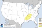
 Latest day 6 outlook for this event
Storm Prediction Center Sep 7, 2024 Day 4-8 Severe Weather Outlook
Severe weather, tornado, thunderstorm, fire weather, storm report, tornado watch, severe thunderstorm watch, mesoscale discussion, convective outlook products from the Storm Prediction Center.
www.spc.noaa.gov
tennessee storm
Member
Yeah looks to be a potent setup , already MEG nws Memphis tn using the word outbreak In this morning big afd s discussion .. I comment more as model runs become closer to event
Z
Zander98al
Guest
Wanna say something. The new years threat may be a multi pronged event. Two big severe events back to back two surface lows are going to swing through. First may be open but the second has a pretty potent cold front and closed low . And a fairly substantial flooding threat along north Alabama and Tennessee. Actually a very substantial threat coming up.
Z
Zander98al
Guest
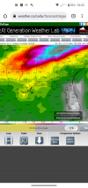
Almost getting a filling of a repeat with all the rain from last 2 years.Forecast rainfall from GFS through around 7 days. View attachment 99362
Z
Zander98al
Guest
Also of note the nws of bham is leaning towards a more volatile solution of there being a large warm sector and potential outbreak of severe.
Z
Zander98al
Guest
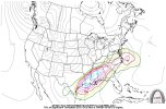
This setup keeps getting more worrisome. As it gets closer. Very good shear a large warm sector, plenty of forcing. Good EML. Bowling ball ejecting and negatively tilted. All the makings for a significant event for the south. The cherry on top has been both global models putting out a sub 1000 mb low in the vicinity of the Memphis area. This is almost better than our average spring setup. Gee wiz. ?
This setup keeps getting more worrisome. As it gets closer. Very good shear a large warm sector, plenty of forcing. Good EML. Bowling ball ejecting and negatively tilted. All the makings for a significant event for the south. The cherry on top has been both global models putting out a sub 1000 mb low in the vicinity of the Memphis area. This is almost better than our average spring setup. Gee wiz. ?
As we saw with the last 2 outbreaks, the pattern is certainly conducive for another anomalous severe weather event.
Z
Zander98al
Guest
Z
Zander98al
Guest
Lol, I'd take it for a grain of salt as of right now honestly. Just a reassuring factor for what a lot of people are thinking about the event, according to how past similar events played out.Well that's not good.
A quick look at the 18z GFS looks like a really messy setup. Probably a far south AL/MS event.This setup keeps getting more worrisome. As it gets closer. Very good shear a large warm sector, plenty of forcing. Good EML. Bowling ball ejecting and negatively tilted. All the makings for a significant event for the south. The cherry on top has been both global models putting out a sub 1000 mb low in the vicinity of the Memphis area. This is almost better than our average spring setup. Gee wiz. ?
Z
Zander98al
Guest
Has looked like its shifted a bit south. Still 6 days away though. A bit of dry air aloft though, I would think it would be limited a bitA quick look at the 18z GFS looks like a really messy setup. Probably a far south AL/MS event.
Z
Zander98al
Guest
Thing to note GFS is starting to forecast convection on the gulf, this may limit severe potential a good bit if it verifies.
Z
Zander98al
Guest
tennessee storm
Member
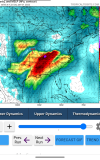
O shart… larger warm sector too. Puts west Tennessee more game nowDude that 12z euro run is nutz. 992 mb in south Missouri as well ?View attachment 99538
Last edited:
Z
Zander98al
Guest
Lol I'd wait for a few more model runs before I start believing in this solution though. Cause it wasn't even 24 hours ago. When the surface low was being shown not even making it into northern Alabama lol. The warm sector is huge though.O shart… larger warm sector too. Outa west Tennessee more game now
tennessee storm
Member
YeaLol I'd wait for a few more model runs before I start believing in this solution though. Cause it wasn't even 24 hours ago. When the surface low was being shown not even making it into northern Alabama lol. The warm sector is huge thou
Yeah but it’s got ensemble support there … red flag be honestLol I'd wait for a few more model runs before I start believing in this solution though. Cause it wasn't even 24 hours ago. When the surface low was being shown not even making it into northern Alabama lol. The warm sector is huge though.
Instead of a two wave look it has keyed on the first wave. From a quick look, it’s way more dangerous than the negative trough from yesterday’s GFS.Lol I'd wait for a few more model runs before I start believing in this solution though. Cause it wasn't even 24 hours ago. When the surface low was being shown not even making it into northern Alabama lol. The warm sector is huge though.


