-
Hello, please take a minute to check out our awesome content, contributed by the wonderful members of our community. We hope you'll add your own thoughts and opinions by making a free account!
You are using an out of date browser. It may not display this or other websites correctly.
You should upgrade or use an alternative browser.
You should upgrade or use an alternative browser.
Pattern June 2022
- Thread starter SD
- Start date
Iceagewhereartthou
Member
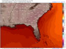
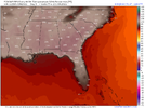
I hope this doesn't happen but it appears to be the outlier. The latest GFS is quite "cooler". These aren't percentiles but the modeled 18z temps.Odds of widespread 100+ next week increasing by the day View attachment 119240View attachment 119239


The GEFS is pretty much inline with the operational. The Euro/EPS has been much higher so we'll have to watch it, but I noticed the last frame of the 18z EPS came in a bit cooler for Tues 18z.
12z

18z

We'll see but still a few days out. Gonna be hot regardless.
I hope this doesn't happen but it appears to be the outlier. The latest GFS is quite "cooler". These aren't percentiles but the modeled 18z temps.
The GEFS is pretty much inline with the operational. The Euro/EPS has been much higher so we'll have to watch it, but I noticed the last frame of the 18z EPS came in a bit cooler for Tues 18z.
12z
18z
We'll see but still a few days out. Gonna be hot regardless.
For what it’s worth, the GFS op came in much warmer at 0z. Very similar to the 12z EPS as far as I can tell. I think ensembles are certainly the way to go this far out. Haven’t been paying much attention to the GFS Ensemble candidly.
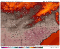
Picking up some much needed rain back at the homestead this morning, .41 so far and looks like more on the way.
I think somebody else (..Rain Cold) stated we tend to back off on the modeled temperatures as we get closer to the actual day. Kind of like the 7 day modeled snow storms. We saw this last year where models constantly showed 110 type readings but it never verified that hot. I would take 5-7 degrees off; which is still hot.For what it’s worth, the GFS op came in much warmer at 0z. Very similar to the 12z EPS as far as I can tell. I think ensembles are certainly the way to go this far out. Haven’t been paying much attention to the GFS Ensemble candidly.
View attachment 119241
For sure. I'm certainly not looking for anything like 110 around here.I think somebody else (..Rain Cold) stated we tend to back off on the modeled temperatures as we get closer to the actual day. Kind of like the 7 day modeled snow storms. We saw this last year where models constantly showed 110 type readings but it never verified that hot. I would take 5-7 degrees off; which is still hot.
That was a yuge back off on the eps last night Holy crap
iGRXY
Member
I always laugh at those extreme temperatures spit out in the summer by these models. I don't think people understand just how hard it is to get 100 degrees in the piedmont, upstate, Northern Georgia. You can squeak out those readings in the flat areas along the coastal plains here and there, but even then those temps are hard to come by. Next week has the makings of a major extreme heat wave and even then temps likely aren't going beyond 105 at most for the hottest areas in the southeast with temps hovering around the upper 90's most places else.
I will eat crow if we get those 105+ degree readings but averages, climo, and models doing the extreme thing says that odds are we get miserably hot, but not to that extreme. As others have said, it is the exact same thing when you get sub zero lows and highs in the teens in the southeast during an extreme artic outbreak on day 5-10 on models. Does it get very cold? Absolutely but temps usually moderate to low teens and single digit lows and around freezing for highs even during the most extreme cold spells in winter. I think the same thing happens here with the heat (99.9% of the time it does).
I will eat crow if we get those 105+ degree readings but averages, climo, and models doing the extreme thing says that odds are we get miserably hot, but not to that extreme. As others have said, it is the exact same thing when you get sub zero lows and highs in the teens in the southeast during an extreme artic outbreak on day 5-10 on models. Does it get very cold? Absolutely but temps usually moderate to low teens and single digit lows and around freezing for highs even during the most extreme cold spells in winter. I think the same thing happens here with the heat (99.9% of the time it does).
NoSnowJoe
Member
I got 1.27 just south of Senoia. My garden needed that bad.
BHS1975
Member
Pretty good write up here.I always laugh at those extreme temperatures spit out in the summer by these models. I don't think people understand just how hard it is to get 100 degrees in the piedmont, upstate, Northern Georgia. You can squeak out those readings in the flat areas along the coastal plains here and there, but even then those temps are hard to come by. Next week has the makings of a major extreme heat wave and even then temps likely aren't going beyond 105 at most for the hottest areas in the southeast with temps hovering around the upper 90's most places else.
I will eat crow if we get those 105+ degree readings but averages, climo, and models doing the extreme thing says that odds are we get miserably hot, but not to that extreme. As others have said, it is the exact same thing when you get sub zero lows and highs in the teens in the southeast during an extreme artic outbreak on day 5-10 on models. Does it get very cold? Absolutely but temps usually moderate to low teens and single digit lows and around freezing for highs even during the most extreme cold spells in winter. I think the same thing happens here with the heat (99.9% of the time it does).
Historic Heat Waves in the Carolinas
www.weather.gov
difference here is the lack of surface dews. easier to get super hot super fast when there's limited cu field and the boundary layer is a solid 100mb-200mb thicker than it typically is this time of year. check this out-I always laugh at those extreme temperatures spit out in the summer by these models. I don't think people understand just how hard it is to get 100 degrees in the piedmont, upstate, Northern Georgia. You can squeak out those readings in the flat areas along the coastal plains here and there, but even then those temps are hard to come by. Next week has the makings of a major extreme heat wave and even then temps likely aren't going beyond 105 at most for the hottest areas in the southeast with temps hovering around the upper 90's most places else.
I will eat crow if we get those 105+ degree readings but averages, climo, and models doing the extreme thing says that odds are we get miserably hot, but not to that extreme. As others have said, it is the exact same thing when you get sub zero lows and highs in the teens in the southeast during an extreme artic outbreak on day 5-10 on models. Does it get very cold? Absolutely but temps usually moderate to low teens and single digit lows and around freezing for highs even during the most extreme cold spells in winter. I think the same thing happens here with the heat (99.9% of the time it does).
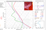
this is the kind of sounding i would expect in a place like phoenix, not augusta lol.
i don't think you're misguided in your skeptical attitude in the slightest, and I think there's room for the longwave trough/various MCSs/general tom foolery to erode the heat potential on the periphery of the ridge- the 00z euro somewhat shows this- but because of the antecedent dry air mass i think we have a crack at some pretty gnarly temps.
I think the key is ultimately how low the dewpoints go this weekend. I’m not sure I’ve ever seen dewpoints in the 30s during June like what some of the models are spitting out right now. If that does verify then they probably wouldn’t be able to recover to help avoid seeing temps in the 102-106 range across the Piedmont that allows some spots to challenge all time records, otherwise we’re talking about our normal upper 90s with rising humidity type heat wave.difference here is the lack of surface dews. easier to get super hot super fast when there's limited cu field and the boundary layer is a solid 100mb-200mb thicker than it typically is this time of year. check this out-
View attachment 119245
this is the kind of sounding i would expect in a place like phoenix, not augusta lol.
i don't think you're misguided in your skeptical attitude in the slightest, and I think there's room for the longwave trough/various MCSs/general tom foolery to erode the heat potential on the periphery of the ridge- the 00z euro somewhat shows this- but because of the antecedent dry air mass i think we have a crack at some pretty gnarly temps.
StormDrain
Member
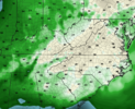
GFS usually has dew points lower than other weather models, but nonetheless a very dry airmass for mid-June.And like the modeled heat I wonder if the modeled dew points will verify for this weekend.
6z GFS for midday Sunday:
View attachment 119242
With highs in the low/mid 80s, the dew points would still make it refreshing.
BHS1975
Member
Getting all kinds of crazy weather these days.
weatherfide
Member
- Joined
- Jan 5, 2017
- Messages
- 3,076
- Reaction score
- 4,498
It looks hot and humid but with very little rain the next 10 days. Going to be rough.
Iceagewhereartthou
Member
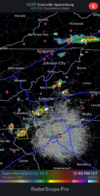
I will be interested to see how that impacts temps around the area, definitely hit or miss. Temps in the upstate have soared toady, GSP already at 95 at 1pm, just one shy of the forecast high of 96. That will bust big time unless some clouds or rain can intervene. CLT at 93. Even CAE only at 92 but looks like some clouds in the area.Mountain convection much more robust today than yesterday
View attachment 119254
Up to 95.4 right now. We will see if we can surpass yesterdays high of 97.2. Looks like it could be possible.
50kft+ tops today in WNC

