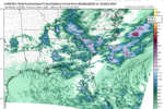
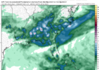
Op gfs would be a heatwave for the record books around here at least a week straight near or over 100. We are likely to have some very hot days mixed in here over the next 7-10 days but you have to think the cmc and icon are a little more realistic with the hottest days being near 100 but the majority of days 92-97Going to be interesting to see if the Euro and gfs are once again way too hot at 850 and 2m. New euro has 25c 850s from clt to gso Saturday and Sunday
-
Hello, please take a minute to check out our awesome content, contributed by the wonderful members of our community. We hope you'll add your own thoughts and opinions by making a free account!
You are using an out of date browser. It may not display this or other websites correctly.
You should upgrade or use an alternative browser.
You should upgrade or use an alternative browser.
Pattern July '22
- Thread starter Detective WX
- Start date
Downeastnc
Member
Op gfs would be a heatwave for the record books around here at least a week straight near or over 100. We are likely to have some very hot days mixed in here over the next 7-10 days but you have to think the cmc and icon are a little more realistic with the hottest days being near 100 but the majority of days 92-97
Brutal
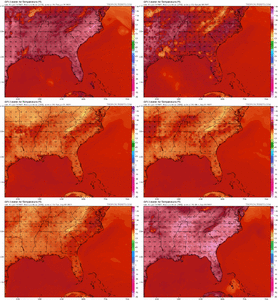
I don't believe that will happen. Even if you shave of 10 degrees, it still absolutely sucks.
Looks like Coastal storms Have fired up along the (immediate) Sea breeze Front on the Coast Proper..
Rain Thunder/Lighting ATM, Typical Summer time stuff..
Speaking about (AC),, grew up around Ft. Bragg (Fayettnam), and We didn't have AC in the Summer..
IN Addition..
When I was *married* with 2 young Daughters, We didn't have "AC" in our "trailer" Tin Cracker Box it was.. We Mostly lived/Stayed, at the Beach, or the N E. .. cape fear Public Landings cooling off.. Though I Did have..A Shop sized , Shop fan in My Tin box..
Now Older, , It would be brutal too me..
LickWx
Member
Omg in time for my birthday too! My god! Epic. My birthday has historically featured great weather. In 2012 it had a massive storm with heat, last year too.
iGRXY
Member
I'll bet my last dollar this is way overdone like usual. Mid 90's the highest, but I doubt the temps will be this bad. GFS is also the only model showing temps THAT extreme. The EURO is hot for a couple of days, but both of them seem to overdo the heat way too often.
Brent
Member
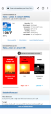
Today's record of 108*F (last set in 2018) has been broken. Currently 109*F at DFW.
Now we see if the elusive 110*F+ high can happen...
EDIT: Oh, and another record maximum low was tied this morning (84*F).
Now we see if the elusive 110*F+ high can happen...
EDIT: Oh, and another record maximum low was tied this morning (84*F).
HugeSnowStick
Member
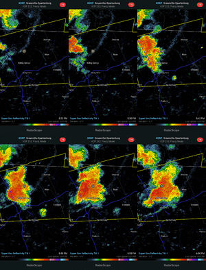
Violent storms moving through ATL right now,,,only got to 84 today,,66 now,,
I wasn't home for this one but it was probably the strongest in a long time. There is a lot of damage around town. It put down 1.4 inches of rain.
I was in Newberry during March 93. I do remember it being wind driven snow and was awesome to see. But it rained most of the event and switched over at the end. Just off memory probably 3-4 inches is all we had there. GSP had 9.3 I believe out of it.Yeah. There both bad. I know man. It's tough to get those big snows in the upstate. I'm almost right there with you most of the time. I've been on the losing side more than not in the winter. I'm 12 miles north of Chesnee off 221 in Rutherford county. It's amazing what those 12 miles can do in the elevation department. I remember playing in a basketball tournament in Jan of 03 in Peach Valley just south of Chesnee and it started snowing that evening and we had a good inch or two on the ground at the house and I thought they would cancel but they didn't and I get down there and you could barely tell there might of been a dusting in shady areas and it had all turned to rain down there. When I leave to go home once I get back into NC over the state line the roads are snow covered and there is about 6 inches on the ground once I got home. Crazy what those 12 miles will do going north. If I go just a little farther north it's like double what I get. I remember that January 2000 snow real good. It was a big one for us also. I got 11 inches out of that one. For you to get 7.8 inches all the way down to Newberry SC that was a huge one down there to. Probably the last time that has happened down there in 22 years I would imagine. Where we're you in the 93 blizzard and how much do you get? I heard there was a sharp cutoff on the accumulations once you got into SC during the blizzard.
lol...
000
FXUS64 KFWD 191951
AFDFWD
Area Forecast Discussion
National Weather Service Fort Worth TX
251 PM CDT Tue Jul 19 2022
...New Long Term...
There`s been a noteworthy shift in the ensemble data from the
GEFS, GEM, and ECMWF toward a wetter and "cooler" Thursday
forecast. A convectively induced vort max is forecast to move into
the region from the northwest and produce a round of elevated
convection late Wednesday night into Thursday morning. The CAMs
that comprise the HREF are most aggressive with rain chances and
cloud cover into midday Thursday. Needless to say uncertainty in
the temperature forecast is high, because without the convection
we will easily top 105 degrees for highs again. On the flip side
there are CAM solutions that hold parts of North Texas in the mid
to upper 80s for highs due to abundant cloud cover and rain cooled
air/outflows. For the official forecast did advertise a break in
the 100 degree heat for North and Northeast Texas with a slight
chance of rain and partly to mostly cloudy skies. We`ll see if the
HREF can hold onto these higher rain chances for another run
before we start forecasting better chances of rain in the midst of
our dry streak. Across Central Texas, the prospects for rain are
lower with the track of the disturbance a bit too far to the
northeast. Therefore the temperature forecast is a little more
certain in that another round of 100 to 105 degree heat is likely.
Brent
Member
lol...
000
FXUS64 KFWD 191951
AFDFWD
Area Forecast Discussion
National Weather Service Fort Worth TX
251 PM CDT Tue Jul 19 2022
...New Long Term...
There`s been a noteworthy shift in the ensemble data from the
GEFS, GEM, and ECMWF toward a wetter and "cooler" Thursday
forecast. A convectively induced vort max is forecast to move into
the region from the northwest and produce a round of elevated
convection late Wednesday night into Thursday morning. The CAMs
that comprise the HREF are most aggressive with rain chances and
cloud cover into midday Thursday. Needless to say uncertainty in
the temperature forecast is high, because without the convection
we will easily top 105 degrees for highs again. On the flip side
there are CAM solutions that hold parts of North Texas in the mid
to upper 80s for highs due to abundant cloud cover and rain cooled
air/outflows. For the official forecast did advertise a break in
the 100 degree heat for North and Northeast Texas with a slight
chance of rain and partly to mostly cloudy skies. We`ll see if the
HREF can hold onto these higher rain chances for another run
before we start forecasting better chances of rain in the midst of
our dry streak. Across Central Texas, the prospects for rain are
lower with the track of the disturbance a bit too far to the
northeast. Therefore the temperature forecast is a little more
certain in that another round of 100 to 105 degree heat is likely.
Yeah our met is talking about the Euro next week too... Said it could be Christmas in July if it verifies.
Yet another record maximum low tied this morning at DFW (82*F, previously set in 1954).
While still hot, I see the GFS has backed off on those ridiculous numbers.... shocked I tell you, just shocked.
smast16
Member

