Figured I would make a thread for the call maps for the storm at the beginning of the week. I always enjoy seeing the call maps that y’all do on here. Bring them on! I may even try one myself later on!
-
Hello, please take a minute to check out our awesome content, contributed by the wonderful members of our community. We hope you'll add your own thoughts and opinions by making a free account!
You are using an out of date browser. It may not display this or other websites correctly.
You should upgrade or use an alternative browser.
You should upgrade or use an alternative browser.
Wintry January 29th and 30th call maps
- Thread starter Parker
- Start date
Storm5
Member

Sent from my iPhone using Tapatalk
This may be my first time doing a region wide map so don't be too harsh on me. A couple of caveats to point out, the area of trace or less includes areas I think may have small chance at seeing at least a *brief* period of snow showers/wintry mix or flurries which is why that area is so broad. Also because the Chattanooga banner blocks it, Murray, Fannin, Union, Towns, and Rabun counties in NGA are in the 2+ inches range. I may come out looking like an idiot with this map, but it's all good, I'm rarely right I just do this for fun.

Last edited:
Snowflowxxl
Member

But honestly I will be making my first call tomorrow. Too late tonight.

mydoortotheworld
Member
My first time doing a call map, this is a lot harder to do than I thought it would be? Anyway, here it is :
Snowflowxxl
Member
First time ever making a Call Map, used paint. I am NO artist lol
Update - Made a lot of changes lol
Trace areas only include areas where I actually believe it's possible a trace of snow could fall and not areas that could see snow flurries at best.
1/2 inch -1 inch, 1-2 inches, and 2+ inches cover a wider area (still includes those GA counties from my first map)
I was conflicted on this, but I left Atlanta in the 1/2 -1 inch range, I left the 1-2 inch line just a county to the NW of me (Fulton).

Zoomed In Version for my GA folks.")

Trace areas only include areas where I actually believe it's possible a trace of snow could fall and not areas that could see snow flurries at best.
1/2 inch -1 inch, 1-2 inches, and 2+ inches cover a wider area (still includes those GA counties from my first map)
I was conflicted on this, but I left Atlanta in the 1/2 -1 inch range, I left the 1-2 inch line just a county to the NW of me (Fulton).
Zoomed In Version for my GA folks.
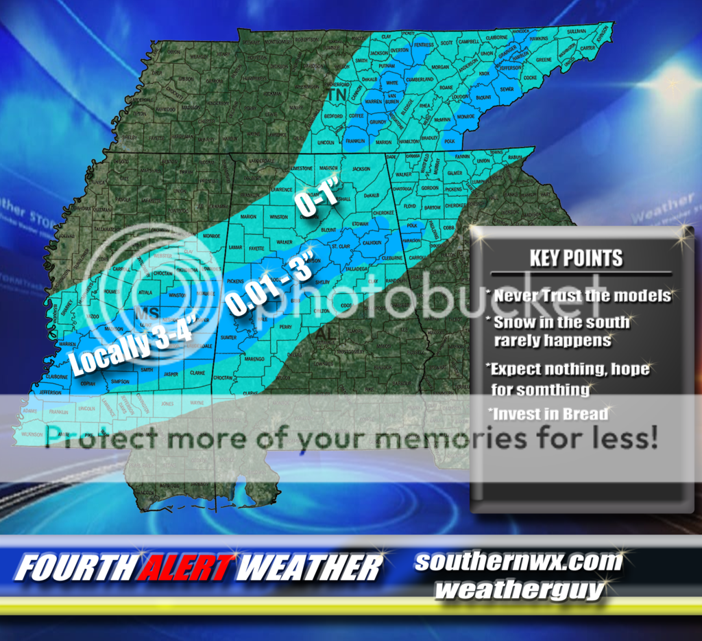
Final forecast

weatherguy
Member
My Final Call