• Hello, please take a minute to check out our awesome content, contributed by the wonderful members of our community. We hope you'll add your own thoughts and opinions by making a free account!

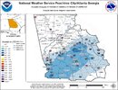
Jan. 17-18, 2026 SE Winter Weather Threat

Area Forecast Discussion
National Weather Service Peachtree City GA
241 PM EST Wed Jan 14 2026

...Afternoon Area Forecast Discussion...

.KEY MESSAGES...
Updated at 229 PM EST Wed Jan 14 2026

- Light snow showers are possible in the mountains between 7 PM
and 5 AM with very limited accumulation potential (trace to
0.5") across the highest elevations of north Georgia.

- Much colder air and gusty winds will bring frigid wind chills
ranging from near 0 to 15 degrees across north Georgia Thursday
morning. A Cold Weather Advisory is in effect for the
mountains of north Georgia.

- Cool temperatures continue through the weekend into early next
week, with mostly dry conditions.

- There is potential for a winter storm system in the region
Saturday night into Sunday, but there is VERY LOW confidence in
the location and severity of impacts, IF ANY, at this time.


.LONG TERM...
(Friday morning through next Tuesday)
Issued at 229 PM EST Wed Jan 14 2026

Potential Weekend Storm System:

Going to start out by addressing the elephant in the room, as
there has been a rather large shift in the ensemble guidance
regarding a system over the weekend, compared to what we were
looking at this time yesterday. Over 40% of this morning`s
ensemble guidance members are now showing a swath of winter
weather (snow or rain/snow mix) across portions of southern and
central GA Saturday night into Sunday morning, with about 20% of
members bringing the winter weather threat up into north GA. This
potential setup is tied to a shortwave trough that will be
tracking through the Southeast US, with the location of the track
and speed and strength of the system determining where winter
weather impacts (if any) would be. Unfortunately for us, this
setup is notorious for poor model agreement overall, as well as
run to run inconsistency. These issues are certainly true this far
in advance (~4 days), but will likely remain an issue until about
24-48hrs out. So, while our current forecast is going with the
majority of ensemble guidance (no winter weather impacts), it is
critical for residents of Georgia to pay attention to the
forecast, as there is potential for a storm system with
significant impacts.

Cold Through Early Next Week:

The aspect of the forecast that we have higher confidence in over
the weekend into early next week is that temperatures will remain
cooler than normal overall, courtesy of broad mid-level troughing
parked over the Eastern US. Lows on Friday morning will be in the
20s, with a bit of warm air briefly filtering in during the day
bringing highs in the upper 40s to low 50s. Another cold front
will approach the area Friday night into Saturday morning,
bringing light rain showers (some snow showers in the north GA
mountains), with another shot of cold air moving in behind it for
the rest of the weekend into early next week. From Saturday night
through Tuesday, overnight lows will generally be in the high
teens to mid 20s in north GA, and low to mid 20s in central GA.
Cold Weather Advisory criteria may be met some of these mornings.
High temps will generally be in the 30s to low 40s in north GA,
and 40s in central GA.
 
My guess is the EPS-AI members are too warm, that's why SN probs outside elevation are <10%. Mean does show a clear signal for a weak coastal. All you can ask for is a chance at this stage, still another ~48hrs to hammer down details, and it could certainly go to crap quickly as we are dependent on subtle changes to trough axis and vorticity mechanics, impossible to nail down even 4 days out, no matter how good computer models have become. The cold however, does appear to be in place and as others have stated, I'd rather take cold and roll my dice on QPF, then vice-versa.
qpf_024h-mean-imp.conus.png
sfcmslp-meanmem.conus.png
 
CAE mention on Sunday

Key Message 4: Potential for a coastal low on Sunday is loaded with
uncertainty.

A digging trough in the central US and then into the northern
Gulf of America will bring the potential for a coastal low as we
move into Sunday. Guidance remains, expectedly, all over the
place with little run to run or internal ensemble consistency.
So all that needs to be said right now is this: lots of
uncertainty remains but this is a fairly good pattern for an
overrunning wintry precip event in eastern GA and SC, with a
developing low in the GoA, and sufficient cold air & moisture in
place. Generally southern snow storms start to come into decent
focus in the models around 72 hours.
 
on Twitter he added "The Reliable" EURO A.I.... look, I get verification scores ect but my god, enough with the glazing of the EURO. Like if its that much better just get rid of the other suites, apparently no one looks at them or cares what they say anyway so why even run them. The issue that makes it annoying though is if roles were reversed and EURO was showing an amped stormy solution they wouldnt post it and then theyd hug the gfs. It is the double standard for me
How long has the euro ai been a thing? I don’t remember any mention of it last year. If it’s a new model then what’s the track record so far? Spann BUSTED the rain forecast last week… said 2-4 inches my area… we got over 7 inches! Based on the fact no one seems to be able to forecast anything these days, I think no one knows what’s going to happen 100% even leading up to the event.
 
How long has the euro ai been a thing? I don’t remember any mention of it last year. If it’s a new model then what’s the track record so far? Spann BUSTED the rain forecast last week… said 2-4 inches my area… we got over 7 inches! Based on the fact no one seems to be able to forecast anything these days, I think no one knows what’s going to happen 100% even leading up to the event.

To be fair, that 7" I believe was localized, and part of a difficult stormy setup to forecast (severe and all).

That said, the Euro AI scores best with anything not thermodynamic. So Spann taking the warm bias as just a sign of nothing more than cold rain is not great.
 
Solid AFD from TAE this afternoon, they did introduce 30% wintry mix probs into the grid Saturday night...

Area Forecast Discussion
National Weather Service Tallahassee FL
256 PM EST Wed Jan 14 2026

Okay, so back to Sunday morning. It`s very much a "thread the needle" kind of event. In other words, wintry mischief is a long shot, but in the words of Lloyd Christmas: So you`re telling me there`s a chance.

Yes. Yes, there is. However, it`s a low (less than 20%) chance at this time. There are a few things working both for and against wintry weather Sunday morning and will chat about what we`ll be watching the next couple of days.

Okay, so what does this event have going for it?

There is a broad H5 trough diving out of Canada Friday night into Saturday. A shortwave will be rotating around the trough on the western side of it, which eventually gets flung eastward as it
rounds the base of the trough Saturday night. This provides ample lift ahead of it, right over our area Saturday night into early Sunday morning. Additionally, we`ll be in the right entrance region
of a stout 100+ knot jet at 200mb over the southeast, further enhancing upper-level lift. A strong cold front rushes southeast through the region early Sunday morning, providing a focal point for lift at the surface. In other words, there`s lots of lift around. We`ll also have a strong 1030+ mb surface high oozing out of Canada and into our area Saturday night into Sunday morning. This is what`s bringing the cold weather, whether it brings wintry weather or not.

What is working against it?

Cold chasing moisture. Precipitation typically outruns the arrival of the cold. Virtually all model and ensemble guidance has rain changing over to snow on the western (or back) side of the
precipitation. In this forecaster`s experience, that usually doesn`t work out so well or typically happens exactly as modeled by global models. We`ll keep an eye on how hi-res guidance starts handling things, but those only go out 48 to 84 hours. We`ll start to get in the range of some of the hi-res guidance tonight.

Another thing working against it are dew points forecast to be well into the 40s and even lower 50s for portions of the area Saturday afternoon. Add in the fact forecast temperatures Saturday afternoon are in the upper 50s and 60s and it`ll be tough to wet bulb, or cool, close to freezing. That said, strong Cold Air Advection (CAA)
arrives Saturday night into Sunday morning. But that goes back to whether the cold can appropriately cool the nearly saturated column
of air before precipitation ends. That`s a big ask in many parts of the country, much less along the Gulf Coast.

Let`s break down a few potential scenarios:

Scenario #1:

The precipitation outruns the cold and we`re stuck with an all rain event. The cold is delayed just long enough to limit any snow accumulation potential.

Scenario #2:

The cold arrives, as advertised, and allows for a sudden change over to wintry weather (read snow). If this scenario were to play out, there`d be a 1 to 3 hour window for snow before quickly exiting to the east Sunday morning. Exact timing would be tricky leading up to the event, much less 3.5-4 days out.

Scenario #3:

The trough is a little more east than forecast and we get a dry frontal passage. That means little to no rain; no wintry weather. Nada. Just cold.

We`ll continue to monitor the potential the next couple of days and adjust the forecast as necessary. Be sure to remain updated with the latest weather forecast and get your weather information from trusted sources.
Clearly the regional conference-call talking points have been disseminated
 
More/less every model run has trended diggier/wetter since yesterday. With the exception of the ukmet.

I expect that will continue tonight. Wouldn’t shock me if the next gfs run is even more amped than 12z.
 
More/less every model run has trended diggier/wetter since yesterday. With the exception of the ukmet.

I expect that will continue tonight. Wouldn’t shock me if the next gfs run is even more amped than 12z.
The Ukmet looked great yesterday, then lost it last night and has started trending back. They're all wobbling on both sides of what will most likely happen and will start to zero in on that in next 48 hrs. As long as none lose it completely either way, lots of folks very much in play for sure
 
Does anyone know if the Verizon tower issues will potentially affect any websites? Just curious if it will affect some of the weather sites, for instance, I'm having issues logging into my pivotal account. Weird I can access it on my phone but not the computer
 
Does anyone know if the Verizon tower issues will potentially affect any websites? Just curious if it will affect some of the weather sites, for instance, I'm having issues logging into my pivotal account. Weird I can access it on my phone but not the computer
I was having trouble with mine earlier on my phone but I don't have Verizon. It was throwing up a 404 error
 
More/less every model run has trended diggier/wetter since yesterday. With the exception of the ukmet.

I expect that will continue tonight. Wouldn’t shock me if the next gfs run is even more amped than 12z.

I'm very happy with how far west and south the vort has gotten. I think it will all come down to where, when, and how much the tilt begins. It almost seems the more west it gets, the more positive the tilt is going to be, but I know more goes into than that. Right now the only model showing a good tilt, amp is the GFS. Not a great place to be for MBY.
 
More/less every model run has trended diggier/wetter since yesterday. With the exception of the ukmet.

I expect that will continue tonight. Wouldn’t shock me if the next gfs run is even more amped than 12z.

The 18Z 1/17/25 Euro run’s precip shield for 1/21-2/25 was much too far SE and it corrected a lot the next day and this made it much wetter in much of the SE:
IMG_7097.png
 
Energy on 18z Nam way more consolidated than it's 12z run

Tilt is shade more posotive at 78 verse 12z. NVM actually started to look pretty good last frame. Maybe tommorrow we can get nam'd


1768423497776.png


1768423551545.png
 
Last edited:
End of NAM
0b58739f8a6d57febc8191c2e11a3cec.jpg


Sent from my iPhone using Tapatalk
 
1 thing I would caution anyone using the NAM is, it's okay to use it's H5 depictions to see if it's in a realm of other guidance, but please don't look at it's surface map. The NAM has been absolutely awful with being too dry in the long range.
 
Back
Top