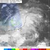
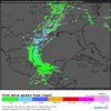
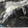
It just got designated. Some of the models are developing this in the Bay of Campeche.
-
Hello, please take a minute to check out our awesome content, contributed by the wonderful members of our community. We hope you'll add your own thoughts and opinions by making a free account!
You are using an out of date browser. It may not display this or other websites correctly.
You should upgrade or use an alternative browser.
You should upgrade or use an alternative browser.
Tropical Invest 91L
- Thread starter Snowfan
- Start date
Brent
Member
Brent
Member
Tropical Weather Outlook
NWS National Hurricane Center Miami FL
200 AM EDT Sat Jun 1 2019
For the North Atlantic...Caribbean Sea and the Gulf of Mexico:
1. A broad area of low pressure accompanied by cloudiness and showers
is centered near the west coast of the Yucatan Peninsula. The low
is forecast to move westward to west-northwestward over the southern
Bay of Campeche during the weekend and near the east coast of Mexico
early next week. Gradual development of this system is possible as
long as it remains over water, and a tropical depression could form
early next week. Regardless of development, the disturbance will
likely produce heavy rainfall over portions of southern and
southeastern Mexico during the next few days.
* Formation chance through 48 hours...low...30 percent.
* Formation chance through 5 days...medium...40 percent.
000
ABNT20 KNHC 011132
TWOAT
Tropical Weather Outlook
NWS National Hurricane Center Miami FL
800 AM EDT Sat Jun 1 2019
For the North Atlantic...Caribbean Sea and the Gulf of Mexico:
A broad area of low pressure located over the southern Bay of
Campeche is producing disorganized showers and thunderstorms. The
low is forecast to move westward to west-northwestward across the
southern Bay of Campeche toward the east coast of Mexico during the
next few days. If the system remains over water, a tropical
depression could form before it moves inland early next week.
Regardless of development, the disturbance will likely produce heavy
rainfall over portions of southern and southeastern Mexico during
the next few days.
* Formation chance through 48 hours...medium...40 percent.
* Formation chance through 5 days...medium...50 percent.
accu35
Member
Not saying it will happen, but the CMC and Icon is further north.
New ICON has it not that far north.
GFS does not form anything.
NBAcentel
Member
Lol I quoted the wrong person ?
NBAcentel
Member
GFS does not form anything.
No, but it slings the tropical moisture into the SE, with high PWATs, this would likely increase shower/T-storms across much of the SE, high PWATs and t-storms can create such big amounts of rain
Brent
Member
Tropical Weather Outlook
NWS National Hurricane Center Miami FL
200 PM EDT Sat Jun 1 2019
For the North Atlantic...Caribbean Sea and the Gulf of Mexico:
Recent satellite data indicate that circulation of a low pressure
system located over the southern Bay of Campeche has become a little
better defined today. However, the associated showers and
thunderstorms remain disorganized. This system is expected to move
slowly west-northwestward toward the coast of Mexico, and it could
become a tropical cyclone before it moves inland early next week.
Regardless of development, the disturbance will likely produce heavy
rainfall over portions of southern and eastern Mexico during the
next few days. An Air Force Reserve reconnaissance aircraft is
scheduled to investigate the disturbance on Sunday, if necessary.
Interests along the Gulf coast of Mexico should monitor the progress
of this system.
* Formation chance through 48 hours...medium...60 percent.
* Formation chance through 5 days...medium...60 percent.
$$
Brent
Member
Yeah, the rich get richer, or the flooded get more flooded! Wish we could get some of that in the desert SE!
NBAcentel
Member
Yeah, the rich get richer, or the flooded get more flooded! Wish we could get some of that in the desert SE!
That would get caught up in the flow into the SE, well the best moisture would anyways since the right quadrant of TCs always have the best synoptic scale forcing for ascent
That was my post before it was removedThat would get caught up in the flow into the SE, well the best moisture would anyways since the right quadrant of TCs always have the best synoptic scale forcing for ascent
NBAcentel
Member
That was my post before it was removed
Huh ? Why was it removed ?
NBAcentel
Member
That was my post before it was removed
And what do you mean by “that was my post”
769
ABNT20 KNHC 012334
TWOAT
Tropical Weather Outlook
NWS National Hurricane Center Miami FL
800 PM EDT Sat Jun 1 2019
For the North Atlantic...Caribbean Sea and the Gulf of Mexico:
A low pressure system located over the southern Bay of Campeche
continues to produce disorganized shower and thunderstorm activity.
This system is expected to move slowly west-northwestward toward the
coast of Mexico, and it could become a tropical cyclone before it
moves inland early next week. Regardless of development, the
disturbance will likely produce heavy rainfall over portions of
southern and eastern Mexico during the next few days. An Air Force
Reserve reconnaissance aircraft is scheduled to investigate the
disturbance on Sunday, if necessary. Interests along the Gulf coast
of Mexico should monitor the progress of this system.
* Formation chance through 48 hours...medium...60 percent.
* Formation chance through 5 days...medium...60 percent.
$$
Forecaster Beven
Brent
Member
That would get caught up in the flow into the SE, well the best moisture would anyways since the right quadrant of TCs always have the best synoptic scale forcing for ascent
Yeah i wouldnt expect much here if it did track into Louisiana the east side will always be favored
Now how far east remains to be seen of course but at the least it would increase the diurnal storms
ForsythSnow
Moderator
From what the early model runs are saying, looks like this may be a good shot at rain for a lot of us who have not had any in weeks.
pcbjr
Member
Brent
Member
000
ABNT20 KNHC 021117
TWOAT
Tropical Weather Outlook
NWS National Hurricane Center Miami FL
800 AM EDT Sun Jun 2 2019
For the North Atlantic...Caribbean Sea and the Gulf of Mexico:
A low pressure system located over the southern Bay of Campeche has
changed little in organization since yesterday. This system is
expected to move slowly northwestward toward the coast of Mexico,
and it could become a tropical cyclone before it moves inland in a
day or two. Regardless of development, the disturbance will likely
produce heavy rainfall over portions of southern and eastern Mexico
during the next few days. An Air Force Reserve reconnaissance
aircraft is scheduled to investigate the disturbance later today, if
necessary. Interests along the Gulf coast of Mexico should monitor
the progress of this system.
* Formation chance through 48 hours...medium...60 percent.
* Formation chance through 5 days...medium...60 percent.
Recon was cancelled today but there are two more missions scheduled.
SUSPECT AREA (BAY OF CAMPECHE)
FLIGHT ONE - TEAL 72 FLIGHT TWO - TEAL 75
A. 03/1830Z A. 04/0530Z,1130Z
B. AFXXX 01BBA INVEST B. AFXXX 0202A CYCLONE
C. 03/1530Z C. 04/0215Z
D. 20.0N 95.0W D. 21.0N 96.5W
E. 03/1800Z TO 03/2300Z E. 04/0500Z TO 04/1130Z
F. SFC TO 10,000 FT F. SFC TO 10,000 FT
2. OUTLOOK FOR SUCCEEDING DAY: CONTINUE 6-HRLY FIXES IF SYSTEM
DEVELOPS AND REMAINS A THREAT.
3. REMARK: THE MISSIONS TASKED IN TCPOD 19-004 WERE CANCELED BY
NHC AT 02/1240Z
pcbjr
Member
Loop is too big to post ...
Static ...

Loop (time sensitive) ... https://www.star.nesdis.noaa.gov/GOES/conus_band.php?sat=G16&band=GEOCOLOR&length=12
Static ...

Loop (time sensitive) ... https://www.star.nesdis.noaa.gov/GOES/conus_band.php?sat=G16&band=GEOCOLOR&length=12
EURO really washes this system out over the Mississippi River areas that don’t need rain. Sounds about right. Dry and hot east in Florida.
000
ABNT20 KNHC 021717
TWOAT
Tropical Weather Outlook
NWS National Hurricane Center Miami FL
200 PM EDT Sun Jun 2 2019
For the North Atlantic...Caribbean Sea and the Gulf of Mexico:
A broad area of low pressure is producing disorganized showers and
thunderstorms over the Bay of Campeche. This system is expected to
move slowly northwestward toward the coast of Mexico, and it could
become a tropical cyclone before it moves inland in a day or two.
Regardless of development, the disturbance will likely produce heavy
rainfall over portions of southern and eastern Mexico during the
next few days. An Air Force Reserve reconnaissance mission scheduled
for this afternoon has been canceled, however another aircraft will
investigate the disturbance tomorrow afternoon, if necessary.
Interests along the Gulf coast of Mexico should monitor the progress
of this system.
* Formation chance through 48 hours...medium...60 percent.
* Formation chance through 5 days...medium...60 percent.
$$
Forecaster Zelinsk
000
ABNT20 KNHC 022307
TWOAT
Tropical Weather Outlook
NWS National Hurricane Center Miami FL
800 PM EDT Sun Jun 2 2019
For the North Atlantic...Caribbean Sea and the Gulf of Mexico:
Showers and thunderstorms associated with a broad area of low
pressure over the Bay of Campeche remain disorganized. This system
is expected to move slowly northwestward toward the coast of Mexico,
and may become a tropical cyclone before it moves inland in a day or
two. Regardless of development, the disturbance will likely produce
heavy rainfall over portions of southern and eastern Mexico during
the next few days. An Air Force Reserve reconnaissance aircraft will
investigate the disturbance Monday afternoon, if necessary.
Interests along the Gulf coast of Mexico should monitor the progress
of this system.
* Formation chance through 48 hours...medium...60 percent.
* Formation chance through 5 days...medium...60 percent.
$$
Forecaster Latto/Beven
Brent
Member
000
ABNT20 KNHC 031138
TWOAT
Tropical Weather Outlook
NWS National Hurricane Center Miami FL
800 AM EDT Mon Jun 3 2019
For the North Atlantic...Caribbean Sea and the Gulf of Mexico:
A broad area of low pressure is producing disorganized shower and
thunderstorm activity over the Bay of Campeche. This system is
expected to move slowly northwestward toward the northeastern coast
of Mexico, and could become a tropical cyclone before it moves
inland in a day or two. Regardless of development, the disturbance
will likely produce heavy rainfall over portions of southern and
eastern Mexico during the next few days. An Air Force Reserve
reconnaissance aircraft will investigate the disturbance this
afternoon, if necessary. Interests along the Gulf coast of Mexico
should monitor the progress of this system.
* Formation chance through 48 hours...medium...60 percent.
* Formation chance through 5 days...medium...60 percent.
accu35
Member
Man, my area could use the rain. I'm hoping for a bend
Recon has been cancelled for today.
000
NOUS42 KNHC 031417
REPRPD
WEATHER RECONNAISSANCE FLIGHTS
CARCAH, NATIONAL HURRICANE CENTER, MIAMI, FL.
1015 AM EDT MON 03 JUNE 2019
SUBJECT: TROPICAL CYCLONE PLAN OF THE DAY (TCPOD)
VALID 04/1100Z TO 05/1100Z JUNE 2019
TCPOD NUMBER.....19-006
I. ATLANTIC REQUIREMENTS
1. SUSPECT AREA (BAY OF CAMPECHE)
FLIGHT ONE - TEAL 72 FLIGHT TWO - TEAL 75
A. 04/1900Z A. 05/0530Z,1130Z
B. AFXXX 01BBA INVEST B. AFXXX 0202A CYCLONE
C. 04/1545Z C. 05/0230Z
D. 23.0N 96.5W D. 24.5N 97.0W
E. 04/1830Z TO 04/2330Z E. 05/0500Z TO 05/1130Z
F. SFC TO 10,000 FT F. SFC TO 10,000 FT
2. OUTLOOK FOR SUCCEEDING DAY: CONTINUE 6-HRLY FIXES IF SYSTEM
DEVELOPS AND REMAINS A THREAT.
3. REMARK: THE MISSIONS TASKED IN TCPOD 19-005 WERE CANCELED BY
NHC AT 03/1215Z.
000
ABNT20 KNHC 031727
TWOAT
Tropical Weather Outlook
NWS National Hurricane Center Miami FL
200 PM EDT Mon Jun 3 2019
For the North Atlantic...Caribbean Sea and the Gulf of Mexico:
Showers and thunderstorms associated with a broad area of low
pressure located over the Bay of Campeche have become a little
better organized since yesterday. However, recent satellite-based
wind data indicate that the circulation of the low is elongated and
poorly defined. This system is expected to move slowly northwestward
toward the northeastern coast of Mexico, and could become a tropical
cyclone before it moves inland in a day or two. Regardless of
development, the disturbance will likely produce heavy rainfall over
portions of southern and eastern Mexico during the next few days.
Heavy rainfall is also likely to spread over southeastern Texas and
Louisiana through Thursday. The Air Force Reserve reconnaissance
mission for this afternoon has been canceled, however another
aircraft has been scheduled to investigate the disturbance tomorrow,
if necessary. Interests along the Gulf coast of Mexico should
monitor the progress of this system.
* Formation chance through 48 hours...medium...60 percent.
* Formation chance through 5 days...medium...60 percent.
$$
Forecaster Zelinsky
000
ABNT20 KNHC 032322
TWOAT
Tropical Weather Outlook
NWS National Hurricane Center Miami FL
800 PM EDT Mon Jun 3 2019
For the North Atlantic...Caribbean Sea and the Gulf of Mexico:
Showers and thunderstorms associated with a broad area of low
pressure located over the Bay of Campeche have changed little in
organization during the last several hours. This system is expected
to move slowly northwestward toward the northeastern coast of
Mexico, and it could become a tropical cyclone before moving inland
in about a day. Regardless of development, the disturbance will
likely produce heavy rainfall over portions of southern and eastern
Mexico during the next few days. Heavy rainfall is also likely to
spread over southeastern Texas and Louisiana through Thursday. An
Air Force Reserve reconnaissance aircraft is scheduled to
investigate the disturbance tomorrow, if necessary. Interests along
the Gulf coast of Mexico should monitor the progress of this system.
* Formation chance through 48 hours...medium...60 percent.
* Formation chance through 5 days...medium...60 percent.
$$
Forecaster Beven
Brent
Member
Brent
Member
Chances for development have dropped for the first time
Showers and thunderstorms associated with a broad area of low
pressure located over southwestern Gulf of Mexico are currently
disorganized. This system is expected to move slowly northwestward
toward the northeastern coast of Mexico, and it could become a
tropical cyclone before moving inland later today or tonight.
Regardless of development, the disturbance will likely produce heavy
rainfall over portions of southern and eastern Mexico during the
next few days. Heavy rainfall is also likely to spread over
southeastern Texas and Louisiana through Thursday. An Air Force
Reserve reconnaissance aircraft is scheduled to investigate the
disturbance later today, if necessary. Interests along the Gulf
coast of Mexico should monitor the progress of this system.
* Formation chance through 48 hours...medium...50 percent.
* Formation chance through 5 days...medium...50 percent.
NBAcentel
Member
Brent
Member
Looks like the Barry search will be continuing
The chances have decreased to 20/20.
Brent
Member
0/0
Next on the tropical potential anyway
Next on the tropical potential anyway
Brent
Member


