• Hello, please take a minute to check out our awesome content, contributed by the wonderful members of our community. We hope you'll add your own thoughts and opinions by making a free account!

Tropical TD2

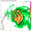
Satellite imagery appears to suggest two competing circulations with the broader weak circulation. One is likely an MLC, near 28N and 83W, and the other near 25.5N and 84.5W. Again, just eyeballing visible imagery.

Should this system consolidate farther south than previously thought, that would make things far more interesting.
 
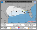
The 12Z UKMET was the 4th full run (full runs are at 0Z/12Z) that developed this into a mainly W moving full fledged TS. The last 2 runs developed it into a TD by early tomorrow morning! Landfall near TX/LA border:

NEW TROPICAL CYCLONE FORECAST TO DEVELOP AFTER 18 HOURS

FORECAST POSITION AT T+ 18 : 27.1N 84.9W


LEAD CENTRAL MAXIMUM WIND

VERIFYING TIME TIME POSITION PRESSURE (MB) SPEED (KNOTS)

-------------- ---- -------- ------------- -------------

1200UTC 19.07.2026 24 27.5N 84.9W 1010 25

0000UTC 20.07.2026 36 28.1N 85.2W 1006 28

1200UTC 20.07.2026 48 28.2N 86.0W 1004 30

0000UTC 21.07.2026 60 28.1N 86.1W 1002 33

1200UTC 21.07.2026 72 28.4N 86.1W 1000 38

0000UTC 22.07.2026 84 29.2N 86.2W 997 50

1200UTC 22.07.2026 96 29.6N 86.9W 998 51

0000UTC 23.07.2026 108 29.3N 87.8W 996 52

1200UTC 23.07.2026 120 28.9N 88.8W 999 44

0000UTC 24.07.2026 132 28.7N 90.0W 999 40

1200UTC 24.07.2026 144 29.0N 92.0W 1001 36

0000UTC 25.07.2026 156 29.3N 94.2W 1004 37

1200UTC 25.07.2026 168 CEASED TRACKING
 
Last edited:
0Z UKMET: 5th run in a row with a TD, which it has forming today, and a TS, which it has upgraded to Mon night, but doesn’t get as strong as prior 2 runs; mainly WNW movement to SE LA Wed night

NEW TROPICAL CYCLONE FORECAST TO DEVELOP AFTER 12 HOURS
FORECAST POSITION AT T+ 12 : 27.4N 85.2W

LEAD CENTRAL MAXIMUM WIND
VERIFYING TIME TIME POSITION PRESSURE (MB) SPEED (KNOTS)
-------------- ---- -------- ------------- -------------
1200UTC 19.07.2026 12 27.4N 85.2W 1011 23
0000UTC 20.07.2026 24 28.0N 85.1W 1008 25
1200UTC 20.07.2026 36 27.7N 85.5W 1007 27
0000UTC 21.07.2026 48 28.0N 85.4W 1005 31
1200UTC 21.07.2026 60 28.6N 86.1W 1004 36
0000UTC 22.07.2026 72 28.9N 86.6W 1004 38
1200UTC 22.07.2026 84 29.7N 88.3W 1004 46
0000UTC 23.07.2026 96 28.9N 89.5W 1006 36
1200UTC 23.07.2026 108 29.4N 90.7W 1009 35
0000UTC 24.07.2026 120 CEASED TRACKING
 
Last edited:
Northern Gulf of America and near Florida (AL91):
Recent satellite-wind data and nearby surface observations indicate
that an area of low pressure located over the northeastern Gulf of
America is slowly becoming better defined. However, its associated
shower and thunderstorm activity remains disorganized. Regardless,
gradual development of this system is forecast, and a tropical
depression could form over the next couple of days as the system
moves slowly northward or northwestward. Interests along the
northern Gulf coast from Florida, Alabama, Mississippi, to Louisiana
should monitor the progress of this system as it is expected to
bring heavy rain to portions of that region during the next several
days. An Air Force Reserve reconnaissance aircraft is scheduled to
investigate the system later today, if necessary.

* Formation chance through 48 hours...medium...60 percent.
* Formation chance through 7 days...medium...60 percent.
 
Tropical Weather Outlook
NWS National Hurricane Center Miami FL
800 AM EDT Sun Jul 19 2026

For the North Atlantic...Caribbean Sea and the Gulf of America:

Northern Gulf of America and near Florida (AL91):
An area of low pressure located over the northeastern Gulf of
America continues to become better defined and the associated shower
and thunderstorm activity is gradually increasing. Continued
gradual development is expected, and a tropical depression is likely
to form later today or on Monday as the system moves slowly
northward or northwestward. Interests along the northern Gulf coast
from Florida, Alabama, Mississippi, and Louisiana should monitor
the progress of this system, as tropical storm watches or warnings
could be required for portions of the area later today. In
addition, this system is expected to bring heavy rains to portions
of the northern Gulf coast during the next several days. An Air
Force Reserve reconnaissance aircraft is scheduled to investigate
the low pressure area later today.
* Formation chance through 48 hours...high...80 percent.
* Formation chance through 7 days...high...80 percent.

$$
Forecaster Cangialosi
 
As Levi pointed out in his 91L update yesterday, the stronger the system manages to get, the further west it should move as the steering influence of the 500MB high currently located in the Southern Great Plains becomes dominant rather than the southerly surface flow from the Bermuda high.

The system does seem to be developing rather steadily, implying that a more westerly motion, giving the system more time over water, is now favored.

The latter is my take.
 
Should NC be worried? Probably not.
But I think the SLGT risk is warranted. 😠
 
As Levi pointed out in his 91L update yesterday, the stronger the system manages to get, the further west it should move as the steering influence of the 500MB high currently located in the Southern Great Plains becomes dominant rather than the southerly surface flow from the Bermuda high.

The system does seem to be developing rather steadily, implying that a more westerly motion, giving the system more time over water, is now favored.

The latter is my take.
Keep it to the west. I am sitting on the beach in North Myrtle this week.
 
Back
Top