486
WTNT34 KNHC 022045
TCPAT4
BULLETIN
Tropical Storm Isaias Advisory Number 23
NWS National Hurricane Center Miami FL AL092020
500 PM EDT Sun Aug 02 2020
...ISAIAS STRENGTHENS SLIGHTLY WHILE MOVING NORTH-NORTHWESTWARD JUST
OFFSHORE THE EAST-CENTRAL FLORIDA COAST...
...HURRICANE WATCH AND STORM SURGE WARNING ISSUED FOR PORTIONS OF
THE CAROLINAS...
SUMMARY OF 500 PM EDT...2100 UTC...INFORMATION
----------------------------------------------
LOCATION...27.8N 79.8W
ABOUT 65 MI...105 KM SE OF CAPE CANAVERAL FLORIDA
ABOUT 410 MI...660 KM S OF MYRTLE BEACH SOUTH CAROLINA
MAXIMUM SUSTAINED WINDS...70 MPH...110 KM/H
PRESENT MOVEMENT...NNW OR 345 DEGREES AT 9 MPH...15 KM/H
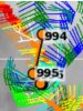
MINIMUM CENTRAL PRESSURE...994 MB...29.36 INCHES
WATCHES AND WARNINGS
--------------------
CHANGES WITH THIS ADVISORY:
A Storm Surge Warning is in effect from Edisto Beach South Carolina
to Cape Fear North Carolina.
A Storm Surge Watch is in effect from Cape Fear to Duck North
Carolina, including Pamlico and Albemarle Sounds.
A Hurricane Watch is in effect from South Santee River South
Carolina to Surf City North Carolina.
The Tropical Storm Warning has been extended northward to Ocracoke
Inlet North Carolina.
The Tropical Storm Watch has been extended northward to Watch Hill
Rhode Island, including the Chesapeake Bay, the Tidal Potomac
River, Delaware Bay, Long Island and Long Island Sound.
The Tropical Storm Warning has been discontinued south of Sebastian
Inlet Florida.
SUMMARY OF WATCHES AND WARNINGS IN EFFECT:
A Storm Surge Warning is in effect for...
* Edisto Beach South Carolina to Cape Fear North Carolina
A Storm Surge Watch is in effect for...
* Cape Fear to Duck North Carolina
* Pamlico and Albemarle Sounds
A Hurricane Watch is in effect for...
* South Santee River South Carolina to Surf City North Carolina
A Tropical Storm Warning is in effect for...
* Sebastian Inlet Florida to Ocracoke Inlet North Carolina
A Tropical Storm Watch is in effect for...
* Ocracoke Inlet North Carolina to Watch Hill Rhode Island
* Pamlico and Albemarle Sounds
* Chesapeake Bay
* Tidal Potomac River
* Delaware Bay
* Long Island and Long Island Sound
Interests elsewhere along the northeast coast of the United States
should monitor the progress of Isaias. Additional watches or
warnings may be required tonight or early Monday.
A Storm Surge Warning means there is a danger of life-threatening
inundation, from rising water moving inland from the coastline,
during the next 36 hours in the indicated locations. For a depiction
of areas at risk, please see the National Weather Service Storm
Surge Watch/Warning Graphic at hurricanes.gov. This is a
life-threatening situation. Persons located within these areas
should take all necessary actions to protect life and property from
rising water and the potential for other dangerous conditions.
Promptly follow evacuation and other instructions from local
officials.
A Storm Surge Watch means there is a possibility of life-
threatening inundation, from rising water moving inland from the
coastline, in the indicated locations during the next 48 hours.
A Hurricane Watch means that hurricane conditions are possible
within the watch area. A watch is typically issued 48 hours
before the anticipated first occurrence of tropical-storm-force
winds, conditions that make outside preparations difficult or
dangerous.
A Tropical Storm Warning means that tropical storm conditions are
expected somewhere within the warning area, generally within 36
hours.
A Tropical Storm Watch means that tropical storm conditions are
possible within the watch area, generally within 48 hours.
For storm information specific to your area in the United
States, including possible inland watches and warnings, please
monitor products issued by your local National Weather Service
forecast office. For storm information specific to your area
outside of the United States, please monitor products issued by
your national meteorological service.