• Hello, please take a minute to check out our awesome content, contributed by the wonderful members of our community. We hope you'll add your own thoughts and opinions by making a free account!

Tropical Major Hurricane Erin

0Z UKMET shifted a bit E with recurve at 69.6W (vs 71.9W on 12Z) meaning passing by closer to Bermuda:

TROPICAL STORM ERIN ANALYSED POSITION : 17.1N 51.9W

ATCF IDENTIFIER : AL052025

LEAD CENTRAL MAXIMUM WIND
VERIFYING TIME TIME POSITION PRESSURE (MB) SPEED (KNOTS)
-------------- ---- -------- ------------- -------------
0000UTC 15.08.2025 0 17.1N 51.9W 1004 34
1200UTC 15.08.2025 12 18.0N 55.1W 1003 37
0000UTC 16.08.2025 24 19.5N 58.1W 1001 39
1200UTC 16.08.2025 36 20.3N 61.6W 999 41
0000UTC 17.08.2025 48 20.8N 64.4W 996 40
1200UTC 17.08.2025 60 21.4N 66.5W 992 46
0000UTC 18.08.2025 72 22.5N 67.7W 989 48
1200UTC 18.08.2025 84 24.1N 68.7W 987 50
0000UTC 19.08.2025 96 25.9N 69.2W 985 52
1200UTC 19.08.2025 108 27.5N 69.4W 983 57
0000UTC 20.08.2025 120 29.4N 69.6W 979 60
1200UTC 20.08.2025 132 31.7N 68.7W 971 64
0000UTC 21.08.2025 144 33.8N 67.2W 964 70
1200UTC 21.08.2025 156 35.8N 64.0W 960 73
0000UTC 22.08.2025 168 37.6N 59.0W 954 75
 
Damn.....appears to be the worst case of all the models. But has been consistent run to run.

5am NHC still indicating possible higher peak than forecasted (cat 4/5) and "nudged slightly west" with uncertainty for US.

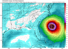
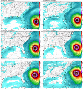
icon_mslp_wind_seus_47.png

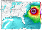
icon_mslp_wind_seus_52.png
 
Last edited:
Most guidance on Erin has been slowly nudging her west during the past 24 hours. I still think the incoming trough that will be arriving as she approaches the East Coast will keep her from making a landfall in the United States. This will be a closer shave than earlier model prognostications were showing and the NC Coast will feel some of the effects in the form of tropical storm force winds, rough seas and dangerous rip currents.
 
Most guidance on Erin has been slowly nudging her west during the past 24 hours. I still think the incoming trough that will be arriving as she approaches the East Coast will keep her from making a landfall in the United States. This will be a closer shave than earlier model prognostications were showing and the NC Coast will feel some of the effects in the form of tropical storm force winds, rough seas and dangerous rip currents.
That’s why I was trying to say yesterday to keep an open idea to track guidance. I hope it splits between Hatteras and Bermuda but at a week out there is always room for changes. I get annoyed by people speaking in absolutes over a week out!
 
Most likely scenario still is OTS, imo. You can never say never with the tropics, and it's unwise to cancel the storm, but the overwhelming majority of the guidance, both operationals and ensembles are comfortably east of the US. And the pattern the looks to be in place is supportive as well.

Stranger things have happened, but it's going to be a monumental bust if this thing somehow plows into the US.
It would take a florence-esgue change in the pattern to change this from a fish storm. Would be a tall order to fill to make that change here.
 
Beach erosion would be off the charts from Oregon Inlet to Duck

ICON
18z. 904 low
Last 3 runs were in the 910s
3 runs before that in the 920s.
Dang....that's called a trend I think....

NHC 5 pm:
"It is also expected that Erin will become very large and
powerful hurricane by the end of the forecast period in the
southwestern Atlantic, and the current forecast wind radii at 96-120
h may not be large enough."

96H 19/1800Z 27.9N 70.6W 120 KT 140 MPH
120H 20/1800Z 32.2N 69.7W 115 KT 130 MPH
 
Last edited:


NHC 5am. It's now a cat3 hurricane.
NHC says cat4 by Saturday night.

It's intensifying faster than the any of the models now. Hurricane Hunters going back in it later this morning.

Middle of next week, forecast to double or triple in size.

Confidence continues to increase
that the core of Erin will pass to the east of the Bahamas and the
United States.
 
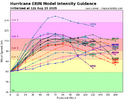
None of the models have this thing at a cat4, heck maybe a cat5, before the turn. Can that nudge it west or south?
 
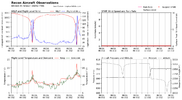
...NOAA HURRICANE HUNTERS FIND ERIN A DANGEROUS CATEGORY 4
HURRICANE...

The NOAA Hurricane Hunters are currently investigating Erin and on
the first pass through the hurricane they found that maximum
sustained winds have increased to 130 mph (215 km/h) with higher
gusts. This makes Erin a Category 4 hurricane on the
Saffir-Simpson Hurricane Wind Scale. The minimum pressure has
fallen to 948 mb (27.99 inches). The next intermediate advisory
will be issued at 800 AM AST (1
200 UTC).
 
The NHC still has Erin getting no farther west than around 70 degrees longitude which will give the East Coast a little breathing room. She has really intensified and even though it will remain a safe distance off the coast for most of us her large size and strength is still going to cause issues along the beaches with rough seas, beach erosion, dangerous rip currents and maybe even tropical storm force winds if the wind shield gets large enough.
 
Just ridiculous. No model had this right now

Remember that the next time your favorite model shows nothing

Reports from NOAA and Air Force Reserve Hurricane Hunter aircraft
indicate that maximum sustained winds have increased to near
145 mph (230 km/h) with higher gusts.
 
Intensity forecasting sucks in general, also it seems like every storm with even a half way decent environment goes nuclear the last several years...
 
Just ridiculous. No model had this right now

Remember that the next time your favorite model shows nothing

Reports from NOAA and Air Force Reserve Hurricane Hunter aircraft
indicate that maximum sustained winds have increased to near
145 mph (230 km/h) with higher gusts.

Yeah, I'm concerned. My inner cynic is kicking in. Not one model has a cat4 at 8am on Saturday. So we are flying by the seat of our pants hoping the thing follows an arbitrary path that has no assumption correct. Just crazy.
Is it possible that it stays west or south just long enough to change that curve? Million dollar question.

Even ICON who has it going nuclear missed the timing. It has it nuclear after the turn. Still showing the low pressure of 909 at 30N.
 
Back
Top