• Hello, please take a minute to check out our awesome content, contributed by the wonderful members of our community. We hope you'll add your own thoughts and opinions by making a free account!

Feb 26-29 snow showers/clippers

accu35

Member
Joined
Jan 5, 2017
Messages
8,387
Reaction score
9,836
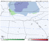
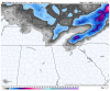
Heck,why not? Folks in the northern areas of MS/AL/GA has a good possibility of seeing snow showers with these clipper systems that will push through towards end of the week through the weekend. Some of the higher resolution models do have snow showers breaking out further south. Post away if you want.
GEFSSE_prec_meansnacc_108.png
 
I can't believe the TN forums show no sign of a pulse with these clipper snow prospects this week. I realize they're not going to produce winter storm 2020, but I think we stand a chance to pick up a dusting to 1/2 inch even at BNA.
Mountains will do really good as well
 
This is the time period from Wednesday- Saturday. I change locations, I'm now gonna stay in Blairsville GA. I've been watching the models and Blairsville will do better this week than Clayton.
gem_asnow_seus_15.png
 
GEFSSE_prec_meansnacc_090.png
Nice increase with the mean for north GA.
 
Let’s go. Trynna get hype for at least a good shower or two


Sent from my iPhone using Tapatalk
This isn't a big deal thread I made, but there is good chances for snow showers and minor accumulation towards Al/GA mountains and possibly flurries outside the mountains. Honestly, I wouldn't made this thread if I wasn't going up there.
 
This isn't a big deal thread I made, but there is good chances for snow showers and minor accumulation towards Al/GA mountains and possibly flurries outside the mountains. Honestly, I wouldn't made this thread if I wasn't going uo there.

I know. I’m just trying to hype myself up over seeing a shower rather than be disappointed


Sent from my iPhone using Tapatalk
 
I can't believe the TN forums show no sign of a pulse with these clipper snow prospects this week. I realize they're not going to produce winter storm 2020, but I think we stand a chance to pick up a dusting to 1/2 inch even at BNA.
NAM looks better for northern Middle Tennessee. The Friday system came in looking a little juicer.
 

Attachments

  • D48E9451-DBCE-4FEF-85C3-7CE38701CDDC.png
    D48E9451-DBCE-4FEF-85C3-7CE38701CDDC.png
    117 KB · Views: 50
  • 7308E7B1-35C6-4B81-84A1-9A1B34B9864D.png
    7308E7B1-35C6-4B81-84A1-9A1B34B9864D.png
    117.3 KB · Views: 50
This model here has some "heavy" snow showers to it.
wrf-nmm_ref_frzn_seus_29.png
 
This is the time period from Wednesday- Saturday. I change locations, I'm now gonna stay in Blairsville GA. I've been watching the models and Blairsville will do better this week than Clayton.
gem_asnow_seus_15.png
For some real action looks like you need to hike up to Mt. LeConte
 
Made it up here in Blairsville Ga for work, but staying in Murphy NC which is 30 min drive north of Blairsville.
 
Back
Top