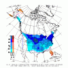
From Radiant this morning about the anomalously strong Plains storm that is similar to the one from a few weeks ago and its projected major impacts:
“Powerful April Storm Impacts Mid-Continent
Just a few weeks removed from a record-breaking March cyclone that brought damaging winds and heavy rain/snow to the mid-continent, another anomalously strong storm will impact many of the same regions in the next few days. Low pressure will deepen in the lee of the Rockies tonight and continue to strengthen as it tracks into the Plains tomorrow before slowly lifting northeastward through the western Midwest at the end of the week. With a central pressure down to ~980 mb at its peak, the storm may challenge April record low sea level pressure for parts of the central Plains. This storm will bring a variety of impacts to a large portion of the US, including widespread strong winds particularly in the High Plains, flooding rains in areas of the Mid-South and Midwest, and heavy snowfall from the central Rockies to the northern/central Plains and upper Midwest. In fact, Minneapolis could challenge its all-time April snowfall record of 15.8” set just last year, and places in South Dakota could even reach 2’+! The snow cover left in its wake may lend to some colder risks to forecasts in the north-central US late this week into early next week, although beyond that point the risk may be that models (particularly the Euro) could hold on to that bias for too long. Winds will gust as high as 50-70 mph across the Texas Panhandle/West Texas tomorrow....”


