Tropical
-
Hello, please take a minute to check out our awesome content, contributed by the wonderful members of our community. We hope you'll add your own thoughts and opinions by making a free account!
You are using an out of date browser. It may not display this or other websites correctly.
You should upgrade or use an alternative browser.
You should upgrade or use an alternative browser.
Tropical TS Erin
- Thread starter SD
- Start date
lexxnchloe
Member
lexxnchloe
Member
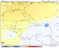
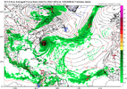
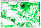
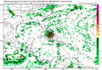
The 12Z CMC, like its recent runs, is significantly further S than other models at 171 (just ENE of PR) with it again much weaker than other models at 1003 mb. It isn’t recurving as it is underneath an extensive H5 ridge:
View attachment 174050
Edit: ends up near Andros I. moving NW toward FL.
lexxnchloe
Member
GeorgiaGirl
Member
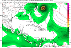
GEFS is still rolling, but from what I can tell, it has a weaker system so far compared to the most recent runs as the mean.
Edit: Also seems as if it's conflicted on the idea of what happens. There's one batch that's further southeast and another batch that's further northwest and more consolidated at just west of 60W.
Edit2: Looks like the mean is going to recurve, don't feel like continuing the run.
Edit: Also seems as if it's conflicted on the idea of what happens. There's one batch that's further southeast and another batch that's further northwest and more consolidated at just west of 60W.
Edit2: Looks like the mean is going to recurve, don't feel like continuing the run.
Last edited:
lexxnchloe
Member
GEFS is still rolling, but from what I can tell, it has a weaker system so far compared to the most recent runs as the mean.
Edit: Also seems as if it's conflicted on the idea of what happens. There's one batch that's further southeast and another batch that's further northwest and more consolidated at just west of 60W.
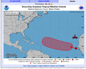
Eastern Tropical Atlantic (AL97):
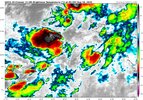
A broad area of low pressure, associated with a tropical wave, is
producing a large area of disorganized showers and thunderstorms
just off the west coast of Africa. Environmental conditions appear
conducive for gradual development of this system, and a tropical
depression could form by the middle to latter portion of next week
while moving west-northwestward at 15 to 20 mph across the eastern
and central tropical Atlantic. Locally heavy rainfall is possible
Sunday and Monday across portions of the Cabo Verde Islands.
* Formation chance through 48 hours...low...10 percent.
* Formation chance through 7 days...medium...50 percent.
0/50
lexxnchloe
Member
lexxnchloe
Member
Its like someone is just changing the name from GFS to EURO AI.
lexxnchloe
Member
EURO is nothingville
Brent
Member
lexxnchloe
Member
GeorgiaGirl
Member
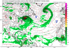
GFS looks like it might be a NE hit (edit: it is) after it gets uncomfortably close to NC.
I know that this is for entertainment purposes only right now, but any other storms besides Sandy involving the NE?
I know that this is for entertainment purposes only right now, but any other storms besides Sandy involving the NE?
lexxnchloe
Member
lexxnchloe
Member
Some in recent yearsGFS looks like it might be a NE hit (edit: it is) after it gets uncomfortably close to NC.
I know that this is for entertainment purposes only right now, but any other storms besides Sandy involving the NE?
Brent
Member
GFS looks like it might be a NE hit (edit: it is) after it gets uncomfortably close to NC.
I know that this is for entertainment purposes only right now, but any other storms besides Sandy involving the NE?
Bob
Gloria
Carol
Long Island Express
0/60.
Eastern Tropical Atlantic (AL97):
A broad area of low pressure, associated with a tropical wave, is
producing a large area of disorganized showers and thunderstorms
just off the west coast of Africa. Environmental conditions appear
conducive for gradual development of this system, and a tropical
depression could form by the middle to latter portion of next week
while moving west-northwestward at 15 to 20 mph across the eastern
and central tropical Atlantic. Locally heavy rainfall is possible
Sunday and Monday across portions of the Cabo Verde Islands.
* Formation chance through 48 hours...low...10 percent.
* Formation chance through 7 days...medium...60 percent.
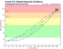
97L looks like a classic Outer Banks storm with some effects being felt there even if the center passes well offshore according to the GFS. The intensity will need to be watched carefully. If 97L is weaker than models are showing so far, then it might move closer to the Outer Banks or even inland due to the tendency for weaker storms to move further west before making the northerly turn they make when influenced by a high pressure. The Northeast needs to keep its eyes on this developing tropical system for a later landfall.
Last edited:
Henry2326
Member
This is truly the key to the final result. But might I add that the ridge is never as strong as modeled.....never. I guess there is always a small possibility for a first.
Also AI has throw a SC hit three times in the past 3 days. Something to think about.
Henry2326
Member
lexxnchloe
Member
Henry2326
Member
Henry2326
Member
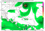
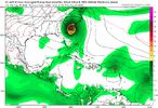
The Euro stalls 97L just off the eastern coast of Florida for about 24 hours before it moves north for a landfall on the Georgia/South Carolina border. Another difference between it and the GFS is the intensity of the hurricane. The Euro has a maximum intensity of around 955mb while the GFS bombs it out about 20mb lower off the Outer Banks. The important thing at this point is that most of the models are giving a strong signal for a potentially strong hurricane developing and possibly affecting the Eastern Seaboard.
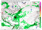
0z GFS is close to Bermuda lol
0z Euro is closer than 12z but still a comfortable miss OTS
lexxnchloe
Member
JB weeps. You cant beat the CFS for pattern recognition. CFS shows nothing of interest for its entire run0z GFS is close to Bermuda lol
Brent
Member
Well he can get over itJB weeps. You cant beat the CFS for pattern recognition. CFS shows nothing of interest for its entire run
Not like we haven't had plenty of hurricanes since 2017 anyway
I can't even believe how many landfalls we've had since then honestly. It's unheard of in modern records and I mean some year it's gonna end
We've gone 3 years without a hurricane landfall twice this century
Last edited:
MichaelAndrews
Member
I know with the slow start some are gonna be disappointed if this goes OTS
But I can’t stress enough how much of a disaster a direct hit on Charleston would be
I don’t want to downplay any landfall but, it floods if somebody leaves the faucet on too long down there
But I can’t stress enough how much of a disaster a direct hit on Charleston would be
I don’t want to downplay any landfall but, it floods if somebody leaves the faucet on too long down there
Shaggy
Member
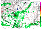
The Euro Ai was in Texas last night and now at the same time frame at 06 it in the Bahamas. The 06z GEFS has a large west shift to a more threatening look.
Meanwhile as we debate this the system is still south of the cape Verde islands.
Meanwhile as we debate this the system is still south of the cape Verde islands.
Shaggy
Member
Brent
Member
I know with the slow start some are gonna be disappointed if this goes OTS
But I can’t stress enough how much of a disaster a direct hit on Charleston would be
I don’t want to downplay any landfall but, it floods if somebody leaves the faucet on too long down there
Exactly and I don't even understand why people are acting like the season depends on landfalls. How many have we had lately? Like I said we've never had a stretch like this to have so many year after year anyway. Yes I'm aware it's not as flashy and whatever but the chasers have had plenty of opportunities to go chase lately. They can whine if they want but they also know it's barely August and nobody knows what's gonna happen
We don't even know for sure this wave is OTS yet on August 10th!!
And even if this goes OTS when was Helene and Milton last year?
Last edited:
Henry2326
Member
Been doing this awhile with a bunch of you. 
It always comes down to within 3-5 days of a landfall event. So really this is all entertainment and distraction until August 17, let's say. Until then it will be watching a storm moving at its leisure through the Atlantic.
The sad part is thr majority of folks on the coast have no plan and no prep. When Hugo hit Charleston in 1989, there were about 300,000 people there. Not it's exploded to over 1 million who would be impacted with the majority never experiencing a cat3-4 with no plan.
GeorgiaGirl
Member
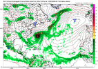
Wasn't awake for 0z last night, but this is what I should've probably noticed first here over the 6z GFS recurving (edit: and I noticed that the 18z ensemble suite became less certain yesterday). Yikes.
According to the ensemble suite, it seemingly suggests anything from a Florida landfall to a safe recurve is possible. Good luck!
Brent
Member
Been doing this awhile with a bunch of you.
It always comes down to within 3-5 days of a landfall event. So really this is all entertainment and distraction until August 17, let's say. Until then it will be watching a storm moving at its leisure through the Atlantic.
The sad part is thr majority of folks on the coast have no plan and no prep. When Hugo hit Charleston in 1989, there were about 300,000 people there. Not it's exploded to over 1 million who would be impacted with the majority never experiencing a cat3-4 with no plan.
Right theres so many places on the coast that are way more populated and haven't been hit yeah and most people just don't care enough to have a plan. I mean people don't know where they live on a map to begin with. How can they prepare for a hurricane?
And it's gonna be very ugly when they do eventually get hit one day

