-
Hello, please take a minute to check out our awesome content, contributed by the wonderful members of our community. We hope you'll add your own thoughts and opinions by making a free account!
You are using an out of date browser. It may not display this or other websites correctly.
You should upgrade or use an alternative browser.
You should upgrade or use an alternative browser.
Severe 3/27-3/31 2025 Severe
- Thread starter SD
- Start date
tractor girl
Member
BufordWX
Member
tractor girl
Member
NWMSGuy
Member
This is a bit perplexing to me at the moment but we’ll see how it goes
This is a bit perplexing to me at the moment but we’ll see how it goes
The parameters are certainly there for severe weather, from what I’ve read and watched. Granted, I’m not a future meteorologist like you.
cscott
Member
Didn't see the large enhanced area coming. Looks like high bust potential with this one. If we don't get sun beforehand it probably won't be that bad.
BufordWX
Member
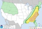
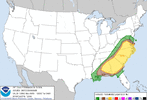
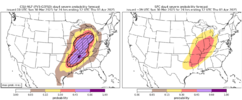
Today’s enhanced risk is the largest day 1 enhanced issued by the SPC.
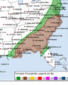
Still think the main threats will be wind and hail, but tornado threat likely greatest during the late afternoon into early evening from SE MO/NE AR into W KY and TN. Although, I’m not too impressed by the overall tornado threat with this system.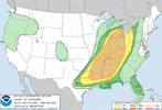
Still think the main threats will be wind and hail, but tornado threat likely greatest during the late afternoon into early evening from SE MO/NE AR into W KY and TN. Although, I’m not too impressed by the overall tornado threat with this system.

Twister
Member
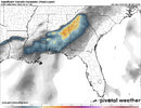
Are there a model that shows Hail?
The 10% tor is the only thing I’m a little hesitant on. 30% wind could certainly verify if we can get some of these higher end cape numbers to develop
tractor girl
Member
No.Are there a model that shows Hail?
SHIP = (MLCAPE / 1000) × (EBWD / 20) × (LR700-500 / 6.5) × (PW / 1.5)
EBWD is Effective Bulk Wind Difference (deep layer shear) the others should be explanatory.
cscott
Member
Tornado hit near Lansing, MI. Sounds like a lot of damage.
BufordWX
Member
NEW AFD FROM BIRMINGHAM
.SHORT TERM...
(Tonight through Monday Night)
Issued at 700 PM CDT SUN MAR 30 2025
The stable capping is beginning to set up over the area, putting a
squash on much of the precipitation, at least for the next 4 to 7
hours. We have made some minor adjustments on the severe timing
with a slower start but then increasing speed as it moves through
the area. A good consensus of the short range models are now
really hitting at the one line of storms moving through early
morning through early afternoon. Have adjusted the timing in the
forecast and will still need to adjust the thunder probabilities.
This will be updated soon. If we truly see the MCS move through in
one swoop, there will not be much to work with in the afternoon,
resulting in generally just showers and perhaps a rumble of
thunder as the front. Most of the precipitation should be out of
the southeast by late afternoon, with clearing Monday night of the
clouds. There may be just enough low level moisture in the far
south/southeast that dense fog may develop around 3 AM and persist
for a few hours before moving back south of the area after
sunrise. Will need to monitor that scenario, so included in the
GHWO but will not issue any other products due to the conditional
situation.
GeorgiaGirl
Member
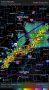
Brad Arnold has an unwarned tornado that is now fully on the ground near Weiner AR at least for the time being...
Edit: Just got warned, I got to watch it touch down on his stream.
Edit: Just got warned, I got to watch it touch down on his stream.
Haven’t been following this too closely from an Atlanta perspective but hey this is different then our usual 3am slopfest. Storms look to move through around 12pm or so give or take a couple of hours which is different.
Not sure I see much of a tornado threat but it’s at least possible. Biggest threat looks to be damaging winds if the line can coalesce and rejuvenate a bit with some daytime heating.
It’s something to watch though!
Not sure I see much of a tornado threat but it’s at least possible. Biggest threat looks to be damaging winds if the line can coalesce and rejuvenate a bit with some daytime heating.
It’s something to watch though!
tractor girl
Member
The HRRR isn't buying the energy NAM is selling. Both show a strong line of storms moving through sometime between 11-3ish. Maybe some isolated descrete supercells out in front.Haven’t been following this too closely from an Atlanta perspective but hey this is different then our usual 3am slopfest. Storms look to move through around 12pm or so give or take a couple of hours which is different.
Not sure I see much of a tornado threat but it’s at least possible. Biggest threat looks to be damaging winds if the line can coalesce and rejuvenate a bit with some daytime heating.
It’s something to watch though!
It will be interesting to see how much CAPE we have tomorrow morning going into noon time. Looking more like a straight wind threat with potential for some lower grade and short-lived spinups. Hope it's that or even less than.
boogeyman
Member
Looks like this is different from the severe threats we have had here so far this year with more instability but less sheer.
BufordWX
Member
tractor girl
Member
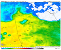
00z NAM uptick in CAPE from ~2100 to ~2400
00z HRRR also uptick in CAPE from ~1600 to ~1800
NAM has a little SRH but not much shear
HRRR not much shear or helicity
00z HRRR also uptick in CAPE from ~1600 to ~1800
NAM has a little SRH but not much shear
HRRR not much shear or helicity
BufordWX
Member
Brent
Member
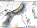
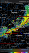
The nam shows a very fast moving bow echo in Alabama late morning
Maybe a derecho
Maybe a derecho
Not looking great west of the Nashville area right now. Late night. People will be tired at work in the morningThe nam shows a very fast moving bow echo in Alabama late morning
Maybe a derecho
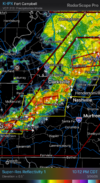
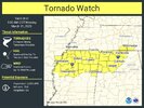
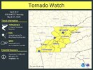
NEW TORNADO WATCH COMING FOR PARTS OF NW ALABAMA, NE MISSISSIPPI, AND PART OF TENN
BufordWX
Member
Here’s a good livestream
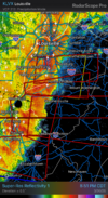
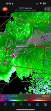
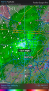
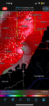
Broadening out for a moment, never saw a debris signature but this was an impressive velocity image
BufordWX
Member
BufordWX
Member
BufordWX
Member
Mahomeless
Member
Supercells went wild….The 12z GFS just screams one of the setups that give us problems in the south and big headaches for the NWS offices. One of those setups where if you break the cap at the right time, you have a extremely dangerous setup. If the cap breaks late, winds veer and big Hail is the main threat.
Looks like a supercellfest.
Supercells went wild….
A lot changed in a week of model runs.
Who would have thunk it?

