That wasn’t nothing 


Severe outbreaks ain't what they used to be.Not even a quarter inch of rain here in eastern Forsyth County NC and we need rain badly. My cat did get caught in a downpour though, so the house smells like wet pet.
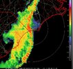
Not too bad.Incoming? @Shaggy @lexxnchloe
Agree.. things look way worse in model data (even high res models) and like clockwork, once fronts reach GA they fizzle out for the most part.Severe outbreaks ain't what they used to be.
You would think it has a lot to do with the mountains and the way severe systems are oriented SW to NEAgree.. things look way worse in model data (even high res models) and like clockwork, once fronts reach GA they fizzle out for the most part.
Meteorologically speaking, why is that?

I don't know, TBH. I posted on X about it the other day, but maybe it's possible that the dynamics typically at place send prefrontal convection out ahead and work the atmosphere in regions close to the mountains. Obviously, the mountains are a disrupting agent also. We get a lot of systems moving through at night too. I can't really see a meteorological reason for that, though.Agree.. things look way worse in model data (even high res models) and like clockwork, once fronts reach GA they fizzle out for the most part.
Meteorologically speaking, why is that?
I don't think North GA has had a major tornado event since March 2012 when a couple of supercells came out of Alabama. Those same general areas also got hit in 2011 and 1994 too. The 1994 storms hit Oconee County SC very hard and one of them hit the NW side of Charlotte too, I think.I don't know, TBH. I posted on X about it the other day, but maybe it's possible that the dynamics typically at place send prefrontal convection out ahead and work the atmosphere in regions close to the mountains. Obviously, the mountains are a disrupting agent also. We get a lot of systems moving through at night too. I can't really see a meteorological reason for that, though.
This is incorrect! my house was hit by a EF1 or forming EF-1 on 4-12-2020! That storm tore up parts of Ft. Oglethorpe and became a major in Tn.!I don't think North GA has had a major tornado event since March 2012 when a couple of supercells came out of Alabama. Those same general areas also got hit in 2011 and 1994 too. The 1994 storms hit Oconee County SC very hard and one of them hit the NW side of Charlotte too, I think.
Of course, Newnan got hit a couple of years ago, but that was only 1 tornado, I think.
This is incorrect! my house was hit by a EF1 or forming EF-1 on 4-12-2020! That storm tore up parts of Ft. Oglethorpe and became a major in Tn.!
That is only one tornado though. I was thinking more about tornado outbreaks like March 2012, March 1994 and April 2011. Those featured multiple tornados, some of them F2+.This is incorrect! my house was hit by a EF1 or forming EF-1 on 4-12-2020! That storm tore up parts of Ft. Oglethorpe and became a major in Tn.!
Newnan March 25 2021.... Didn't that tornado get close to the Atlanta suburbs
Heard, Coweta, and Fayette County Tornado (Newnan EF-4)
www.weather.gov
Newnan info
I can’t think of any major events in North GA in the last 10 years. Newnan is not really North GA so I don’t count them.I don't think North GA has had a major tornado event since March 2012 when a couple of supercells came out of Alabama. Those same general areas also got hit in 2011 and 1994 too. The 1994 storms hit Oconee County SC very hard and one of them hit the NW side of Charlotte too, I think.
Of course, Newnan got hit a couple of years ago, but that was only 1 tornado, I think.