• Hello, please take a minute to check out our awesome content, contributed by the wonderful members of our community. We hope you'll add your own thoughts and opinions by making a free account!

Wintry 1/20 - 1/23 Winter Storm

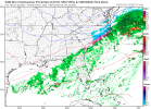
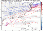
Ok this a head scratcher… the H5 looked better on both the HRRR and the Euro, but the surface reflection looks worse… the H5 looks worse on the NAM, but the surface reflection looks better… I guess this just truly going to come down to now casting
Yeah the northern stream did not look better that run at all. The SW interaction was better early on especially but still. I figured the surface reflection we got from the HRRR and EURO would match the NAMs H5 and I don't even think the NAM surface reflection would've been good enough for what the HRRR looked like at H5. That had boom written all over it.
 
Ok this a head scratcher… the H5 looked better on both the HRRR and the Euro, but the surface reflection looks worse… the H5 looks worse on the NAM, but the surface reflection looks better… I guess this just truly going to come down to now casting
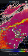
Your LP in the Atlantic is closer back toward the coast, keeps creeping closer every run. Need it on Hatteras, wed all be hammered, pref wilm.
 
Yep Columbia is definitely in a sweet spot.

My best forecast right now is freezing drizzle the further North from deeper moisture you go... need saturation in the snow growth region... so I-20 and Southeast and towards the eastern Midlands is my best possible guess for a nice little dusting+ as of right now. Of course, that could change...


Edit: seems CAE updated the advisory ;)
 
My best forecast right now is freezing drizzle the further North from deeper moisture you go... need saturation in the snow growth region... so I-20 and Southeast is my best possible guess for a nice little dusting+ as of right now. Of course, that could change...
I live between Manning and Summerton right on I-95 I think we are in a good spot for some kind of wintry wx.
 
Does this mean the moisture is going to be future west than what the models are showing
It's supportive of more moisture back further west but doesn't mean it will happen. Just that the upper atmosphere looks like there should be more moisture at least back towards the 26 corridor.
 
I think you can arguably say it was slightly improved, but it still was pretty poor, at least for those of us further west. The NAM continues to be the worst of all models. Let’s hope the RGEM/GFS/ICON/GGEM hold to their much snowier solutions here at 18z. Can the NAM pull a coup here?
 
Yeah the northern stream did not look better that run at all. The SW interaction was better early on especially but still. I figured the surface reflection we got from the HRRR and EURO would match the NAMs H5 and I don't even think the NAM surface reflection would've been good enough for what the HRRR looked like at H5. That had boom written all over it.
The one thing that did stand out about the NAM run was that 700mb jet being in a prime spot for moisture back this way. It really is something that we’re this close in and there is still such a spread of how this could go
 
For the most part, not one piece of guidance is showing less moisture versus previous runs. That is the idea... extreme ground specifics, accumulation maps, etc.. are kinda pointless imo. The guys in Mid-Eastern NC should care about them though honestly.... but to us scavengers in the West.. give it time.
 
The one thing that did stand out about the NAM run was that 700mb jet being in a prime spot for moisture back this way. It really is something that we’re this close in and there is still such a spread of how this could go
It's definitely supportive of more moisture falling than what is being depicted on the surface. There a lot of lift around 500mb with a decently saturated column for at least 6 hours even back my way.
 
Back
Top