
Tsappfrog20
Member
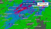
Some good rain in Raleigh/ Wake Forest!!
Sent from my iPhone using Tapatalk
Sent from my iPhone using Tapatalk


Looks promising but until it happens....

Barely a cloud in the sky. Incredible stuff

Started out atv70% and never saw a shower within 75 miles of us.Not sure when it'll rain again after today, ensembles are dreadful. Might hit a 30 day total of 0.00 in early October

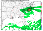
Yeah something has changed. But also, summer time rainfall is almost always scattered convection, some winners and some losers. Usually, however, you have wet springs and if you miss out on some of the summer convection, it's bad but not horrible. Throw in a dry winter, a very dry spring and then miss out on most of the summer convection and it's nearly a disaster. I've heard as much thunder this summer as just about any other just missed probably 80% of them.It seems like something has changed in terms of how rain forms now that the climate is so warm. Clear and obvious environmental conditions that used to result in widespread rain, frequently only result in partly cloudy skies and widely scattered to isolated showers, possibly a rogue thunderstorm.
Humidity at 250%, steep lapse rates, boundaries everywhere, strong instability, and a massive shortwave, and you end up with a nice partly cloudy afternoon.


It seems like something has changed in terms of how rain forms now that the climate is so warm. Clear and obvious environmental conditions that used to result in widespread rain, frequently only result in partly cloudy skies and widely scattered to isolated showers, possibly a rogue thunderstorm.
Humidity at 250%, steep lapse rates, boundaries everywhere, strong instability, and a massive shortwave, and you end up with a nice partly cloudy afternoon.
The Euro was quite bullish for much of the southeast and mid Atlantic yesterday, but the radar at game time was quite paltry. That's just one model, but still, it was not great.Been my experience too - one thing I see more now that ever is cloud debris, and its persistent - particularly at night and acts a blanket. This results in lows of 78° at night (warm air can't escape) and then this builds over time to create a cap. In the past - seems like we were able clear the deck near nightfall or shortly after, and lows were in the high 60's. (not anymore).
Shortwaves under the heat dome seems limited in capacity (exhibit A yesterday) where the shortwave stayed in WNC and did not do much of anything.

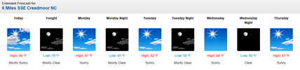

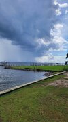
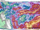
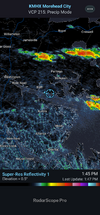
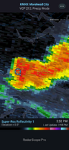
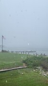
97-98 is still the leader in the clubhouse but 15-16 is on the course on pace to shoot a 59. Really illustrates the point that December is very likely strongly bn like 97 or an like 15. I'm not wild about where we stand right now for winter, I think given the pattern so far you have to lean to the warm side of analogs. It would be really nice to see the pattern show some signs of life along the WC and actually attempt ridging as we get into October to feel better about winterGreensboro is runing +6.5 AN for September as we cross the halfway mark.
For comparison purposes. I would write a check to repeat super el nino December 1997 this December as we averagaged -3.5 BN. However if you go back and look at Sept 1997 it was solidily BN. Unlike our current Sept of AN.
