Carolina Fever
Member
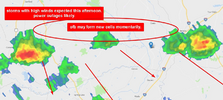
It's hot sitting on the beach in North Myrtle. At least there is a breeze and some higher gusts every now and then. Looks like another chance of storms back home today



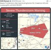
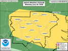
Training vectors on the severe mdSEVERE THUDERSTORM WATCH #500 WL BE ISSUED UNTIL 9PM

For those who's wondering what happened to us 168 hours agoNow the real test to see if that new line that Duke installed isn't going to get hit by another vehicle tonight.

Nope, storms are forming now.ILM has completely removed any percentage of rain today locally. Feels like living in Dubai with sunny skies and 81F dew points.

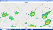
Nope, storms are forming now.
How is it, that you guys dont get anything, whereas we are the unluckiest of them all?Not in SC they aren't.
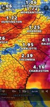

Probably should include @Stevo24 and maybe even @Rain Cold in this disaster tooI'm so tired of this upstate rain shadow thats been here for months I feel like logging off until fall and maybe something more interesting will be happening then. Because this clearly isn't going to break this summer. Its the most persistent thing I've seen in a long time. I guess congrats to everyone except me, @JHS @jackendrickwx @Jimmy HypocracyView attachment 196885

Brick seriously try to come back across NC line next year. Face due south and the bermuda HP always sends a stiff 15mph + breeze out of the SW. You will never cook at Holden Beach unless you get back across IC on mainland. Case in point look at current web cam and the white caps. At MYB you are facing due east and sw wind is coming almost off land.It's hot sitting on the beach in North Myrtle. At least there is a breeze and some higher gusts every now and then. Looks like another chance of storms back home today
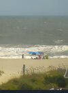
Brick seriously try to come back across NC line next year. Face due south and the bermuda HP always sends a stiff 15mph + breeze out of the SW. You will never cook at Holden Beach unless you get back across IC on mainland. Case in point look at current web cam and the white caps. At MYB you are facing due east and sw wind is coming almost off land.

It feels like we've been whiffing pretty bad in spartanburg co lately. That's just sort of how it goes with parts of Oconee, Pickens, Gvl co's all picking up some extra juice from terrain kicking things off. By the time whatever OFB makes it over here it has been paltryI'm so tired of this upstate rain shadow thats been here for months I feel like logging off until fall and maybe something more interesting will be happening then. Because this clearly isn't going to break this summer. Its the most persistent thing I've seen in a long time. I guess congrats to everyone except me, @JHS @jackendrickwx @Jimmy HypocracyView attachment 196885
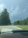
It’s probably a sign of things to come for winter. Probably the exact same map but snow all around.Probably should include @Stevo24 and maybe even @Rain Cold in this disaster too

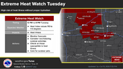


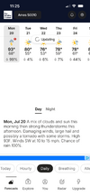
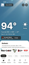
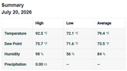
Little moist out!! Feeling like Miami today! View attachment 196914
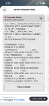



No rain, AGAIN! for me. Way to go Wake county. View attachment 196917