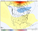
• Hello, please take a minute to check out our awesome content, contributed by the wonderful members of our community. We hope you'll add your own thoughts and opinions by making a free account!

March 2026 - Winter or Spring?

Color me excited. The tendency in the pattern in general since November has been to amplify. Cold has been amped. Warmth has been amped. And March patterns tend to amplify as is. Should be one heck of a roller coaster ride, even by March standards.

Using Atlanta as a benchmark, temps in the extremes have consistently exceeded the normal min-max range all season long by an average of 7 degrees (the spread for February 2026 includes a forecasted max of 76 for this week). Continuing that pattern into March would translate to a min-max spread of 59 degrees for Atlanta. So, what do Marches look like when Atlanta has a min-max spread of 59 give or take 2 degrees? They look pretty interesting lol. List of years below, some really good ones in there.

1771473817775.png


1771474112029.png
 
12gfs continues to show our storm around the 2nd of March


Sent from my iPhone using Tapatalk

64163be9a3d83cdde6aeeb53e71b0d9b.png

Day 10 12z GFS


Sent from my iPhone using Tapatalk
 
Storm is there on the 12zeuro but don’t have the cold air in place so we shall see


Sent from my iPhone using Tapatalk
 
So far from a big picture perspective March looks awful IMO for SE cold and snow peeps as usual. Global Ridge of Doom.

It can change and it's way out there, but right now my trip to NY will probably be warm as well. Hoping that December pattern shows back up where the Canadian troughing pushes down in the east at least for the NE.

1771610525341.png
 
Honestly surprised I haven't seen a whole lot of talk about the polar vortex. It's been getting disrupted fairly quietly behind the scenes. Probably has something to do with nobody expects something like this in Late Feb/March.

Following images look quite a bit ahead. However, stratospheric warming has already been ongoing.1771707471347.png1771707482309.png
 
Honestly surprised I haven't seen a whole lot of talk about the polar vortex. It's been getting disrupted fairly quietly behind the scenes. Probably has something to do with nobody expects something like this in Late Feb/March.

Following images look quite a bit ahead. However, stratospheric warming has already been ongoing.View attachment 194402View attachment 194403
Adding onto this, here is progression on euro after about 170 hours. 1771708145016.png
 
There is still a decent chance for another Arctic intrusion across the eastern two-thirds of the lower 48 states in the longer term. But truth be told, opportunities for high-latitude blocking will be lower, and the subtropical jet stream will be gaining latitude as the La Nina episode is now ascending into a negative-neutral ENSO signature, and should reach weak El Nino status in the 3.4 sector by May 1. I think we will end up with a higher-number weak, perhaps low-end moderate +ENSO signature this summer and fall. Which gives credence to the idea of the warmth and dryness in the Southwest overtaking the Desert and Intermountain regions and south central through the JJAS semester, much like 2023. With less chance for Atlantic Basin tropical cyclones and better odds on thunderstorm threats in the Midwest and Eastern Seaboard after Memorial Day.

But first things first. Week 2 will likely start out very cold to the right of the Rocky Mountains, and there could be an important storm that impacts Texas, the Great Plains, and the Front Range with heavy rain and higher elevation snow and wind (possibly a longwave/Colorado/Limon cyclone....). That system may start to break apart the colder air from the Mississippi Valley to the East Coast. At the same time Californai should start to warm up after an initial chilly period. The longer term model guidance wants to bring the subtropical jet stream up into northern Mexico and the Gulf Coast in Weeks 3 and 4. If so the serious cold (Arctic) values will remain in Canada and the north central U.S. by mid-March.

Watch that southern branch wind field, as it presents opportunities for thunderstorms and heavy rainfall in much of Dixie, the Midwest and Mid-Atlantic. That would mean a dry and increasingly warm Southwest which, in time, could spread into Texas and the Heartland in early summer. But most importantly, readings should stay out of the "snow and cold" zone in the second half of next month. For many in the grip of the early week storm, such a forecast will be greatly appreciated.


Prepared by Meteorologist LARRY COSGROVE on
Saturday, February 21, 2026 at 11:25 P.M. CT
 
What you see here is exactly why you can't 100% count out winter down south yet.

This is a portion of the Polar Vortex(PV) lobe that splits after stratospheric warming. You can see the general recent GEFS trend of it.

These shifts are significant in the long run of things and is absolutely something to monitor.

Remember, a polar vortex can be super unpredictable and small changes can completely affect where the PV lobe goes. All up to where it migrates.


What is ultimately means for the US is, yes there is a chance of another opportunity of frigid cold, but this isn't a guarantee. Should this lobe continue to trend to migrate into the US, things get interesting fast although climo is becoming less favorable, something to monitor going forwards.

I'll post some analogs of similar scenarios like this once i do some more research on it.

Also note, this is looking ahead 300+ hours, yes that's a long way to go, which is why specific placement of the lobes are a huge question. however, The PV is already splitting as stratospheric warming has continued.
 

Attachments

  • gfs-ensemble-all-avg-namer-z50_anom-1771740000-1773100800-1773100800-10.gif
    gfs-ensemble-all-avg-namer-z50_anom-1771740000-1773100800-1773100800-10.gif
    1.2 MB · Views: 24
Last edited:
Back
Top