-
Hello, please take a minute to check out our awesome content, contributed by the wonderful members of our community. We hope you'll add your own thoughts and opinions by making a free account!
You are using an out of date browser. It may not display this or other websites correctly.
You should upgrade or use an alternative browser.
You should upgrade or use an alternative browser.
Pattern Another Angry August: Broiled, Baked, and Bone-Dry
- Thread starter SD
- Start date
NWS GSP AM update: pretty much nailed it: “As of 125 AM EDT Wednesday: Starting off the forecast period in a
soupy mess of showers and gross humidity”
Sent from my iPhone using Tapatalk
soupy mess of showers and gross humidity”
Sent from my iPhone using Tapatalk
Another record we have too be setting, but no data/ metric to compare. Is sunlight in August. I can't ever remember so many days with 0 sunshine . They have what's called cooling degree days, but not sure what that's all about. Believe it's tied to solar insulation. If you are dependent on pure solar, you have had some challenges, most likely this month at times.
CDD is how much a day’s mean between max and min is over 65 F. Example: if max 90 and min 70 that averages 80 or 15 CDD.
NCSNOW
Member
Carolina Fever
Member
Sheesh is it ever gonna stop raining in Raleigh?

Drizzle Snizzle
Member
Will Aug end cooler than it started?
I sure hope it ends cooler than it started considering it started at 94 degrees in Atlanta on August 1
More rain in the last 72 hours than all of July. We take
lexxnchloe
Member
Why do you continually post these outlandish maps? We've all been on these boards for a hundred years, and like, it's cool to see every once in a while...or in the context of a long range forecast analysis or something.
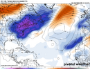
But to just carpet bomb the place with maps of the CFS at 600 hours isn't serious. The tropical, storm, and pattern threads are supposed to be serious threads. I know it's slow, but let's at least try and keep things in the realm of plausible. Plllllease.
Shaggy
Member
One of the craziest summer time pattern flips I've ever seen. July was dry and just scorching hot everyday and now we are low 80s cloudy snd rainy all the time it seems
Some videos of yesterday's flash flooding in the Chattanooga area.
.
.
Does the 18z euro not come out until midnight now?
This is the most an evening has felt like a steam bath in a while. It’s foggy in the low 80s and the sweat comes easily.
JHS
Member
We have slipped back into our July pattern here. Probably no rain coming now for 7+ days and 90+ heat is back.
SnowNiner
Member
We have slipped back into our July pattern here. Probably no rain coming now for 7+ days and 90+ heat is back.
It just rained an hour ago again here. Streets are still wet. I bet you may possibly be mistaken.
GeorgiaGirl
Member
Yeah, it was actually quite miserable yesterday (it’s looking as if taking a blend between GFS/Euro temps should’ve occurred and we’re closer to that now), but it’s rained all night here.
It’s probably finally close to quitting though.
I wish I didn’t know that it was to an extent. Gah my sleep has been garbage for a while. Granted, I think all night may be “some before 11 PM and then starting again at 4ish in the morning,” and we may probably somehow come out with a total below 1” again.
Edit: okay, forget the joking around, the yard was close to flooded. That was probably at least 2" and for a change, the far southern part of the county was hit hard with rain.
Last edited:
NCSNOW
Member
LOLWe have slipped back into our July pattern here. Probably no rain coming now for 7+ days and 90+ heat is back.
That subtropical ridge lurking right before labor day kind of sucks
GeorgiaGirl
Member
Yeah, it was actually quite miserable yesterday (it’s looking as if taking a blend between GFS/Euro temps should’ve occurred and we’re closer to that now), but it’s rained all night here.
It’s probably finally close to quitting though.
I wish I didn’t know that it was to an extent. Gah my sleep has been garbage for a while. Granted, I think all night may be “some before 11 PM and then starting again at 4ish in the morning,” and we may probably somehow come out with a total below 1” again.
Edit: okay, forget the joking around, the yard was close to flooded. That was probably at least 2" and for a change, the far southern part of the county was hit hard with rain.
1.6" last night/early morning in multiple rounds of storms, still somehow less than what it feels, but a number that makes more sense.
I'm definitely over my July total as well.
Drizzle Snizzle
Member
Over 8” of rain so far in August.
JHS
Member
100 degree heat not that far away from NC and SC early next week. Nashville TN now forecast to hit that mark Tuesday. Mid to upper 90's there from Sunday through Wednesday of next week. This probably gets east of the mountains at some point.
Bunch of trees down around here from the storm that popped up and pushed north to south
It’s getting dark in the N sky here and the radar says strong thunderstorms are on the way as an outflow boundary is coming through:
SPECIAL WEATHER STATEMENT
NATIONAL WEATHER SERVICE CHARLESTON SC
635 PM EDT FRI AUG 15 2025
GAZ118-119-SCZ047-051-152330-
COASTAL CHATHAM GA-INLAND CHATHAM GA-COASTAL JASPER SC-INLAND
JASPER SC-
635 PM EDT FRI AUG 15 2025
...A STRONG THUNDERSTORM WILL IMPACT JASPER AND CHATHAM COUNTIES
UNTIL 730 PM EDT...
AT 635 PM EDT, DOPPLER RADAR WAS TRACKING A STRONG THUNDERSTORM NEAR
BELLINGER HILL AREA, MOVING SOUTHWEST AT 15 MPH.
HAZARD...WIND GUSTS UP TO 50 MPH AND PENNY SIZE HAIL.
SOURCE...RADAR INDICATED.
IMPACT...GUSTY WINDS COULD KNOCK DOWN TREE LIMBS AND BLOW AROUND
UNSECURED OBJECTS. MINOR DAMAGE TO OUTDOOR OBJECTS IS POSSIBLE.
LOCATIONS IMPACTED INCLUDE...
POOLER, BLUFFTON, HUTCHINSON ISLAND, DOWNTOWN SAVANNAH, BELLINGER
HILL AREA, SAVANNAH INTERNATIONAL AIRPORT, GODLEY STATION,
WILMINGTON ISLAND, GARDEN CITY AND PORT WENTWORTH.
———
Edit: I got only little. I’ll call it a T.
Last edited:
First 90 in 2 weeks
JHS
Member
A lot more coverage of storms today than I expected some of them strong too. All of them missed us until the last few minutes, but an isolated cell finally just hit us. Now we get a few days of 90-92 degree weather, followed by another cooldown late next week.
Temperature wise, the first half of August has been cool and enjoyable comparable to what the dog days of summer normally bring. It has been wet this month, especially this past week in the RDU area. Now we shift to a more normal August pattern for the next week or so. August will still end up quite a bit below normal temperature wise and above normal precipitation wise. It could end up well above normal precipitation wise if anything tropical in nature shows up during the last days of the month.
Thunderstorms that popped up along the seabreeze have resulted in moderate to heavy rain here since 1:45. I’m >1” and adding to that. So, I’m >13” for MTD!
Edit: I ended up with ~1.6” on 8/16. That gets me to a whopping ~13.6” for Aug 1-16! Some in the county got as much as ~3” around the Windsor Forest area.
Edit: I ended up with ~1.6” on 8/16. That gets me to a whopping ~13.6” for Aug 1-16! Some in the county got as much as ~3” around the Windsor Forest area.
Last edited:
GeorgiaGirl
Member
Raining pretty hard for the past hour here. If I can get it to slack up, probably going to risk going outside while it's still cloudy.
Sometimes it works out, but then sometimes it's insufferable to do so.
Sometimes it works out, but then sometimes it's insufferable to do so.
NoSnowATL
Member
Good luckRaining pretty hard for the past hour here. If I can get it to slack up, probably going to risk going outside while it's still cloudy.
Sometimes it works out, but then sometimes it's insufferable to do so.
NCSNOW
Member
I've mowed grass more this summer, than I can ever recall. Sweat missery index was through the roof today .
Similar to yesterday earlier in the afternoon, thunderstorms with some heavy rains have just popped up including here along the seabreeze. Rain starting and just heard thunder.
Edit: I ended up with ~0.80”, which brings me to ~14.4” Aug 1-17!
Edit: I ended up with ~0.80”, which brings me to ~14.4” Aug 1-17!
Last edited:
Brent
Member
Brent
Member
GoDuke
Member
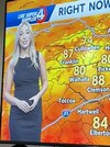
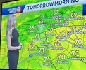
She’ll be on Fox News weather in a year.So we got a new met over on WYFF. I think the boys can appreciate the new hire View attachment 174367View attachment 174368
lexxnchloe
Member
NCSNOW
Member
Yep. We struggle to hit 80 for the foreseeable future here. Forecasted highs in the 70s-81-82 ish.

