• Hello, please take a minute to check out our awesome content, contributed by the wonderful members of our community. We hope you'll add your own thoughts and opinions by making a free account!

Pattern June’s Drought Dialogues

11AM today/24 hours ago:

RDU 95/95
GSO 91/90
FAY 96/94

Unlike the last two days, today’s 6Z Euro is way too cool for 11AM:
RDU 87 (8 too cool)
GSO 83 (8 too cool)
FAY 90 (6 too cool)

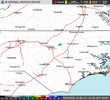
So unlike the last 2 days, when the Euro did much better than the GFS, this Euro run will be pretty useless for highs today due to it being way too cool at 11AM. The reason it is so cool is that it had a nonexistent area of convection moving W across NC earlier this morning:
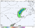
IMG_3831.png

Thus, the 6Z Euro has PM highs of only 94 at RDU/GSO and 95 at FAY. RDU/FAY were already 1F warmer than those progged highs at 11AM as a result of that phantom convection!

The 6Z GFS didn’t have the phantom convection. Thus the GFS is much hotter than the Euro/close to reality at 11AM:

RDU 96 (only 1 too warm)
GSO 93 (only 2 too warm)
FAY 96 (perfect)

So unlike Mon/Tue, the 6Z GFS highs will be much closer to reality than the Euro:
RDU 102
GSO 98
FAY 102

Based on all of this, my guesses for highs today are these:
RDU 100
GSO 97
FAY 101
 
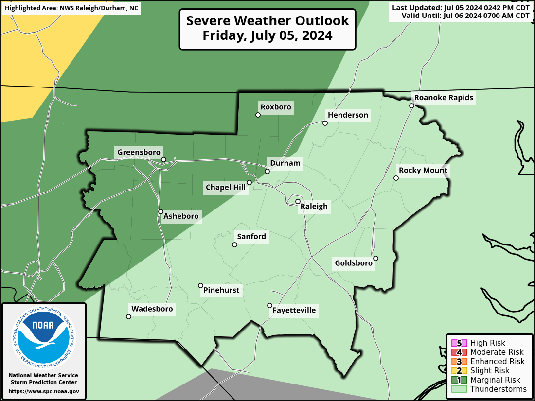
Oh bless your heart @Jimmy Hypocracy Its an enhanced for you!
RAH_swody1.png
 
I was in Ohio during the 2012 Derecho commentating an event. I was trying to tell the promoters that ---- was going down. Officials "ignored" my concern. The rest was a big, old.....tent flying, tree damage mess. No one was hurt but it was wicked. https://en.wikipedia.org/wiki/June_2012_North_American_derecho
 
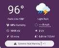
It would be both of ours because mine is even giving me this under light rain.

View attachment 173232
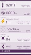
Yeah, it's either a global problem with Tempests or it's really humid. I can't tell the difference between a 77 and 81 degree dewpoint, so idk. But it feels absolutely despicable outside with instantaneous sweat.

Screenshot_20250625_134331_Tempest.jpg
Screenshot_20250625_134320_Tempest.jpg
 
SVR issued for WAKE AND JOCO!
WUUS52 KRAH 251747
SVRRAH
NCC101-183-251845-
/O.NEW.KRAH.SV.W.0155.250625T1747Z-250625T1845Z/

BULLETIN - IMMEDIATE BROADCAST REQUESTED
Severe Thunderstorm Warning
National Weather Service Raleigh NC
147 PM EDT Wed Jun 25 2025

The National Weather Service in Raleigh has issued a

* Severe Thunderstorm Warning for...
Southeastern Wake County in central North Carolina...
Northwestern Johnston County in central North Carolina...

* Until 245 PM EDT.

* At 146 PM EDT, a severe thunderstorm was located near Garner, or 9
miles southeast of Raleigh, moving southeast at 5 mph.

HAZARD...60 mph wind gusts.

SOURCE...Radar indicated.

IMPACT...Expect damage to roofs, siding, and trees.

* Locations impacted include...
Raleigh, Garner, Fuquay-Varina, Clayton, Knightdale, Wendell, Coats
Crossroads, and Lake Benson.

PRECAUTIONARY/PREPAREDNESS ACTIONS...

Seek shelter in a sturdy structure until the storm has passed. Stay
away from windows as flying debris generated by damaging winds can
be deadly.

Damaging wind, and continuous cloud to ground lightning are
occurring with this storm. Move indoors immediately. Lightning is
one of nature's leading killers. Remember, if you can hear thunder,
you are close enough to be struck by lightning.

&&

LAT...LON 3577 7829 3550 7853 3554 7879 3555 7882
3587 7853
TIME...MOT...LOC 1746Z 318DEG 5KT 3572 7855

HAIL THREAT...RADAR INDICATED
MAX HAIL SIZE...<.75 IN
WIND THREAT...RADAR INDICATED
MAX WIND GUST...60 MPH

$$

PWB
 
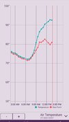
KCHS has already hit 98 today, at 95 at 2pm, with a light NE wind. HX has come down the last 2 hours consecutively. (101 at 2pm).

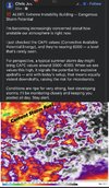
Very odd, it felt absolutely oppressive this morning, currently just uncomfortably hot now. (And oddly enough, SBCAPE inched downward here). Was near 6000 earlier, around 5000 to 5500 now
We've mixed out a lot more today than the last few and we are also hotter. ILM had am obs at 99 a little while ago but is back down to 97. The DP had dropped from 77 to 70 as well.

Screenshot_20250625_141507_Chrome.jpg
 
11AM today/24 hours ago:

RDU 95/95
GSO 91/90
FAY 96/94

Unlike the last two days, today’s 6Z Euro is way too cool for 11AM:
RDU 87 (8 too cool)
GSO 83 (8 too cool)
FAY 90 (6 too cool)

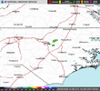
So unlike the last 2 days, when the Euro did much better than the GFS, this Euro run will be pretty useless for highs today due to it being way too cool at 11AM. The reason it is so cool is that it had a nonexistent area of convection moving W across NC earlier this morning:
View attachment 173226

Thus, the 6Z Euro has PM highs of only 94 at RDU/GSO and 95 at FAY. RDU/FAY were already 1F warmer than those progged highs at 11AM as a result of that phantom convection!

The 6Z GFS didn’t have the phantom convection. Thus the GFS is much hotter than the Euro/close to reality at 11AM:

RDU 96 (only 1 too warm)
GSO 93 (only 2 too warm)
FAY 96 (perfect)

So unlike Mon/Tue, the 6Z GFS highs will be much closer to reality than the Euro:
RDU 102
GSO 98
FAY 102

Based on all of this, my guesses for highs today are these:
RDU 100
GSO 97
FAY 101

RDU may not reach 100 degrees if the thunderstorm cells expanding west and south over Wake County can generate a shower to cool things down.

Yep, it maxed at 99 at RDU just before the storm cooled it back down to 97. So, 99 almost definitely will end up as the RDU high stopping the 100 streak at two days.

GSO is at 95 at 2PM (high so far today) and was still slowly rising then with no convection nearby as of yet. So, the GSO high may end up a couple of degrees above 95.

FAY as of 2PM had already had a high of 100 with it down to 98 with convection . So, 100 will likely end up as FAY’s high, their hottest day yet.
 
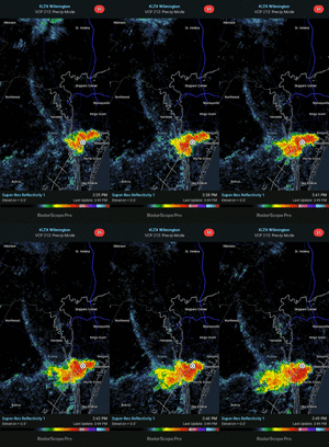
There is a lot of thunderstorm activity in the counties just to the east of Wake County and it doesn't look to be going anywhere in a hurry. Besides the severe thunderstorm warnings that have been issued I expect we will see some flood warnings in the near future if this activity continues.
 
Back
Top