BrickTamland
Member
I feel like we're going to end up paying for this lack of rain with a lot of flooding sometime down the road.
That’s a pretty vague statement! Of course we will be wet, some point down the road. I don’t think this is a 2016 or 2018 type of deal. At some point yes, we will have more precip. It comes in cycles!I feel like we're going to end up paying for this lack of rain with a lot of flooding sometime down the road
.gif")
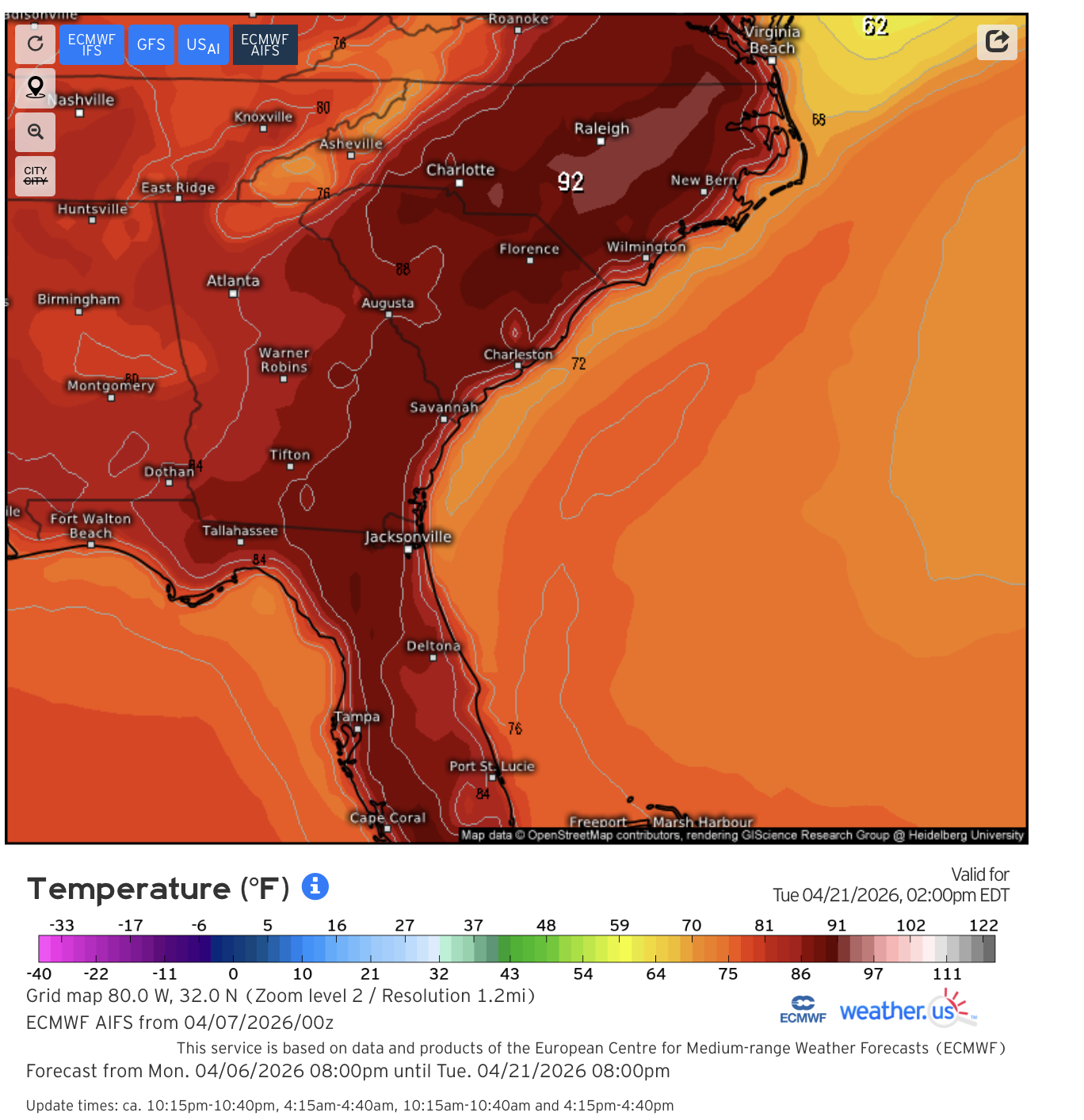
I think I can just about make out where high pressure is forecast to park itself over the next week...99% of the board is bone dry next 7 days.
View attachment 195380
Until the ridge stops centering in the gulf and sending the axis northward through the region the pattern sucks. Classic drought/heat pattern with the only the fringes getting into realistic rain chances. Maybe the CAD zones get saved by a wedge at times but it would be short lived. Phase 8 MJO would pull us out of this, models go there but they havent really reflected that in their 500mb pattern forecasts

Yeah good thing its not mid summer we would be printing 100sThat look at 500mb on the Euro/Euro AI is disgusting.
Going pay for it alright … brutal heat this summerI feel like we're going to end up paying for this lack of rain with a lot of flooding sometime down the road.


GFS is printing 100s in South GA past day 10. Fantasyland of course, but it is gonna be hot, and would expect overperformance given the droughtYeah good thing its not mid summer we would be printing 100s
 6.57.06 p.m..png")

Im surprised he even compared it to 2011.I love spring /sView attachment 195388
Im surprised he even compared it to 2011.
I love spring /sView attachment 195388
It's official, RIP Spring Severe Season 2026...


And I’m looking like spring/summer of ‘93 over here!!


