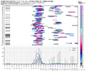
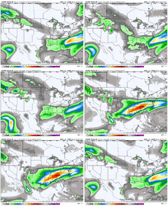
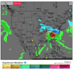
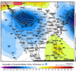
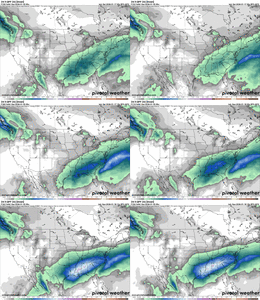
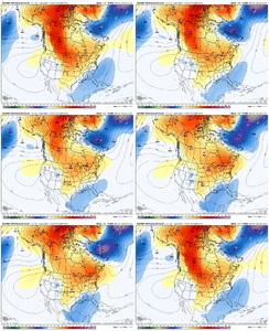
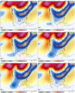
Way too far out to say this 'very confidently' imoI'm very confident that the GEM has a cold bias, and that Atlanta and most of GA will only be seeing a cool rain from this storm, per the Euro. 925mb is over 5 degrees for most places with surface temps in the 40s and 50s.
-
Hello, please take a minute to check out our awesome content, contributed by the wonderful members of our community. We hope you'll add your own thoughts and opinions by making a free account!
You are using an out of date browser. It may not display this or other websites correctly.
You should upgrade or use an alternative browser.
You should upgrade or use an alternative browser.
Wintry January 23rd-27th 2026
- Thread starter SD
- Start date
I was in Charlotte for the early 2000ish ice storm. It wasn't fun. Took me 2.5 hours to get home, which was a 2 mile drive. Then the power. I remember sitting in my car overnight to stay warm.
- Joined
- Jan 23, 2021
- Messages
- 4,602
- Reaction score
- 15,197
- Location
- Lebanon Township, Durham County NC
facts. Slammed the door earlyhuge performance last storm. we had our typical northwest nudges but those models accurately shut the door on today's event ever getting past nuisance level
they're all like that. if you look back even 2002 was relatively narrow, it just happened to be centered over the 40/85 corridorOne of those storms we had in like 2014 had a devastating ice storm that was like two counties wide
packfan98
Moderator
Should switch as the colder air push goes further south.If that run would’ve kept going would it have switched to snow or stayed ice tho whole time?
Sent from my iPhone using Tapatalk
I think nobody can definitely say anything until we watch the trends, the potential is there for an historic winter storm, p-types to be determined. I don’t think it’s a guarantee that this trends north an we’re stuck with a massive ice storm especially NW of I-85 in NC
I think the question somehow is already becoming "where" and not "if"Almost 100% consensus that a significant winter storm is coming.
View attachment 185290
Got Huntsville @packfan98 ?Almost 100% consensus that a significant winter storm is coming.
View attachment 185290
bncho
Member
When forecasting the major winter storm that occurred on February 19-20, 2025, all major operationals had a storm that went up the coast at some point (notably the Euro, which went down spectacularly with its ship). However, the only model not to do that was the Euro AI, consistently showing a more southern slider solution from D8 inwards, which ended up verifying very well.
Do you mind showing that for upstate or Charlotte, much appreciated!!Almost 100% consensus that a significant winter storm is coming.
View attachment 185290
packfan98
Moderator
Got Huntsville @packfan98 ?
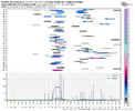
most of the bottom-quartile storms in the ensemble envelopes would still be the most impactful southeastern winter storm of the 2020s if they verified verbatim. even a relative bust is huge.I think nobody can definitely say anything until we watch the trends, the potential is there for an historic winter storm, p-types to be determined. I don’t think it’s a guarantee that this trends north an we’re stuck with a massive ice storm especially NW of I-85 in NC
WolfpackHomer91
Member
Almost 100% consensus that a significant winter storm is coming.
View attachment 185290
TY…. And look at next week following
Sent from my iPhone using Tapatalk
This is a pretty remarkable thing by NWP standards tbh. I know AIFS was firing warning shots (and WxNext may have been too, I wasn't paying close attention), but for every major physics OP to go from no storm to major winter storm unanimously in the same cycle is nuts.
trackersacker
Member
The amount of people cheering on a north trend on this app this week is gonna be insufferable
Snowking2.0
Member
@packfan98 can you post one for Hazel Green Alabama?
packfan98
Moderator
Do you mind showing that for upstate or Charlotte, much appreciated!!
They are going to be similar to the ones I posted.@packfan98 can you post one for Hazel Green Alabama?
rburrel2
Member
trackersacker
Member
What site is this I’m dying to use itFor reference, here's what the Jan 1973 ice storm looked like.. probably the most prolific ice storm that most Atlanta natives know about.View attachment 185296View attachment 185294View attachment 185293
The amount of people cheering on a north trend on this app this week is gonna be insufferable
Orientation changed by 1 degree?
This is a pretty remarkable thing by NWP standards tbh. I know AIFS was firing warning shots (and WxNext may have been too, I wasn't paying close attention), but for every major physics OP to go from no storm to major winter storm unanimously in the same cycle is nuts.
AI has been pretty incredible to be honest. May not get exact specifics dialed in but the general idea gets nailed down fairly quickly in the medium (6-8 day) range a step ahead of the physics based modeling.
I believe that’s Weather.usWhat site is this I’m dying to use it
At least the maps look identical
Y'all gonna have to ease up on the mby questions and requesting specifics or we're gonna have a gazillion pages by next weekend. Plenty of time to iron out specifics and have general discussion for a bit. Thanks
iGRXY
Member
Just going out on a limb here at this lead. I’d say those along and north and west of 85 is a very snow look to me. Along and south looks like a big opportunity for a huge sleet storm. Like 2-6” worth. Probably 20 miles north of I20 and further south had the opportunity for a big ice storm.
NBAcentel
Member
one thing i find interesting with the ai models is that they don't trend... they jump. trends in the physics models manifest in moderate nudges with every suite. ai models take a quantum jump and lock in like a pitbull clamping down on a burglar. bouncycorn you got any takes on this?
packfan98
Moderator
Any chance the ai holds energy in the west too much like the euro operational?That’s a concerning slowing trend…. View attachment 185299View attachment 185298
LongRanger
Member
Well hopefully everything trends away from anyone seeing that kind of Ice Storm. But as far as us upstate folks I think it definitely would take much tweaks to be all Snow up this wayJust going out on a limb here at this lead. I’d say those along and north and west of 85 is a very snow look to me. Along and south looks like a big opportunity for a huge sleet storm. Like 2-6” worth. Probably 20 miles north of I20 and further south had the opportunity for a big ice storm.
Tsappfrog20
Member
That’s a concerning slowing trend…. View attachment 185299View attachment 185298
Can you share why that concerning? I don’t understand thanks. What is it showing?
Sent from my iPhone using Tapatalk
idk. the digging around baja is what transformed this into a qpf nuke on this particular model. need longer sample sizeThat’s a concerning slowing trend…. View attachment 185299View attachment 185298
We have the pattern. We have the ingredients. Just gotta get the details right with the timing of the TPV movement & associated surface high, and the southern stream wave
This is a tremendous look precipitation-wise here on the 18z Euro as northern stream shortwave phases in and kicks out the Baja wave into long fetch SW flow streaming across the southern half of the conus. Would like to see more cold air work in ahead of this of course
View attachment 185280
That Kicker is piece #1. Be on shore in less than 96 hrs. Baja piece 1-A. Hp #2. It will show up. Question is if its 1039 or 150 but position,banana HP, is high confidence at H5. Least im worried about. Piece 1 an 1-A and their timing hold the keys to the puzzle.
Model error comes from two things: 1) architectural errors in the rollout itself (ie filling in the gaps of what is occurring in the simulation) and 2) initial conditions errors. Conventional models suffer from errors from both.. both of which compound over the forecast rollout.one thing i find interesting with the ai models is that they don't trend... they jump. trends in the physics models manifest in moderate nudges with every suite. ai models take a quantum jump and lock in like a pitbull clamping down on a burglar. bouncycorn you got any takes on this?
AI models are far superior to traditional models at simulating the atmosphere.. meaning most error is entirely due to errors in initial conditions.
If there is a substantial error in the initial conditions pertaining to a system, once that error is resolved, it will adjust and settle on the solution that is most likely.
Conventional models have much more run-to-run change because conventional physics-based parameterization (ie filling in the gaps of the atmosphere and microprocesses happening in it) is inferior to AIs handling of the forecast rollout.
Foundationally "why" is this the case? Nobody seems to know.
NBAcentel
Member
This digging trend though is concerning for the southern regions that might see ice though, given its digging more, its bringing in a lot more WAA, and also giving more time for the high pressure to be out ahead of the shortwave and wedge areas east of the appsidk. the digging around baja is what transformed this into a qpf nuke on this particular model. need longer sample size
rburrel2
Member
Seems like it would be really hard for models to trend stronger with the SE ridge here. You have a perfectly placed block with a polar vortex trapped directly in between it and the southern Atlantic coast. If anything, I’m shocked there can be as much ridging as what’s being shown?
Doesn’t this usually trend towards less ridging, when you have the the players lined up like this?
Doesn’t this usually trend towards less ridging, when you have the the players lined up like this?
It’s been a while since we’ve heard the ol’ “it cant possibly cut into a 1040 high”
then it does
That thing is tracking a long way out of the SW. A lot can happen. Lots of moving pieces per usual
then it does
That thing is tracking a long way out of the SW. A lot can happen. Lots of moving pieces per usual
This year, models have persistently tried to park the SE ridge and slowly eroded it away in the 120 to 216hr timeframe.Seems like it would be really hard for models to trend stronger with the SE ridge here. You have a perfectly placed block with a polar vortex trapped directly in between it and the southern Atlantic coast. If anything, I’m shocked there can be as much ridging as what’s being shown?
Doesn’t this usually trend towards less ridging, when you have the the players lined up like this?


