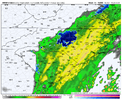
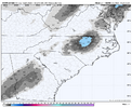
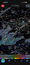
I’m about to do a final call! Name the locations you guys want me to do
-
Hello, please take a minute to check out our awesome content, contributed by the wonderful members of our community. We hope you'll add your own thoughts and opinions by making a free account!
You are using an out of date browser. It may not display this or other websites correctly.
You should upgrade or use an alternative browser.
You should upgrade or use an alternative browser.
Jan. 17-18, 2026 SE Winter Weather Threat
- Thread starter RBR71
- Start date
Zactheplumber
Member
RaleighI’m about to do a final call! Name the locations you guys want me to do
Jonesville, SCI’m about to do a final call! Name the locations you guys want me to do
Columbia lolI’m about to do a final call! Name the locations you guys want me to do
I was thinking the same thing, neighbor, but watching the models come in last night and this morning made me keep interest. Ironically, the NW trend showing up was simply increasing the dynamics here instead of pushing it NW. I think since this trough formed further east (instead of its axis being more west as we typically see) it threw a lot of smart folks off. We will see tomorrow, but would expect to at least see some snow fall (maybe even heavy) for a bit.You and me both. I had completely given up on this event 48 hours ago but now I'm not 100% certain that we won't end up with an accumulation even if it is only a dusting. It's a shame to waste most of the precipitation because there is no blocking high in place over the Northeast.
Last edited:
I’m about to do a final call! Name the locations you guys want me to do
Macon, GA.
- Joined
- Jan 5, 2017
- Messages
- 3,771
- Reaction score
- 5,973
46.8, dewpoint 35. Quite a few rain mPing reports north of Atlanta. Interesting.
Why not?? Monroe, NCI’m about to do a final call! Name the locations you guys want me to do
Thomson, GAI’m about to do a final call! Name the locations you guys want me to do
WolfpackHomer91
Member
I’m about to do a final call! Name the locations you guys want me to do
Mooresville NC
Sent from my iPhone using Tapatalk
ducketta27
Member
Mooresville NC
Sent from my iPhone using Tapatalk
North Augusta, SC!
Sent from my iPhone using Tapatalk
Forevertothee
Member
Clinton SC and Irmo SC
Mahomeless
Member
Start a call maps thread if you want, don't clutter the discussion with requests.
46.8, dewpoint 35. Quite a few rain mPing reports north of Atlanta. Interesting.
As far as I've seen, humidity at the surface has considerably spiked and I assume at this point the columns north or @ ATL have saturated a decent bit. Now the cold just needs to happen before that saturation may be lost.
I can also confirm a consistent light drizzle near Macon.
I didn’t think it would get this many responses my badStart a call maps thread if you want, don't clutter the discussion with requests.
Mahomeless
Member
When the front pushes through, so will the spotty showers.....its not happening in ATL or north of there.As far as I've seen, humidity at the surface has considerably spiked and I assume at this point the columns north or @ ATL have saturated a decent bit. Now the cold just needs to happen before that saturation may be lost.
I can also confirm a consistent light drizzle near Macon.
Clover ScI’m about to do a final call! Name the locations you guys want me to do
HailCore
Member
Just north of Atlanta where I am at, the precipitation despite producing returns of 25dbz is barely spitting any mist and drizzle. Not sure why as I was under the impression the air would get close to saturation here with this first wave.46.8, dewpoint 35. Quite a few rain mPing reports north of Atlanta. Interesting.
NorthHillsWx
Member
38.9 here in Raleigh. Dropped efficiently so far
Just north of Atlanta where I am at, the precipitation despite producing returns of 25dbz is barely spitting any mist and drizzle. Not sure why as I was under the impression the air would get close to saturation here with this first wave.
Perhaps it was localized to near Dahlonega; a few reported a [heavier] shower briefly and a spike of humidity.
I wish it were more widespread for y'all up there!
NoSnowATL
Member
Squirt Creek, Tennessee.
Webberweather53
Meteorologist
May the cold columns bless CNC!
Hopefully the realtime trends are better.
bud006
Member
Some light drizzle at my location right now. 45°, 53% RH, 29° DP.
—30—
—30—
DylanWx
Member
send it a bit southwest
LukeBarrette
im north of 90% of people on here so yeah
Meteorology Student
Member
2024 Supporter
2017-2023 Supporter
Ugh if we can change over under those heavy returns in clt we can really get a nice surprise. Can we please for once have things go our way.
I’m in S. Orange Co. Been more or less in the cross hairs of any model that has shown snow
me as wellI’m in S. Orange Co. Been more or less in the cross hairs of any model that has shown snow
Psalm 148:8
Member
- Joined
- Dec 25, 2016
- Messages
- 344
- Reaction score
- 789
43 and pouring rain in Hogansville GA! 85 SW of ATL
Final Call 
North Carolina
• Raleigh, NC: 1–2” (Overperform)
• Charlotte, NC: Dusting – Trace
• Mooresville, NC: Dusting – Trace
• Monroe, NC: Trace – 1” (Overperform)
Virginia
• Richmond, VA: Trace – 1”
South Carolina
• Jonesville, SC: Flurries at most
• Columbia, SC: Trace (Overperform)
• Augusta, SC: Trace – 0.5” (Overperform)
• Clinton, SC: Flurries at most
• Clover, SC: Flurries at most
Georgia
• Macon, GA: 2–3”
• Thomson, GA: 1–2”
Florida
• Pensacola, FL: Dusting
Alabama
• Dothan, AL: 1–2” (Overperform)
The NAM3km is holding steady that we do. It’s definitely gonna be a nowcasting thing for local mets and the NWS offices. I interested to see GSP’s late evening update her in a bit to see if they mention what the CAMs are showingUgh if we can change over under those heavy returns in clt we can really get a nice surprise. Can we please for once have things go our way.
Actually, I’ve found that the Icon does tend to be a few degrees colder than the non-CMC models for certain situations. But I don’t know if that would apply in this kind of setup.
accu35
Member
Some 0z short range models has trended NW a little again tonight for the western pandhandle. Starting to wonder if I’m gonna get a inch out of it
Its from the front coming through. Big show will start coming up from sw GA around 4 am, blistering northeast.Does the early precip happening right now help with snow chances later or no correlation?
Yea i was just wondering does it help saturate the air any for the 2nd batch or does that not work like that?Its from the front coming through. Big show will start coming up from sw GA around 4 am, bkistering northeast.
BackThePack
Member
Holding on to receipts.
iwantsouthernsnow123
Member
Helps with the moisture and saturation yes, however the bulge is strongly depended on the tilt of the trough and how far NW the precip sheild decides to go. So yes, it helps but only if you get other help if that makes sense.Does the early precip happening right now help with snow chances later or no correlation?


