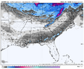
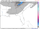
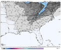
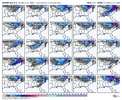
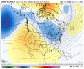
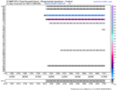
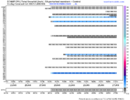
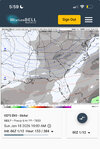
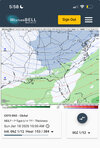
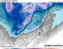
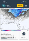
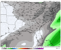
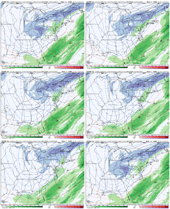
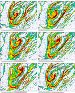
before and after frames?
-
Hello, please take a minute to check out our awesome content, contributed by the wonderful members of our community. We hope you'll add your own thoughts and opinions by making a free account!
You are using an out of date browser. It may not display this or other websites correctly.
You should upgrade or use an alternative browser.
You should upgrade or use an alternative browser.
Pattern January Joke
- Thread starter SD
- Start date
accu35
Member
Plus totalsbefore and after frames?
iGRXY
Member
View attachment 182617
Congrats gulf coast but this is a solid look this far out tbh
I’ll enjoy this quite unlikely solution while it’s here because the odds of it changing drastically by the next run are almost as high as the odds of the GFS outperforming the Euro. And another Gulf coast snow?
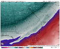
850s are cold enough to the SE coast though 2m/925 mb temps are in the mid 30s.
iGRXY
Member
Again, this has a solid chance of being a big dog like the UK if we continue digging west a bit more.
accu35
Member
Not saying it is, but this is almost like last January gulf coast storm print
Don’t worry this isn’t going to verify. Just another look. If I have to guess probably more in like I-20 ish storm if we can make the pieces come to together.Gulf coast would get more then me
accu35
Member
Yeah I’m pretty close to the 1-20 area just little south. I won’t say the gulf coast will see another one but chances are there, but most likey little north them. Good news is, we have the UK/Euro on our side now.Don’t worry this isn’t going to verify. Just another look. If I have to guess probably more in like I-20 ish storm if we can make the pieces come to together.
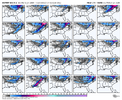
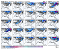
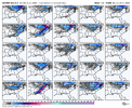
We will wait for the individual members to come out but there looks to be at least some support for the UKMET/EURO ops that were posted above
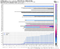
View attachment 182624
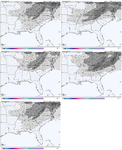
A small portion of the 50 (6) do have a Gulf/SE coast/FL solution for the furthest extent vs only a couple on each of the previous runs:
trackersacker
Member
A small portion of the 50 (6) do have a Gulf/SE coast/FL solution for the furthest extent vs only a couple on each of the previous runs:
View attachment 182625
View attachment 182626
Thanks for sharing these! 2,7,10,46 are some big dog looks there. You can clearly see a signal on some other maps as well. Obviously not huge but I’ll take the 15-20% look at this range. Just nice to see it show something similar to that UKMET layout. Never a bad think to have those two op models lockstep at this point. Hoping we can reel something in here as the temps will be much more in a lot of our favors for this threat vs the first threat. Back to bed now, just had to do my wake up check lol
iGRXY
Member
Yello?
Way to start off a monday morning!!Yello?
rburrel2
Member
Would be nice if the euro/ukmet combo led the way on this. The 06z gfs ai was sharper and deeper with the trough so it’s a start.
rburrel2
Member
packfan98
Moderator
rburrel2
Member
packfan98
Moderator
rburrel2
Member
rburrel2
Member
We might have something here guys. A tale as old as time. Precip that’s been advertised on means for a long time, vanishing in the mid-range, and then slowly coming back to life.
CNCsnwfan1210
Member
We might have something here guys. A tale as old as time. Precip that’s been advertised on means for a long time, vanishing in the mid-range, and then slowly coming back to life.
Eric did mention a few days back to let the first system pass and then watch for something after the TPV dropped in.
Sent from my iPhone using Tapatalk
CNCsnwfan1210
Member

Looks like the trough went a little sharper on the 00z EPS vs the 12z.
Sent from my iPhone using Tapatalk
packfan98
Moderator
Nothing on the 6z AI Euro unfortunately. Let’s see if old DR. NO can give us something.
NCWeatherNow
Member
NW flizzard
Blue_Ridge_Escarpment
Member
NW flow breaking containment all the way down to Valdosta, GA.NW flizzard
Where's the JMA at currently for Sunday? Navy Nogaps, Korean Model lol
tennessee storm
Member
Dry dry is main take on this pattern. Sorry hate
rburrel2
Member
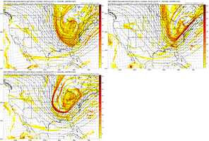
06z euro went the wrong way, dang it. Maybe the eps will look ok.
packfan98
Moderator
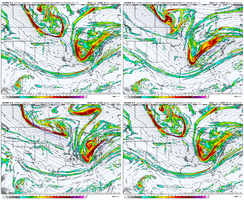
Yeah, the energy is jumping all around. I was hoping the models would start to consolidate. You can see the 0z run on the euro that jumped the energy SW and spit out a better run. That’s similar to the 6z GFS. The other two runs in the gif have no precip. As you said, let’s see if the ensembles can start marching towards that better progression. At least we are seeing some positive blips. Enough to keep us in the game.06z euro went the wrong way, dang it. Maybe the eps will look ok.
NCHighCountryWX
Member
- Joined
- Dec 28, 2016
- Messages
- 699
- Reaction score
- 1,918
NWS GSP Official Guidance
KEY MESSAGE 2: WIDESPREAD RAINFALL AND MOUNTAIN SNOW WILL DEVELOP
ON WEDNESDAY NIGHT AND THURSDAY.
FOLLOWING A PROTRACTED PERIOD OF DRY WEATHER ON TUESDAY AND TUESDAY
NIGHT AS SURFACE HIGH PRESSURE MIGRATES OFFSHORE, THE PATTERN WILL
BECOME ACTIVE AGAIN AS A HIGH-AMPITUDE Z500 TROUGH SHARPENS UP OVER
THE MIDWEST. BY THIS POINT IN TIME, MODEL GUIDANCE IS IN DECENT
AGREEMENT THAT A BAROCLINIC ZONE WILL BE DRAPED ACROSS THE TENNESSEE
VALLEY JUST TO OUR WEST, WHILE A COASTAL FRONT WILL BE LOCATED OFF
THE ATLANTIC COAST. THE ADVANCING TROUGH WILL INCITE ACTIVATION OF
BOTH FEATURES, RESULTING IN THE ONSET OF PRECIPITATION ACROSS THE
APPALACHIANS ON WEDNESDAY AFTERNOON...CONTINUING INTO WEDNESDAY
NIGHT AS THE TROUGH PASSES OVERHEAD. THOUGH RECENT GUIDANCE HAS
WAFFLED ON THE EXACT EVOLUTION OF THE ADVANCING SURFACE WAVE, A
CONSENSUS APPEARS TO BE FORMING THAT RATHER THAN CYCLOGENESIS, WE'LL
JUST SEE A ROBUST COLD FRONTAL PASSAGE. THE RESULT, THEN, WILL BE
MAINLY NW FLOW SNOW SHOWERS ACROSS THE NC MOUNTAINS. MOISTURE
OUTSIDE THE MOUNTAINS WILL BE SEVERELY LIMITED BY THE INFLUENCE OF
THE COASTAL FRONT, SO WHILE A FEW ENSEMBLES SUPPORT THE DEVELOPMENT
OF PRECIPITATION ALONG THE I-40 CORRIDOR IN THE NC FOOTHILLS AND
PIEDMONT, ACCUMS SHOULD BE LIGHT TO NONEXISTENT, AND IT'S UNCERTAIN
WHETHER TEMPERATURES WILL EVEN BE COLD ENOUGH FOR ANY FLAKES. THE
FORECAST WILL NEED TO BE MONITORED FOR POTENTIAL WINTER WEATHER
ADVISORIES ACROSS THE MOUNTAINS AS WE GET CLOSER TO THIS EVENT.
THE TROUGH SHOULD EVOLVE INTO A CLOSED UPPER LOW OVER THE NORTHERN
MID-ATLANTIC BY THURSDAY MORNING, AND IN RESPONSE, THE BULK OF
DETERMINISTIC MODELS AND LONG-RANGE ENSEMBLES STILL DEPICT
CYCLOGENESIS ALONG THE COASTAL FRONT. HOWEVER, THE THINKING HAS NOT
CHANGED THAT THIS FEATURE WILL BE FAR ENOUGH EAST TO PRECLUDE ANY
NOTABLE IMPACTS FOR OUR AREA. RATHER, PRECIPITATION SHOULD TAPER
OFF SMOOTHLY THROUGH THE DAY THURSDAY AS THE FRONT PUSHES EAST OF
US, UNTIL WE'RE MOSTLY DRY AGAIN BY THURSDAY EVENING APART FROM SOME
LINGERING NW FLOW SNOW
packfan98
Moderator
6z AI EPS is much worse than 0z. Back and forth we go. Let’s hope that 0z wasn’t just a blip. I’m sure we will continue to get some different looks over the next 2 days.
iGRXY
Member
Euro was worse
Cheer up guys. It should bring a bit of excitement knowing how "not locked in" our second timeframe is. Just a ridiculous amount of energy around this weekend. The first timeframe brings cold air in place for the following rounds of energy to tap into. 00z Euro was awesome despite what the 06z Euro did.

