• Hello, please take a minute to check out our awesome content, contributed by the wonderful members of our community. We hope you'll add your own thoughts and opinions by making a free account!

Pattern December Doldrums 2025 🎄 ❄️

LC says Deal With It

So you were waiting for that big Arctic outbreak to sweep across your hometown? Keep waiting.

There will be a transient cold intrusion that moves from the Great Plains through the Eastern Seaboard during the Thanksgiving holiday weekend, That could send you chills for two or three days and maybe bring some snow to the Great Lakes and interior Northeast. But with no strong, holding blocking in the high latitudes, any hope of seeing a long-lasting cAk air mass can be rated as "slim" and "none". I am hearing all kinds of talk about a stratospheric warming/splitting event, and while that is a possibility the surface reflection on cold dispersal in the lower atmosphere must wait two to four weeks before being felt at the surface, and then only to the downstream in the south and east sectors of the greatest thermal disruption at 10MB. I suspect that there could be notable temperature drops in later December in association with the upper warmth, but the cold readings might only be transient.

You can blame the Southeast ridge, which in a moderate La Nina happens often. And this is a full-tilt, Pacific Basin wide episode, even though all of the numerical models show a transition to an ENSO neutral/positive or even a weak El Nino in the Spring of 2026. Snowpack will build over the next ten days across the Intermountain Region, northern Great Plains and the Great Lakes, thanks to an active storm track of either the Colorado/Trinidad (A) or Panhandle Hook (A) varieties. The ridging in Georgia and Florida may retrogress in the 11-15 and 16-20 day time frames, so warmth could return occasionally from the Midwest into the St. Lawrence Valley. The GFS model scenario may be wrong about the potential hurricane threat near Belize, but the vast array of warm waters in the Caribbean Sea and western Atlantic Basin in general could give rise to a late season tropical cyclone.

In any event, I suspect that the period from Late January through early March will be the favored period for cold and winter storms in the lower latitudes and more eastern locations. But do us all a favor and do not listen to the lunatic fringe that was calling for Arctic air this past summer (no worse than polar designation) and that the QBO, Gulf Stream current, and the MJO will all gang up on us this next week and produce a white fright/frigid blast from Siberia. Snow will increase across the Intermountain Region, northern Missouri Valley and Great Lakes (a harbinger for later on). For now, the Southeast Ridge rules from East Texas and the mower/middle Mississippi Valley to the Atlantic Coastal Plain. Deal with it!


Prepared by Meteorologist LARRY COSGROVE on
Sunday, November 23, 2025 at 3:30 P.M. CT
Bro went into a time machine & posted in the future?
 
Yeah, I think in the end, our area will average warmer than normal. BUT, I don't think the US or the SE will just sit around through December with a sustained torch. For one thing, there WILL be wedging from time to time. AND I believe there is going to be a good deal more variability to the pattern than the models have been suggesting. Do I think we're going to get frigid and snow a lot? No, at least through mid-month. But I doubt we cook in the 70s every day either. It will probably skew warm and dry here, which is not a complete disaster, given how early we are in the season. But it is disappointing, given how good things were looking for a fast start just a week or so ago.
 
I am not even close to sold that this trough to kick start December is going to drop as West as we thought. 06 Euro AI continues to show a shifting East. Been flirting with it for a day or so now.
Yeah it’s definitely been the theme for the last several months for troughs to come further east the closer we get. Remember a week to 10 days ago everything looked like Thanksgiving was gonna warm here in the Carolinas and now it looks like it’s gonna be a few degrees below average
 
67e867a61abff0c4479bdfcbed0c3d94.gif

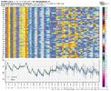
GEFS trying to get rid of the ridge around 12/3. 5 run trend


Sent from my iPhone using Tapatalk
 
77fce95691330dc9fcd25b45a30dd535.jpg

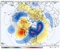
The subseasonal AI model that Judah Cohen and his team uses shows the most extreme cold from south central Canada to the US east coast from 12/15-12/21.


Sent from my iPhone using Tapatalk

Makes sense given the current MJO forecast moving into P8 during that timeframe.


Sent from my iPhone using Tapatalk
 
DJF MJO last 15 winters (2010-1 through 2024-5): # of days each phase

*7: 286 days from 58 phase 7s or 4.9 days/phase

*8: 95 days from 34 phase 8s or 2.8 days/phase

1: 76 days from 24 phase 1s or 3.2 days/phase

2: 96 days from 23 phase 2s or 4.2 days/phase

3: 167 days

4: 173 days

5: 212 days

6: 249 days


———————

Per the above data, the # of phase 8 days for the last 15 winters, combined, has been only 1/3 the # of phase 7 days. This was due to a combo of much fewer phase 8 periods than phase 7 periods (34 vs 58) and much shorter avg. duration for 8 vs 7 (~3 days vs ~5 days). So, there sometimes is a struggle in going from phase 7 to 8. The # of combined 8-1-2 days has been ~# of phase 7 days, alone!

The coldest E US phases have been 8, 1, and 2 while the warmest have been 4-6 (see bottom). The # of phase 8-1-2 days, combined, has only barely been higher than the # of phase 6 days, alone!

So, as we look at Dec MJO progs, keep in mind the relative difficulty in getting as many phase 8 days (as well as each of phases 1 and 2, for that matter) as phase 7 days (if any at all). Just because models suggest a 2+ week long phase 7 is very likely doesn’t necessarily mean the durations of each of phases 8, 1, and 2 immediately following will be anywhere near as long, if they even occur.

Recent history tells us that after the upcoming long duration phase 7, the subsequent 2nd half of Dec MJO is practically un-forecastable as of now with dominance by the often cold 8-1-2 about equally as probable as a feared hardly any 8-1-2.
IMG_5609.png


Daily MJO:
 
Last edited:
DJF MJO last 15 winters (2010-1 through 2024-5): # of days each phase

*7: 286 days from 58 phase 7s or 4.9 days/phase

*8: 95 days from 34 phase 8s or 2.8 days/phase

1: 76 days from 24 phase 1s or 3.2 days/phase

2: 96 days from 23 phase 2s or 4.2 days/phase

3: 167 days

4: 173 days

5: 212 days

6: 249 days


———————

Per the above data, the # of phase 8 days for the last 15 winters, combined, has been only 1/3 the # of phase 7 days. This was due to a combo of much fewer 8s than 7s (34 vs 58) and much shorter avg. duration for 8 vs 7 (~3 days vs ~5 days). So, there sometimes is a struggle in going from phase 7 to 8. The # of combined 8-1-2 days has been ~# of phase 7 days, alone!

The coldest E US phases have been 8, 1, and 2 while the warmest have been 4-6 (see bottom). The # of phase 8-1-2 days, combined, has only barely been higher than the # of phase 6 days, alone!

So, as we look at Dec MJO progs, keep in mind the relative difficulty in getting as many phase 8 days (as well as each of phases 1 and 2, for that matter) as phase 7 days (if any at all). Just because models suggest a 2+ week long phase 7 is very likely doesn’t necessarily mean the durations of each of phases 8, 1, and 2 immediately following will be anywhere near as long, if they even occur.

Recent history tells us that after the upcoming long duration phase 7, the subsequent 2nd half of Dec MJO is practically un-forecastable as of now with dominance by the often cold 8-1-2 about equally as probable as a feared hardly any 8-1-2.

View attachment 177095


Daily MJO:
I’m calling the authorities if we don’t stay in 8 for at least 3 months
 
IF the 11/18 bc version of the extended EPS that you just posted were to be right, you couldn’t ask for a better position of the MJO in Dec/Jan: just outside the circle in phase 8 (and very slow moving making it last longer would be a big bonus) is about the coldest on average in the E US as it’s colder than strong phase 8 (though there’s always lots of variation of course): if you asked me to place it in a better place I couldn’t:
View attachment 176855
just for comparison's sake, here's today's ecwmf ext (bc) mjo-cast. not too terribly different and like how it looks beyond mid-dec.

1763923839627.png
here's the non-bc version from a week and a half ago
1763924014160.png
 
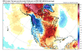
Today’s Euro Weeklies for the SE aren’t what I’m looking for since I’m a “the colder the better” type (I hate sweating in winter when I walk outside) and they look the worst in the US in the SE, especially near where I live thanks to the SER:

Dec 1-7: slightly warmer/still torchy
Dec 8-14: slightly warmer/now a torch deep SE/still AN elsewhere
Dec 15-21: warmer with AN vs yesterday’s NN most
Dec 22-28: ~same/still NN most with warmest deep SE
Dec 29-Jan 4: ~same/still NN most with warmest deep SE

The most intense cold on the run is W and SW of Chic and perhaps near ME. So Mack, Webb, the SE guys who moved to ME/Chicago, the guy who lives in MT, and Brent to a lesser extent should all love these maps!
When you say ME are you referring to Maine ?
 
Those of us in prime CAD areas you can get the idea of a sustained torch out of your heads. If we do ridge the EC we will figure out a way to 45 degree cold mist ourselves into typical winter climo. But as others have said and one reason I stayed silent during the torch discussion is that has been an ongoing thing in the LR for months now and outside of a stretch here or there those troughs have pushed east by around the day 5-7 range. See no reason to think it won’t continue.
 
As Nathan said models are completely in disarray and are in contradiction of Tropical/extratropical signals all because they're unable to figure out how the SSW will influence the 500mb pattern! If the 12z is to be believed which I take with a huge grain of salt(as should anyone), then yes the SER is gone but so is the Alaskan ridge! Also we are heading into a -NAM state(as Eric said) so I don't know why there was a huge change from 0z-12z regarding that!

La Nina is weak and on life support and the Pacific jet is shifting towards the equator so this is in contradiction to what a Jet extension is supposed to look like in this senario nevermind in a +AMM.

 
Last edited:
Back
Top