• Hello, please take a minute to check out our awesome content, contributed by the wonderful members of our community. We hope you'll add your own thoughts and opinions by making a free account!

Tropical Subtropical Storm Alberto

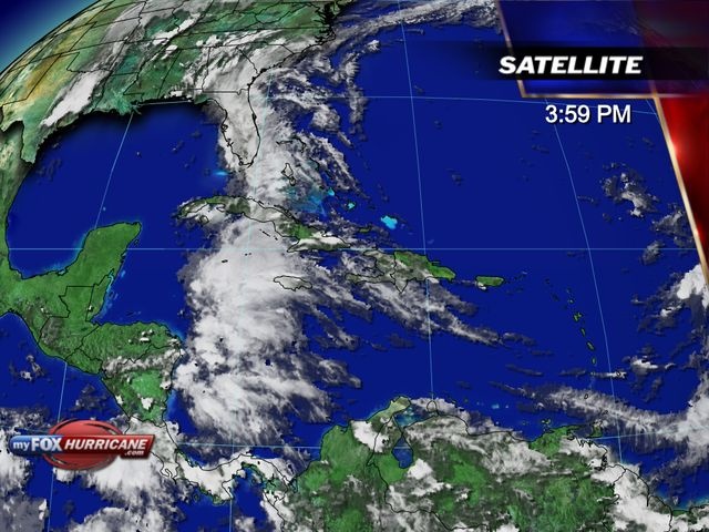
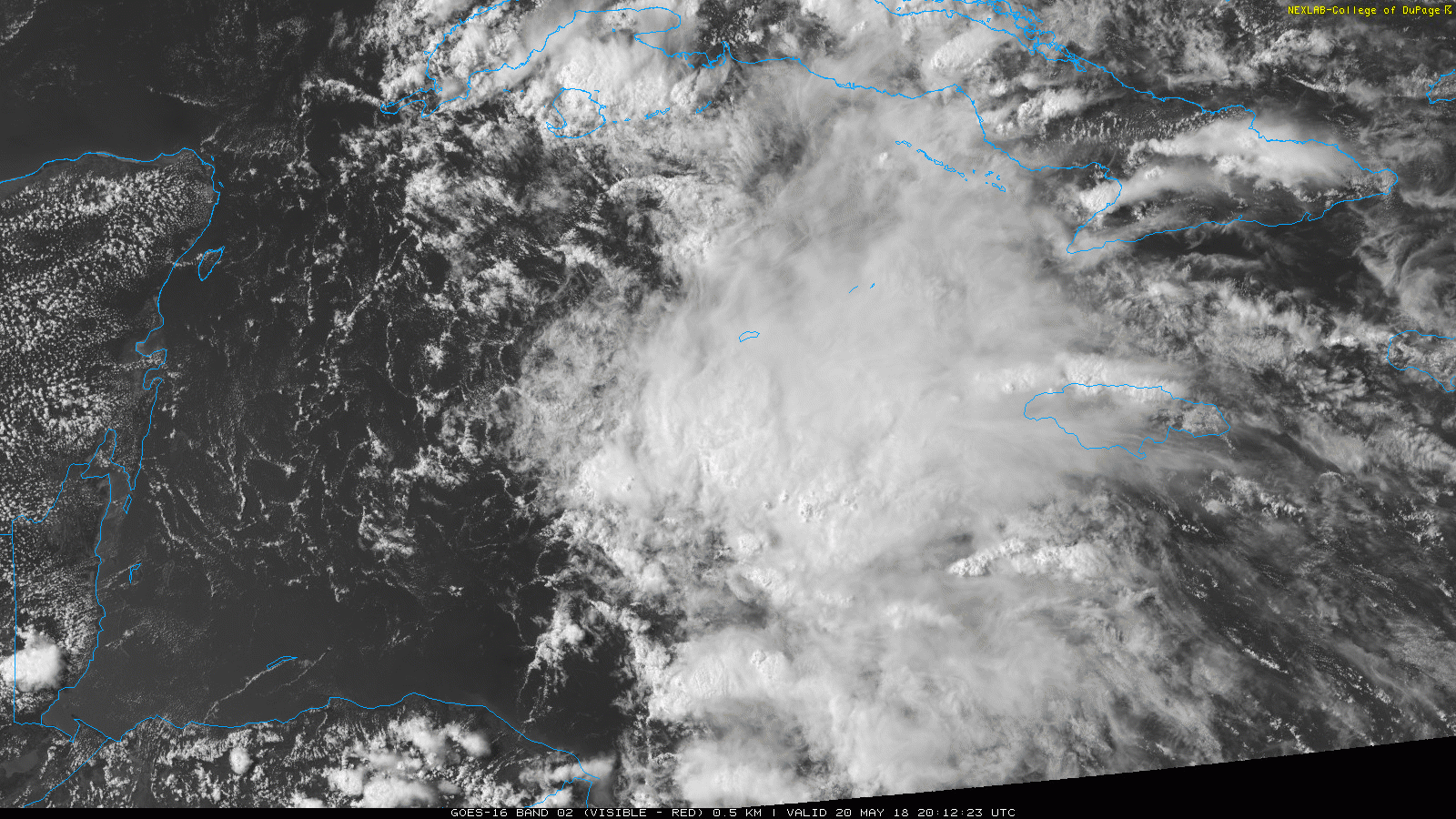
Last year the CMC stepped up quite a bit and they euro stepped down, often missing storm formation entirely. I wouldn't put the Euro too high since its not been its best lately. However because everything is agreeing on a strong tropical low, we could see something. The FV3 is going to have to be watched throughout the season just to see how it reacts to different areas of the Atlantic. I'm sure it's going to be bad unless they correct it.

The CMC was probably the only model that improved from the upgrades last year. I feel like the Euro and GFS both became a bit worse with TC formation, intensity and track. The Euro was by far the most accurate model last year with TC track, beating every other model and even the NHC forecast in the 3 and 5 day verification scores. Maybe if we do actually get a system to form the new FV3 will be better then... but for now it’s just not doing well at all. It also seems to want to spin up every thunderstorm complex into a strong low pressure or tropical system and not being ocean coupled is a huge problem too. They need to ocean couple the GFS/FV3 and fix the feedback issues, maybe over time they will tweak that for the FV3 but early indications are not good.

Btw here are the EPS members. Quite a few develop it and a few get it up to minimal hurricane status.
235C412F-8909-4FF5-82A0-C261C4823AE0.jpeg
 
I have yet to be in the likely to develop camp nor in the hurricane camp (both based on climo), but I did go into the "increasing threat of a TS to FL" camp yesterday when I noted the near unanimous ageement of the models for a tropical low to form in the NW Caribbean near day 7 (5/24). If anything, today that TS threat has fallen back some but there still is a low (more than minute) chance imo. I'm near 5% for a FL TS hit currently. Weak model progs along with climo and knowing that the Gulf has recently not been all that warm are keeping it down as there's a much greater chance that there will either be something weaker than TS, maybe even nothing organized, or maybe even a miss of FL.

Climo to keep in mind: There have been only 5 TS and no H on record to form in the W. Car. or GOM during 5/21-31 since 1851. So, that's only 5 in 167 years or 1 in 33 chance/3% of there even being a genesis. Only 1 of those 5 hit FL. So, only 1 in 167 years had a FL TS hit or well under 1%. So, even going with a 5% chance of a FL hit in 2018 in deference to the model consensus of a threat of something is WAY, WAY above the longterm climo based chance.

The 5 W Car/GOM 5/21-31 geneses on record since 1851:

- 5/30/2008
- 5/28/1959: hit LA at 40 knots
- 5/25/1953: hit FL at 40 knots
- 5/27/1890
- 5/29/1865

Edit: In deference to this model agreement, I'm currently near a respectable 1 in 3 chance for a TD to form next week either in the W Car. or in the GOM, which is quite high in that area for late May, but still only near a 5% chance for a subsequent FL TS hit. So, I'm saying that IF a TD forms next week, there's about a 1 in 6 chance for that TD to hit FL as a TS. That's how I get my 5% FL TS hit chance.
 
Last edited:
Ok, CMC, ICON and EURO has a storm in the gulf of some sort. Something that needs to be watch this upcoming week
 
Can't believe we are not talking about these model runs, gfs is the only one that has a storm on the east coast of Florida .Rest of the models has it in the gulf, maybe just a Tropical Storm but something to watch very closely this week as it forms.
 
Looks like a hybrid slop storm, if anything. The moisture influx and heavy rains , will be the highlight late week and into the holiday weekend.
 
The earliest on record TS to hit the US Gulf coast W of FL is 5/30's Arlene, which hit LA with 45 mph winds/1000 mb in 1959. So, this has a chance to make history.
 
The earliest on record TS to hit the US Gulf coast W of FL is 5/30's Arlene, which hit LA with 45 mph winds/1000 mb in 1959. So, this has a chance to make history.
Rain will be the big story I imagine
 
17e2a9c4e3191f9d3e84752fdf756de92b59a2ab153c679397b93613b83815b8.jpg
 
Euro just stalls it along the TX/LA border region for days through the end of the run talk about flooding
Yeah, looks like one of those slow moving, wondering lows that wants to flood everyone lol.
 
Yes, the 12z euro run would be really bad as it drops isolated pockets of 20+ inches of rain across Louisiana and widespread 10-15” amounts. It stalls the system right along the coast for at least 5 days as it gets trapped in weak steering currents. Let’s hope that doesn’t happen.
 
0z Euro again doing the very slow motion towards Texas by day 10... rain gets pretty far west towards me :eek:
 
0z Euro again doing the very slow motion towards Texas by day 10... rain gets pretty far west towards me :eek:
Whatever comes of this will cause some major flooding.
 
James posted this on twitter. I'm taking my 10 yr old daughter kayaking Silver Springs and other places around Ocala May 25-28th. Maybe I should just reschedule it. :(


weather.jpg
 
Back
Top