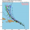
Of all the people in the weather field , I can assure Glenn Burns does not have it lolIf you find a source of that data anywhere, it would be greatly appreciated. I have looked high and low for the raw data, maps, charts, anything to do with it. I noticed that guy, Glenn Burns, has named his "custom in-house model" after it. I highly doubt he has the actual Panasonic modeling.
-
Hello, please take a minute to check out our awesome content, contributed by the wonderful members of our community. We hope you'll add your own thoughts and opinions by making a free account!
You are using an out of date browser. It may not display this or other websites correctly.
You should upgrade or use an alternative browser.
You should upgrade or use an alternative browser.
Tropical Major Hurricane Maria
- Thread starter Webberweather53
- Start date
Tops continue to cool in the NE quad.
- Joined
- Sep 4, 2017
- Messages
- 216
- Reaction score
- 260
Recon going to cut it close for the next pass if they try. If they miss, radar and sat. are still looking like it's intensifying. Hope they can get one more.
Speaking of recon planes possibly bailing out, here is a great read on a near-fatal flight into Hurricane Hugo from Dr. Jeff Masters.
https://www.wunderground.com/resources/education/hugo1.asp
https://www.wunderground.com/resources/education/hugo1.asp
what happens if Jose was to dissipate tonight and not influence Maria and say a steering component from the east was to form and block the escape to the north??
Brent
Member
what happens if Jose was to dissipate tonight and not influence Maria and say a steering component from the east was to form and block the escape to the north??
Maria most likely hits the us if jose dies sooner than expected
ForsythSnow
Moderator
Just a quick question, but what is this about recon bailing? Is there something wrong with the current mission? Plane making the turn now.Speaking of recon planes possibly bailing out, here is a great read on a near-fatal flight into Hurricane Hugo from Dr. Jeff Masters.
https://www.wunderground.com/resources/education/hugo1.asp
She'd likely be steered by lower heights toward Florida or SC, even possibly into the Gulf.what happens if Jose was to dissipate tonight and not influence Maria and say a steering component from the east was to form and block the escape to the north??
You'd have to ask the people flying the plane. If they're going back in, it's likely not a plane engine problem, thankfully! Maybe radar or dropsonde instruments weren't ready yet. Never know.Just a quick question, but what is this about recon bailing? Is there something wrong with the current mission? Plane making the turn now.
- Joined
- Sep 4, 2017
- Messages
- 216
- Reaction score
- 260
I see no evidence of them bailing yet but the proximity to the shore and some higher land elevations may prevent them from making another pass. Shall see.Just a quick question, but what is this about recon bailing? Is there something wrong with the current mission? Plane making the turn now.
She'd likely be steered by lower heights toward Florida or SC, even possibly across into the Gulf.
the gulf is not what anyone wants. its a fuel tank of rocket fuel for her.. NOT THAT ANYONE WANTS A US HIT BUT
I see no evidence of them bailing yet but the proximity to the shore and some higher land elevations may prevent them from making another pass. Shall see.
Here they go!
- Joined
- Sep 4, 2017
- Messages
- 216
- Reaction score
- 260
Looks like one more try, cudos if they make it.
Webberweather53
Meteorologist
All this wasted energy on tracking a fish storm!? Save some for winter storm tracking!
Webberweather53
Meteorologist
All this wasted energy on tracking a fish storm!? Save some for winter storm tracking!
This is definitely not a fish storm lol, tell that to Dominica, Puerto Rico and the rest of the Leeward Islands
- Joined
- Sep 4, 2017
- Messages
- 216
- Reaction score
- 260
Maria has been tracking due west for the last 2-3 hours, possibly due to interaction with Dominica. We'll have to see if this motion corrects once she gets to the other side.
GeorgiaGirl
Member
It's not really scientifically based at all, but I'm simply not buying at all the idea of Jose staying a weak hurricane for as long as the models suggest...if he's a moderate TS or weaker in the next 1-2 days we're going to see some shifting west if/when the models figure it out (perhaps still enough to keep Maria away from the US)...and even still, this hurricane is going to affect countries that DON'T need it at all.
But this has been the season that goes against typical, so maybe Jose does do this and Maria stays off shore for us...
But this has been the season that goes against typical, so maybe Jose does do this and Maria stays off shore for us...
got an erie feeling it wont.Maria has been tracking due west for the last 2-3 hours, possibly due to interaction with Dominica. We'll have to see if this motion corrects once she gets to the other side.

