• Hello, please take a minute to check out our awesome content, contributed by the wonderful members of our community. We hope you'll add your own thoughts and opinions by making a free account!

Tropical Hurricane Dorian

https://www.star.nesdis.noaa.gov/GOES/sector_band.php?sat=G16&sector=car&band=13&length=24

Those storms off of Tampa and those in SC cause a bit of head scratching ...

There was a 40% chance of showers I believe for the KCAE area and then to the east and south but the coverage and the kind of rain I'm getting at the moment sure seems like it should've been more like 60%.

I was a little surprised when I got a look at the southern SC radar after I heard the rain start too.
look at their respective direction and flow ... Tampa and SC ...
 
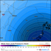
GFS is pretty darn close last run to MBY I live in Simpson ( red circle) ....45-50 or so miles from the center as the crow flies though it is the weak side.....there is usually a wind maxima on the west side inland in the central coastal plains....GFS has the hurricane pretty weak though compared to ICON/Euro/Ukie


us_model-en-087-0_modusa_2019090118_103_3617_149.png
 
hmon_mslp_uv850_05L_2.png

Holy Poop!
 
HWRF is gonna be off if EWRC occurs. I think slight weakening but a bigger storm over the next 24-48
 
SUMMARY OF 700 PM EDT...2300 UTC...INFORMATION
----------------------------------------------
LOCATION...26.6N 77.6W
ABOUT 70 MI...110 KM E OF FREEPORT GRAND BAHAMA ISLAND
ABOUT 150 MI...240 KM E OF WEST PALM BEACH FLORIDA
MAXIMUM SUSTAINED WINDS...185 MPH...295 KM/H
PRESENT MOVEMENT...W OR 270 DEGREES AT 5 MPH...7 KM/H
MINIMUM CENTRAL PRESSURE...910 MB...26.88 INCHES
 
Yeah ERC is imminent. Fortunately, this is good news for the Bahamas, but bad news for Florida. It'll be complete sometime between tomorrow morning and tomorrow evening, still well away from landfall.
How can you tell?
 
How can you tell?
Look

Sorry - just had a major interruption at the front door ... did not mean to seem short ... went off before intended ...

Look at the eye; it seems to be "closing"; look at the bands around the eye --- seem to be increasing; watch how they interact and the outside moves in ... as time moves forward ...
 
Back
Top